Google maps lets you add waypoints, but doesn't automatically advance beyond the waypoint when you get there, which is extremely annoying. Having to hit something on your phone while riding in order to know when your next turn is, is a flawed design.
Best navigation for bikers is mapy cz + old smartphone. Paved roads. Unfortunately there is not even single navigation for mixed type of roads; paved + offroad.
@@podunkman2709yeah, mapy cz doesn't have innate off-road support, one needs to switch to cycling-MTB navigation, although in that case it can lead you to a path with a moto vehicle ban. I've seen people put it into auto-center mode instead of navigation and loading a GPX, it then scrolls the map with the GPX so you can see what path you should take. The best feature, IMO, is the maps themselves, I don't recall any other app having such good maps, free or paid. It is also very easy to transfer maps from computer to cell phone, especially if you have an account, and planning is very easy and straightforward. But really the maps are one of the best points - you don't have to be ever surprised when what seemed to be an important road on the map turns out to be an enduro bike worthy mud bath. Mapy cz will show it's not a big road but a small path. At least in my experience, here in Europe. And it is free.
This!! I don't know when they changed it (it was a few years ago while I was already in Japan) but ever since you have to manually confirm that you've passed a waypoint, Google Maps became completely untenable for me for motorbike navigation. Especially since most phones don't support gloves these days. Having to stop, pull off glove, click the stupid button, put on glove, then continue was a total deal-breaker for me. And yes, I specifically bought motorbike gloves with touchscreen support; guess what, the touchscreen thingy didn't even last a weekend.. That, along with the fact that Google Maps doesn't do offline nav, or only for very limited areas (might depend on the country you're in), made it useless for me.
Great comparison video. I use Google Maps (but I have been experimenting with Cali) I carry only my phone and use it for navigation and controlling GoPros and my Cardo communicator. One device does it all. I also like Google Maps showing traffic snafus along my route. My wife wants me to share my route with her so she knows where to find me and when to expect me home. I share it by copying the link in Google Maps and pasting into an email (any email will do). I also email it to myself because I plot the course on my laptop and retrieve the email in my phone to bring it up on my Google Maps on my phone. For me, plotting a route is a lot easier to do on my laptop than on my phone. In 2022, I planned a cross Canada tour, Ontario to B.C. and back using 3 apps. Google Maps, The Weather Network app, and an online hotel reservation app. 7400kms, Best trip of my life ! Happy (and safe) riding to you.
I am not against tech at all, I just enjoy planning and riding with a paper map. I actually enjoy stopping to check the map, turn the engine off, talk to the guy clipping his hedge, maybe spot an old church/building, and walk over and check it out. I have a phone if I really need to check my position, I just don`t want it wobbling around on the handlebars all the time.
That's a very wise attitude. My step-son's phone when flying off his handlebar last week at a cost of several hundred dollars. I always carry a paper map and I enjoy browsing to get to know a region. But I admit, I enjoy trying out lots of different tech, which is just a personal preference.
I love having paper maps. I buy the Butler G1 maps whenever they go on sale and have built up a pretty comprehensive collection. Too bad they haven't put together maps for Canada..
I had a situation where I was parked alone in a metropolitan area, minding my own business and setting up a new route on a GPS unit. Although I didn't realise it at the time, somebody was watching me and called the cops, who arrested me and they confiscated my phone & laptop (but didn't take the GPS). The stupid cops believed a false accusation from another person but would not accept my position on the matter. If I had a paper map on the day, then things would have been much more simple.
Good presentation. I learned from watching it. Thank you! I still travel on my motorcycle as I did back in 1978. I mainly use paper maps. Now I also use a Tomtom Rider 50 LE GPS. It's easy to enter and change routes on the way and I don't need to bring a computer. I find the Apps very limited in comparison to "a proper motorcycle GPS". I'm the kind of rider that have a general idea but not necessarily stick to a pre-planned route. I usually learn along the way. I also bring an old Garmin for hiking in the mountains (and use my hiking boots on the motorcycle).
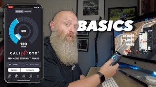
Calimoto is super. I use it all the time. I din a road trip from Sweden down to Croatia last year and planer the route on the desktop. Saved and when I start the app all routes are there. Just perfect.
Over here in the UK I use Waze on-road and Back Country Navigator XE on the trail because it gives access to Ordnance Survey maps. I also have a venerable Garmin Zumo 660 but I am seriously thinking about a Carpuride as that allows your phone to be the satnav but out of the elements which cause it problems.
@@RetiredAdventureRider a couple of questions if you don’t mind. Do you use CaliMoto for your trip planning only? And then push what you’ve created in CaliMoto to your Garmin? Or do you also run CaliMoto on your phone simultaneously? Did you look into Scenic? It also has a lot of type of route planning options….like Fastest, or Curvy, etc. I too am a CRF250L owner. Awesome lil bike that does almost everything “okay”. Thanks for the video.
Hi from Sunny Malaysia, I have been using the paid version of Calimoto for about 2 years, I love it Just have fun with the select twisty random round trip, and off you go. Ridden about 15000 km with only a few bits that I did not like. Great for planning and navi. Enjoy
Me And My Royal Enfield have a TomTom Rider 550. I use the TomTom My Drive app on my phone. Also plan on laptop with TomTom MyDrive Route Planner. Thanks for this video.
I agree, It is great when travelling overseas as the maps are stored on the phone, so no cell coverage required. I have used Sygic for 10 years at least here in Australia where there are vast amounts of land with no cell coverage. So well before Google and others had the offline tile storage capability. I add and delete countries as required.
REVER US routes abound except in the Midwest were in many states there are zero user routes. This despite my submitting several and waiting over a year to see them show up and to date still nothing. Emails to customer service got reasonably quick response - stating only that they have a small team and it takes a while (forever) to review and post user submitted routes. I canceled REVER when even after I paid for the app it wouldn't let me save my last route plan wo/ posting pictures - on a route I'd yet to ride!
I have been annoyed at Google Maps at times when I select one of two routes. It changes to solid blue. Then during the travel it decides to route you to the option you did not choose. I have had to stop and back-track.
Same here. Tried Calimoto, which I just didn't click with. Used Scenic to plan my France/Spain tour and other than forgetting to turn off one setting (tried to route down farm tracks!), it was brilliant. The developer is super responsive too.
I'm running a Carpuride W702 Carplay/Android Auto unit in leu of a GPS. For basic navigation to an address or location I just use Google Maps or Apple's equivalent. If I want to create a route for a trip I've been using Gaia GPS and so far I like it (other than I can't access the record track function via Carplay).
I’ve been using Scenic for 18000 miles. I like it since there’s no subscription. Wish it had web app or desktop app I could use for planning on my 27” monitor. Might try calimoto out a bit
I have used Scenic for almost 70,000 km in Australia. I use Garmin Basecamp on my desktop to plan trips and import the .gpx file into Scenic. Basecamp can be clunky and frustrating but worth persevering.
Nice review. I've been playing with Scenic lately and like it so far. I'm headed to Hyder Alaska in August and have some concerns about cell service, gas and accommodations along the Yellowhead highway through BC. I dont plan on camping. I'd be grateful for any information you can provide.
I've only ridden that route once, three years ago. You won't have a problem along 16 finding gas or accomodation but use Google Maps to plan ahead a bit. Cell service will be off and on, but as far as I remember, mostly on. Hyder is 287 km (about 180 miles) from Kitwanga, so you can do it easily in less than a day. Fill up at Kitwanga. You take 37 north to Meziadin Junction. You probably won't get cell service between Kitwanga and Meziadin Junction, which is where you get the road to Hyder. Here's the link to the map for cell service by Rogers www.rogers.com/mobility/network-coverage-map
I use a Samsung Galaxy Active Tab 2 running the DMD2 app. I has it's own built in maps, or you can use any other mapping/navigation app since it's a Android device. The limitation with DMD2 is that it won't let you save it's maps to SD card, which poses a problem with map storage on my device. In the distant past I used Garmin Mapsource, which I found to work well when using the Garmin devices. I've started experimenting with Google Maps, which seems to work well. Just recently starting trip planning again, so seeking to learn what's available. I like the DMD2 dashboard and mapping, but may need to find newer hardware to run it on.
It’s one thing to use an app that is dependent on excess to communications and the good old fashion paper printed physical map. It has happened to me when on a trip that my phone got lost and with the device gone so where my navigation. It’s about a backup system in place that at the very least can get you back to civilization.
So true. I'm old enough to have grown up with paper maps, and I love going over them just to see what is out there. There's more serendipity with a paper map. I always carry one on my trips, including a detailed topo map when I'm in the back country.
Very helpful. I'm not an app or GPS person, typically using a map if I need to. But the satellite coms is a good idea. I need to learn about that. Sorry, just a low tech person.
I’ve used roadie successfully. Definitely need something that’s works good with custom routes and multi stops for figuring out fuel. I use for planning though, don’t use navigation.
I use Apple maps. It gives you an option to make hotel reservations… offer photos of the stop-points… does not cost me any extra. It show traffic jams…
I plan my route with a large atlas. I plug my route into my Garmin mounted on my handlebar to get me there. I also pay for REVER but I tend to use that in live ride mode. I like the data it gives me at the end of the day. Like you, I don't use that as a social sharing device.
Nice video, but as a long time Harley rider I would like to say that I despise the Harley app. I think you’re much too kind on that one. My only other comment is you didn’t talk about the WAZE app and I’m curious about it. Thanks. P.S. I do really like the google maps app.
I think for most basic navigation, Google maps does the trick. The only advantages other apps can offer is making it easier to find campgrounds, gas stations, or Harley Dealers. I used WAZE a few years ago for commuting because it showed traffic details, but it wasn't valuable for me at my last job because there were no alternative routes no matter what happened on the highway. I'm not sure how it would be for long-distance planning.
I’ve experimenting between My Route-app, Rever, Garmin Tread and the Triumph app. The Garmin Tread is only available on Apple iOS and Android devices no desktop equivalent. Ideally I want to create routes that I can use on my Garmin XT2.
I have been using REVER for a couple of years. Do not use the social side of it. Is it to let my wife see where I am and track my miles traveled. Really like the twisty route option on REVER.
For Western Canada backroads nothing beats BRMB. All possible roads, trails, campsites, gas, POI, etc. I use that to navigate and Rever to track and data. Used Calimoto for the free trial and found it useless unless on standard paved routes. The only two things I liked about it was it displayed elevation and you could see when twisties were coming. But issues were many, especially for the price.
BRMB certainly has the details that I want. I just find the user interface complicated. Maybe after I've used it for a while, it will become more intuitive. I'm going to look at it more closely for off-road adventures.
@@RetiredAdventureRider Yes I agree it's clunky to try and plot routes and such. I just run it with the downloaded maps with appropriate layers added before download. Download in Town and City View to get the appropriate details you need. Newest version has added 3d to map which is useful when zoomed in. I also like that elevation contours have ample stated elevations.
I use Kurvinger and my Scenic Drives on my PC. I use Garmin Tread on my Android. It is great but my Garmin Zumo XT2 doesn't calculate the rides the same way that Tread does.
Trying Gaia for our NMBDR ride in Sep. created my own routes with the free version. So far so good. We will see how it works out. Eventually plan to go with a small Android ruggedized tablet and a rally tower on the KTM 500. Maybe I’ll like it, maybe not.
Yes. It’s common in Canada to be out of cell service in many places. You need to set the route before you lose cell service. But most apps use GPS to track you. So you can follow a route that you have already set.
Just came back from an adventure ride through Idaho, Montana and Washington. I had paid for REVER Pro last year when riding down to California (from Vancouver, BC). I find REVER can give some great route suggestions but is VERY frustrating to use on phone (and I don’t carry a laptop on DR650). Subscription must have come due during trip and app stopped working all together. No warnings and could not renew if I wanted to. Thanks for this video, I think I will try Calimoto on next US ride. For off road routes, OnX is excellent. Even in Canada. User friendly where REVER is anything but.
I can second Ride with GPS. I've been using it for several years. Easy to plan routes and share with friends. You can download offline maps for use in areas with no cell coverage.
Thanks for the video I'm riding an FJR1300 and when loaded really don't want to be on gravel and dirt roads with road tyres. Interesting that none of apps will filter out gravel roads. Even Rever, which say it does, doesn't. These apps can avoid Tolls that might cost a few buck but cannot avoid gravel that might cost me thousands.
Yes, I can use Garmin Explore on my desktop and on my phone, but it's really clunky to plan a route, so I've learned from other users to use an app (most likely one of the ones in this video) to plan a route and then transfer it to Garmin Explore to use on my Zumo. I was originally going to include the process of exporting routes from these apps but the video would have been too long. Moreover, this video is aimed at people who don't use a dedicated satnav.
OnX makes me crazy off road. Hate it for the lack of legend and the tiniest trails (or non-existent roads) sometimes come up looking like major roads due to the coloring and highlighting. They lost me as a paid customer over this issue Cannot differentiate between single track and fast roads (at least in Utah and Arizona and WA) where I have used it. Gaia I have used for BDR's and offline it works, it just tends to lag a couple minutes on the moving map, so quite often to avoid missing a turn I would have stop and wait for GPS to catch up. But otherwise very good. OSM has been reasonable also on free version. I have WRR also, great bike (and DR650 and KLR)
Zumo XT is a dedicated satellite navigation device from Garmin. A new version Zumo XT2 was recently released. That's a different debate: dedicated navigation device or phone?
@@RetiredAdventureRider I would be curious to know if you use a Zumo. I don't own a phone with a GPS in it, so if I want some navigation device on my bike I either have to buy another phone, or a dedicated device like the Zumo. I'm leaning towards a dedicated device, but that's based on personal prejudice more than logical reasoning.
Yes, I have a Zumo XT. One of the main reasons I bought it was because phones can overheat and they are vulnerable to rain. I was on a trip where I developed a bad muscle spasm in my back. I wanted to get to a drug store to buy some pills, but the temperature was super hot, and just as I arrived in town, looking for a drug store, the phone shut down due to heat. Super frustrating. The Zumo has a nice big display, and it's always on. The new version is bigger and brighter. But planning a trip is something I do at my desktop (usually in the dead of winter when riding is not as pleasant). So, I like to plan my trips in advance; I can transfer the routes to the Zumo later. (And that's not necessarily a simple process.)
I had downloaded it, but in the end, I found that I had to limit my review to just a few apps or I never would have completed it. A follow-up will be needed.
I liked google maps until this year 20k trip in Europe there were just few days where it did not f*** up. From errors like leading me to a wrong point, to leading me to roads you cannot ride, leading me to stop where you cannot stop, leading me one way roads agaisnt the traffic, asking to turn around on expressways through lane separation barrier or double lines, etc. Frankly based on this experience its quality went to utter shit. Same with absurd abuse of avoid highway function, trying to push me through closed roads when i clearly went on other way (not up to date info on their side and no algorythm to figure out to adjust road) and so on and so on. And As I thought it's only applied to Balkans I got the same in Italy and France. It's easier to find stuff due to database that does not require exact address like many navigations and just the name of the place is enough, but that's where it ends.
Ok, first, it looks as though you're showing us all these apps on either a desktop or laptop computer, with a mouse, but I'll venture a guess and say that I don't believe you're mounting a desktop or laptop computer to your handlebars. Furthermore, my main question is, Why would anyone want an app for a phone when a typical phone is 90 to 99 percent unreadable in daylight? For me at least, the niceties of the various app features are irrelevant when I can't read anything on the screen of a typical smartphone. The frst and overriding concern then; get me a display that works in sunlight, even while wearing sunglasses (do you never wear sunglasses in bright sunlight, or do you ride only on overcast days?) and THEN we can talk about features.
You start (at least for me) with a false premise. That everyone uses a cell phone for navigation. I'll NEVER again expose my expensive $$ cell phone to the vibration, rain, dirt and dust of motorcycle riding. One broken cell phone was enough. GPS all the way. What someone like me needs is a desktop based mapping application that can be converted to GPX and transferred to our GPS device without difficulty. Google maps and Apple Car play are four wheels only.
If you have a Garmin device and an iPhone, you can put Tread on your iPhone and then upload .gpx files to your Garmin device. Use whatever you want to create a route (provided it will export a .gpx), export the .gpx, then use Tread to load it to your Garmin. I'm currently using Rever to do all of the above. Rever has some nice features, but it also has a major limitation: it will only allow 24 waypoints. You can plan longer rides in stages, but it's kind of a PITA, and it's sub-optimal to have to use a workaround for that limitation. Good luck.
Fair point. I’m not sure that I stated everyone uses a cell phone for navigation but this video is certainly aimed at those who do. I have a Garmin Zumo XT for many of the reasons that you cite. I use these apps for planning not necessarily for navigation. I was going to go into the process of downloading the gpx file for the Garmin but that would have made the video too complicated. Perhaps I’ll make one on how I transfer a route to my Garmin later. Thank for your input.
I use an iPhone for navigation both on the bike and in car. I tend to route plan on an iPad then Airdrop the results to my two iPhones. An elderly iPhone 6S+ came from eBay for $25 and like the iPad it runs that excellent iOS only PocketEarth app. I can preload an entire continent of up to date OSM mapping and data onto it, and no data plan or SIM card is needed. The camera probably doesn’t work and it won’t be the end of the world if it bounces down the road into oblivion. The good phone in my pocket will however Hotspot to it’s brother if I do have to create or modify a route and there is coverage. What is not to like?
I bought a relatively cheap rugged phone to use as my motorcycle nav solution.. was cheaper and more versatile than most bespoke nav units. Coupled with OsmAnd and it doesn't need network connectivity; if I really want network on it, I can always share my primary phone's connection. Benefit over all the different CarPlay or whatever solutions is that I'm not running down my primary phone's battery in case I need it for an emergency or whatever.


Google maps lets you add waypoints, but doesn't automatically advance beyond the waypoint when you get there, which is extremely annoying. Having to hit something on your phone while riding in order to know when your next turn is, is a flawed design.
Best navigation for bikers is mapy cz + old smartphone. Paved roads.
Unfortunately there is not even single navigation for mixed type of roads; paved + offroad.
@@podunkman2709yeah, mapy cz doesn't have innate off-road support, one needs to switch to cycling-MTB navigation, although in that case it can lead you to a path with a moto vehicle ban. I've seen people put it into auto-center mode instead of navigation and loading a GPX, it then scrolls the map with the GPX so you can see what path you should take.
The best feature, IMO, is the maps themselves, I don't recall any other app having such good maps, free or paid. It is also very easy to transfer maps from computer to cell phone, especially if you have an account, and planning is very easy and straightforward. But really the maps are one of the best points - you don't have to be ever surprised when what seemed to be an important road on the map turns out to be an enduro bike worthy mud bath. Mapy cz will show it's not a big road but a small path. At least in my experience, here in Europe. And it is free.
This!! I don't know when they changed it (it was a few years ago while I was already in Japan) but ever since you have to manually confirm that you've passed a waypoint, Google Maps became completely untenable for me for motorbike navigation. Especially since most phones don't support gloves these days.
Having to stop, pull off glove, click the stupid button, put on glove, then continue was a total deal-breaker for me. And yes, I specifically bought motorbike gloves with touchscreen support; guess what, the touchscreen thingy didn't even last a weekend..
That, along with the fact that Google Maps doesn't do offline nav, or only for very limited areas (might depend on the country you're in), made it useless for me.
Hey Peter, thank you for the honest review! We are glad to hear that you enjoy using calimoto 😍
Great comparison video. I use Google Maps (but I have been experimenting with Cali) I carry only my phone and use it for navigation and controlling GoPros and my Cardo communicator. One device does it all. I also like Google Maps showing traffic snafus along my route. My wife wants me to share my route with her so she knows where to find me and when to expect me home. I share it by copying the link in Google Maps and pasting into an email (any email will do). I also email it to myself because I plot the course on my laptop and retrieve the email in my phone to bring it up on my Google Maps on my phone. For me, plotting a route is a lot easier to do on my laptop than on my phone. In 2022, I planned a cross Canada tour, Ontario to B.C. and back using 3 apps. Google Maps, The Weather Network app, and an online hotel reservation app. 7400kms, Best trip of my life !
Happy (and safe) riding to you.
I am not against tech at all, I just enjoy planning and riding with a paper map. I actually enjoy stopping to check the map, turn the engine off, talk to the guy clipping his hedge, maybe spot an old church/building, and walk over and check it out.
I have a phone if I really need to check my position, I just don`t want it wobbling around on the handlebars all the time.
That's a very wise attitude. My step-son's phone when flying off his handlebar last week at a cost of several hundred dollars. I always carry a paper map and I enjoy browsing to get to know a region. But I admit, I enjoy trying out lots of different tech, which is just a personal preference.
I love having paper maps. I buy the Butler G1 maps whenever they go on sale and have built up a pretty comprehensive collection. Too bad they haven't put together maps for Canada..
I had a situation where I was parked alone in a metropolitan area, minding my own business and setting up a new route on a GPS unit. Although I didn't realise it at the time, somebody was watching me and called the cops, who arrested me and they confiscated my phone & laptop (but didn't take the GPS). The stupid cops believed a false accusation from another person but would not accept my position on the matter. If I had a paper map on the day, then things would have been much more simple.
Wild that scenario is beyond comprehension to read? What became of it and your stuff?
Absolutely Love paper maps. Take them with me on every ride❤
Good presentation. I learned from watching it. Thank you! I still travel on my motorcycle as I did back in 1978. I mainly use paper maps. Now I also use a Tomtom Rider 50 LE GPS. It's easy to enter and change routes on the way and I don't need to bring a computer. I find the Apps very limited in comparison to "a proper motorcycle GPS". I'm the kind of rider that have a general idea but not necessarily stick to a pre-planned route. I usually learn along the way. I also bring an old Garmin for hiking in the mountains (and use my hiking boots on the motorcycle).
Calimoto is super. I use it all the time.
I din a road trip from Sweden down to Croatia last year and planer the route on the desktop. Saved and when I start the app all routes are there. Just perfect.
Great recommendation, this year I start to use Calimoto and I’m very satisfied to plan and ride a route.
Over here in the UK I use Waze on-road and Back Country Navigator XE on the trail because it gives access to Ordnance Survey maps. I also have a venerable Garmin Zumo 660 but I am seriously thinking about a Carpuride as that allows your phone to be the satnav but out of the elements which cause it problems.
Awesome video Peter. You research so well! Thanks for sharing!
Thanks for watching!
@@RetiredAdventureRider a couple of questions if you don’t mind.
Do you use CaliMoto for your trip planning only? And then push what you’ve created in CaliMoto to your Garmin? Or do you also run CaliMoto on your phone simultaneously?
Did you look into Scenic? It also has a lot of type of route planning options….like Fastest, or Curvy, etc.
I too am a CRF250L owner. Awesome lil bike that does almost everything “okay”.
Thanks for the video.
Hi from Sunny Malaysia,
I have been using the paid version of Calimoto for about 2 years, I love it
Just have fun with the select twisty random round trip, and off you go.
Ridden about 15000 km with only a few bits that I did not like.
Great for planning and navi.
Enjoy
Me And My Royal Enfield have a TomTom Rider 550. I use the TomTom My Drive app on my phone. Also plan on laptop with TomTom MyDrive Route Planner. Thanks for this video.
Well made video man, I bought Sygic years ago for on road in the USA as it doesnt use data, works well for me.
Thanks for sharing
I agree, It is great when travelling overseas as the maps are stored on the phone, so no cell coverage required. I have used Sygic for 10 years at least here in Australia where there are vast amounts of land with no cell coverage. So well before Google and others had the offline tile storage capability. I add and delete countries as required.
REVER US routes abound except in the Midwest were in many states there are zero user routes. This despite my submitting several and waiting over a year to see them show up and to date still nothing. Emails to customer service got reasonably quick response - stating only that they have a small team and it takes a while (forever) to review and post user submitted routes. I canceled REVER when even after I paid for the app it wouldn't let me save my last route plan wo/ posting pictures - on a route I'd yet to ride!
REVER is garbage ime. Paid, and wish I didn’t, you go slightly off route, and it never recalculates, just annoying beep until you stop it.
I have been annoyed at Google Maps at times when I select one of two routes. It changes to solid blue. Then during the travel it decides to route you to the option you did not choose. I have had to stop and back-track.
Yes! This is very annoying and why I don't use Google maps
Hey Peter, nice review, but the reason for using Calimoto is even better hahaha. Ride safe! :)
Love Scenic. It’s been more solid than Rever. I do route planning on the iPad and enjoy the flexibility in road mix.
I agree. I used rever for a 10,000km adventure ride last year and it worked great! Used it for everything short of trails.
Same here. Tried Calimoto, which I just didn't click with. Used Scenic to plan my France/Spain tour and other than forgetting to turn off one setting (tried to route down farm tracks!), it was brilliant. The developer is super responsive too.
I'm running a Carpuride W702 Carplay/Android Auto unit in leu of a GPS. For basic navigation to an address or location I just use Google Maps or Apple's equivalent. If I want to create a route for a trip I've been using Gaia GPS and so far I like it (other than I can't access the record track function via Carplay).
OsmAnd+ ang Gaia
I’ve been using Scenic for 18000 miles. I like it since there’s no subscription. Wish it had web app or desktop app I could use for planning on my 27” monitor. Might try calimoto out a bit
I have used Scenic for almost 70,000 km in Australia. I use Garmin Basecamp on my desktop to plan trips and import the .gpx file into Scenic. Basecamp can be clunky and frustrating but worth persevering.
Nice review. I've been playing with Scenic lately and like it so far. I'm headed to Hyder Alaska in August and have some concerns about cell service, gas and accommodations along the Yellowhead highway through BC. I dont plan on camping. I'd be grateful for any information you can provide.
I've only ridden that route once, three years ago. You won't have a problem along 16 finding gas or accomodation but use Google Maps to plan ahead a bit. Cell service will be off and on, but as far as I remember, mostly on. Hyder is 287 km (about 180 miles) from Kitwanga, so you can do it easily in less than a day. Fill up at Kitwanga. You take 37 north to Meziadin Junction. You probably won't get cell service between Kitwanga and Meziadin Junction, which is where you get the road to Hyder. Here's the link to the map for cell service by Rogers www.rogers.com/mobility/network-coverage-map
@@RetiredAdventureRider Thanks for the info.
I use a Samsung Galaxy Active Tab 2 running the DMD2 app. I has it's own built in maps, or you can use any other mapping/navigation app since it's a Android device. The limitation with DMD2 is that it won't let you save it's maps to SD card, which poses a problem with map storage on my device. In the distant past I used Garmin Mapsource, which I found to work well when using the Garmin devices. I've started experimenting with Google Maps, which seems to work well. Just recently starting trip planning again, so seeking to learn what's available. I like the DMD2 dashboard and mapping, but may need to find newer hardware to run it on.
It’s one thing to use an app that is dependent on excess to communications and the good old fashion paper printed physical map. It has happened to me when on a trip that my phone got lost and with the device gone so where my navigation. It’s about a backup system in place that at the very least can get you back to civilization.
So true. I'm old enough to have grown up with paper maps, and I love going over them just to see what is out there. There's more serendipity with a paper map. I always carry one on my trips, including a detailed topo map when I'm in the back country.
I agree some of REVER is clunky, but having the BDR routes and all of the amazing Butler Maps available makes it 100% the best choice.
I use REVER’s Butler maps as a reference, but I plan and document my route in MRA Route Plannner
My route works me easy to plan and down load to Garmln
Very good rew of navigation alternative. Nice presentation too.
Rever is good for planning a route. You can drag and drop to change roads of travel. But the app sucks for me, where I live in the US.
Very helpful. I'm not an app or GPS person, typically using a map if I need to. But the satellite coms is a good idea. I need to learn about that. Sorry, just a low tech person.
Very helpful video, thanks much!
I’ve used roadie successfully. Definitely need something that’s works good with custom routes and multi stops for figuring out fuel. I use for planning though, don’t use navigation.
I use Apple maps. It gives you an option to make hotel reservations… offer photos of the stop-points… does not cost me any extra. It show traffic jams…
I plan my route with a large atlas. I plug my route into my Garmin mounted on my handlebar to get me there. I also pay for REVER but I tend to use that in live ride mode. I like the data it gives me at the end of the day. Like you, I don't use that as a social sharing device.
Nice video, but as a long time Harley rider I would like to say that I despise the Harley app. I think you’re much too kind on that one. My only other comment is you didn’t talk about the WAZE app and I’m curious about it. Thanks. P.S. I do really like the google maps app.
I think for most basic navigation, Google maps does the trick. The only advantages other apps can offer is making it easier to find campgrounds, gas stations, or Harley Dealers. I used WAZE a few years ago for commuting because it showed traffic details, but it wasn't valuable for me at my last job because there were no alternative routes no matter what happened on the highway. I'm not sure how it would be for long-distance planning.
Great information. Thank you!
I use my Commercial Truck Map and my phone. Together it works!!
I’ve experimenting between My Route-app, Rever, Garmin Tread and the Triumph app. The Garmin Tread is only available on Apple iOS and Android devices no desktop equivalent. Ideally I want to create routes that I can use on my Garmin XT2.
Look into a android emulator for your computer, I use to play a game in one worked perfect. So I'm sure a Map app would be just fine.
I have been using REVER for a couple of years. Do not use the social side of it. Is it to let my wife see where I am and track my miles traveled.
Really like the twisty route option on REVER.
For Western Canada backroads nothing beats BRMB. All possible roads, trails, campsites, gas, POI, etc.
I use that to navigate and Rever to track and data.
Used Calimoto for the free trial and found it useless unless on standard paved routes. The only two things I liked about it was it displayed elevation and you could see when twisties were coming. But issues were many, especially for the price.
BRMB certainly has the details that I want. I just find the user interface complicated. Maybe after I've used it for a while, it will become more intuitive. I'm going to look at it more closely for off-road adventures.
@@RetiredAdventureRider Yes I agree it's clunky to try and plot routes and such. I just run it with the downloaded maps with appropriate layers added before download. Download in Town and City View to get the appropriate details you need. Newest version has added 3d to map which is useful when zoomed in. I also like that elevation contours have ample stated elevations.
I use Kurvinger and my Scenic Drives on my PC. I use Garmin Tread on my Android. It is great but my Garmin Zumo XT2 doesn't calculate the rides the same way that Tread does.
Trying Gaia for our NMBDR ride in Sep. created my own routes with the free version. So far so good. We will see how it works out. Eventually plan to go with a small Android ruggedized tablet and a rally tower on the KTM 500. Maybe I’ll like it, maybe not.
I think you need the paid version to download maps to use off-line. If you don't download maps, then the resolution out of cell range is poor.
Great info video!
Thank you for a good video
Google maps use show gravel roads, had much more sorting filters. It's much less than it was.
The Harley app is great to fine the nearest place to repair it. 😂
Does it require cell coverage? There are areas lacking such as Great Smoky Mountain National Park...where even GPS can be sporadic.
Yes. It’s common in Canada to be out of cell service in many places. You need to set the route before you lose cell service. But most apps use GPS to track you. So you can follow a route that you have already set.
I download the maps to my phone via wifi. Then there's no need for cell service. In fact, I use a phone without a sim card to navigate.
Just came back from an adventure ride through Idaho, Montana and Washington. I had paid for REVER Pro last year when riding down to California (from Vancouver, BC). I find REVER can give some great route suggestions but is VERY frustrating to use on phone (and I don’t carry a laptop on DR650). Subscription must have come due during trip and app stopped working all together. No warnings and could not renew if I wanted to. Thanks for this video, I think I will try Calimoto on next US ride. For off road routes, OnX is excellent. Even in Canada. User friendly where REVER is anything but.
Thanks, I'll have to give OnX a serious look. My first impression was that the focus was on the US.
Can you find me an app that shows crooked twisty mountain roads across north florida?
I think you're out of luck on that one, unless Florida changes its state boundaries.
Scenic
Which satellite communications system was it that you use? I need to get one…
I use a Garmin InReach Mini 2. I like that I can send text messages through it.
@@RetiredAdventureRider thanks! I’ll look into it
iPhone 14 and 15 have free GPS service.
I use google maps to figure out the places I want to go. Then I use ride with gps to map it out. Then I wing it with nothing on my bars.
Get a Beeline, sounds like the perfect product for you.
@@ArmadilloGodzilla I’ve been looking at beeline for awhile but I think the new one that just came out is going to be the one. 🤘
I can second Ride with GPS. I've been using it for several years. Easy to plan routes and share with friends. You can download offline maps for use in areas with no cell coverage.
Thanks for the video I'm riding an FJR1300 and when loaded really don't want to be on gravel and dirt roads with road tyres. Interesting that none of apps will filter out gravel roads. Even Rever, which say it does, doesn't. These apps can avoid Tolls that might cost a few buck but cannot avoid gravel that might cost me thousands.
Doesn't your Zumo come with an app, too?
Yes, I can use Garmin Explore on my desktop and on my phone, but it's really clunky to plan a route, so I've learned from other users to use an app (most likely one of the ones in this video) to plan a route and then transfer it to Garmin Explore to use on my Zumo. I was originally going to include the process of exporting routes from these apps but the video would have been too long. Moreover, this video is aimed at people who don't use a dedicated satnav.
What about Gaia & Onx?
My ride is a Yam WR250R
If you're riding off road then it's a whole different thing. Those are certainly worthy of consideration.
OnX makes me crazy off road. Hate it for the lack of legend and the tiniest trails (or non-existent roads) sometimes come up looking like major roads due to the coloring and highlighting. They lost me as a paid customer over this issue Cannot differentiate between single track and fast roads (at least in Utah and Arizona and WA) where I have used it. Gaia I have used for BDR's and offline it works, it just tends to lag a couple minutes on the moving map, so quite often to avoid missing a turn I would have stop and wait for GPS to catch up. But otherwise very good. OSM has been reasonable also on free version. I have WRR also, great bike (and DR650 and KLR)
You mentioned zumo. Is that the navigation you use or phone?
Zumo XT is a dedicated satellite navigation device from Garmin. A new version Zumo XT2 was recently released. That's a different debate: dedicated navigation device or phone?
@@RetiredAdventureRider I would be curious to know if you use a Zumo. I don't own a phone with a GPS in it, so if I want some navigation device on my bike I either have to buy another phone, or a dedicated device like the Zumo. I'm leaning towards a dedicated device, but that's based on personal prejudice more than logical reasoning.
Yes, I have a Zumo XT. One of the main reasons I bought it was because phones can overheat and they are vulnerable to rain. I was on a trip where I developed a bad muscle spasm in my back. I wanted to get to a drug store to buy some pills, but the temperature was super hot, and just as I arrived in town, looking for a drug store, the phone shut down due to heat. Super frustrating. The Zumo has a nice big display, and it's always on. The new version is bigger and brighter. But planning a trip is something I do at my desktop (usually in the dead of winter when riding is not as pleasant). So, I like to plan my trips in advance; I can transfer the routes to the Zumo later. (And that's not necessarily a simple process.)
@@RetiredAdventureRider Thank you for taking the trouble to reply. I'm thinking along the same lines.
I had the XT. Although I generally liked it, it was quite buggy. It died after 3 yrs use.
I would consider the XT2, but the price is ridiculous.
Riser?
I had downloaded it, but in the end, I found that I had to limit my review to just a few apps or I never would have completed it. A follow-up will be needed.
I liked google maps until this year 20k trip in Europe there were just few days where it did not f*** up. From errors like leading me to a wrong point, to leading me to roads you cannot ride, leading me to stop where you cannot stop, leading me one way roads agaisnt the traffic, asking to turn around on expressways through lane separation barrier or double lines, etc. Frankly based on this experience its quality went to utter shit. Same with absurd abuse of avoid highway function, trying to push me through closed roads when i clearly went on other way (not up to date info on their side and no algorythm to figure out to adjust road) and so on and so on. And As I thought it's only applied to Balkans I got the same in Italy and France. It's easier to find stuff due to database that does not require exact address like many navigations and just the name of the place is enough, but that's where it ends.
Organic maps is the way to go. Offline, free and you're not handing over your data....
My route app ???
I think it's called MyRoute, and it seems worth checking out.
@@RetiredAdventureRider I use MyRoute App. I plan multi-week trips all across the US. Expensive, but great app!
Ok, first, it looks as though you're showing us all these apps on either a desktop or laptop computer, with a mouse, but I'll venture a guess and say that I don't believe you're mounting a desktop or laptop computer to your handlebars.
Furthermore, my main question is, Why would anyone want an app for a phone when a typical phone is 90 to 99 percent unreadable in daylight? For me at least, the niceties of the various app features are irrelevant when I can't read anything on the screen of a typical smartphone. The frst and overriding concern then; get me a display that works in sunlight, even while wearing sunglasses (do you never wear sunglasses in bright sunlight, or do you ride only on overcast days?) and THEN we can talk about features.
Personally I have a Garmin Zumo XT but I plan my trips on the desktop.
Garmin BaseCamp
Calimoto is way too expensive.
You start (at least for me) with a false premise. That everyone uses a cell phone for navigation. I'll NEVER again expose my expensive $$ cell phone to the vibration, rain, dirt and dust of motorcycle riding. One broken cell phone was enough. GPS all the way. What someone like me needs is a desktop based mapping application that can be converted to GPX and transferred to our GPS device without difficulty. Google maps and Apple Car play are four wheels only.
If you have a Garmin device and an iPhone, you can put Tread on your iPhone and then upload .gpx files to your Garmin device. Use whatever you want to create a route (provided it will export a .gpx), export the .gpx, then use Tread to load it to your Garmin.
I'm currently using Rever to do all of the above. Rever has some nice features, but it also has a major limitation: it will only allow 24 waypoints. You can plan longer rides in stages, but it's kind of a PITA, and it's sub-optimal to have to use a workaround for that limitation. Good luck.
Fair point. I’m not sure that I stated everyone uses a cell phone for navigation but this video is certainly aimed at those who do. I have a Garmin Zumo XT for many of the reasons that you cite. I use these apps for planning not necessarily for navigation. I was going to go into the process of downloading the gpx file for the Garmin but that would have made the video too complicated. Perhaps I’ll make one on how I transfer a route to my Garmin later. Thank for your input.
I use an iPhone for navigation both on the bike and in car. I tend to route plan on an iPad then Airdrop the results to my two iPhones. An elderly iPhone 6S+ came from eBay for $25 and like the iPad it runs that excellent iOS only PocketEarth app. I can preload an entire continent of up to date OSM mapping and data onto it, and no data plan or SIM card is needed. The camera probably doesn’t work and it won’t be the end of the world if it bounces down the road into oblivion. The good phone in my pocket will however Hotspot to it’s brother if I do have to create or modify a route and there is coverage. What is not to like?
Your last statement is wrong. CarPlay is not only for four wheels. Check out Chigee and Carpuride units that is for motorcycles using CarPlay
I bought a relatively cheap rugged phone to use as my motorcycle nav solution.. was cheaper and more versatile than most bespoke nav units. Coupled with OsmAnd and it doesn't need network connectivity; if I really want network on it, I can always share my primary phone's connection.
Benefit over all the different CarPlay or whatever solutions is that I'm not running down my primary phone's battery in case I need it for an emergency or whatever.
Gaia