Exploring 🌍 3D Terrain Creation with Blender GIS Add-On! 🗺️ | Epic Landscapes and GIS Magic! 🚀

Вставка
- Опубліковано 26 лис 2023
- 🚀 Dive into the mesmerizing world of 3D Terrain creation using Blender and the powerful GIS Add-On! 🌄 In this video, we'll embark on a journey to craft stunning landscapes, seamlessly merging the artistry of Blender with the precision of Geographic Information Systems. 🗺️
🌐 Whether you're a GIS enthusiast, 3D artist, or simply curious about the intersection of technology and art, this tutorial is for you! Join me as we harness the capabilities of Blender and GIS to breathe life into digital terrains.
👨💻 Learn key techniques, tips, and tricks to elevate your 3D terrain game, and witness the seamless integration of GIS data for a truly immersive experience. 🏞️
🔗 Ready to create your own virtual worlds? Check out the video and let your creativity soar! Don't forget to like, subscribe, and hit the notification bell for more exciting tutorials! 🛎️
#Blender #GIS #3DTerrain #DigitalArt #Tutorial #Landscapes #ArtAndTech #CreativeJourney #DigitalWorlds
Add-On on Git link: github.com/domlysz/BlenderGIS
Blender Software: www.blender.org/ - Наука та технологія


Question in case anyone happens to know. At 5:35 into the video, the Apply button is selected for first the DEM 001 and then the DEM modifiers. At this point the elevation disappears and we are left with a 2d image again, or so it appears. Then, at 6:00, something is done to bring back both those modifiers into the right side bar again. I've watched the screen and took a look at the script, but have no idea how they reappeared. And, without them, the elevation appears to be gone. Anyone see something I'm missing? Thanks in advance!
I applied the default "strength value" which makes the SRTM values reset so there were two quick fixes to get the SRTM data again from the GIS extension or undo the step and set the "strength value" to 1.10 and apply.
Thanks very much for the reply. I'll give that a try over the weekend and let you know it that worked for me. Cheers @@gisdevops7665
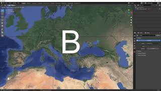
what are we seeing in the video thumbnail? is that a rendering? or is it a real model?
It's just a graphical representation of 3d modal.
I have followed all the steps to install blender, and blender gis, have also used the OpenTopography API key, but not able to load google satellite map, if any solution available please do help.
If you are using version 4 or above it won't work at that stage please revert back to version 3.x and it will work.
After clicking on basemaps it is showing,,,,,,,,,No imaging library available. Image IO was not correctly installed. Please help
If you have installed version blender 4 or above please try to revert to version 3.0.1 and hopefully your problem will be resolved.
@@gisdevops7665 Tried a lot, same issue, again and again, please help, it is very important for me.
@@gisdevops7665 worked good with 3.0.1 but will there be an update for the new Blender 4.1? I am using a Mac M1 Pro