thank you for your amazing tuts, I dont have Geolayers, and I'm trying to connect shapes like the one in this video, to a map imported from google earth studio, I zeroed the anchor point and the orientation values, but still the shape rotating differently, and not stuck to the exported trackers! can you help me to fix it? many thanks
Hi Boone, love your videos , thanks for all the tutorials - finally have bought and installed Geolayers 3 in the aescripts cyber sale using your affiliate link, looking forward to trying some mapping animations.
Nice video thank you ! I spent quite a long time looking for kml files, like arrondissements and quartier_paris... eventually found the files, but they kind of look empty, once in geolayers... Don't see any arrondissements... i think i'm gonna do it the old way, with googleearth... i was excited but now i'm fed up lol. I wish i could have your knowledge and... patience ! :) Cheers
Hi Boone, just joined your Patreon, because your channel is filled with very useful information. One question about this project: I am trying to replicate that, but then for Russian federal entities (oblasts). I found some geojson that I can use, but for my video I would need both the Ukranian Donetsk and Crimea to be in that map as well, but they are not included in the geojson. Is there a way to add shapelayers for both of them, so I can incorporate them in the animation? How would I do that? Also, it doubles my shapelayers; for every layer I get an (empty?) layer with a +1 in the name. So instead of 84, I have 168 shapelayers. I just selected them manually and deleted. Dunno if it will bork sth, but I will see.
Hello, can someone clarify the MapTiler’s Mapdata subscrption? The plugin cost 279usd and we also need to pay a subscription after 6 months on top of it to make it work? How are the features without this subscription thanks?
As far as I know, you lose most of the mapstyling features. You can't change the color palette very significantly, or turn on/off specific layers like roads, river/lakes, etc. You can still create country outlines and all of that via shape layers, and work with bing aerial satellite data. I'm going to get with the creator and see if I can get a list of what features you lose.
@@BooneLovesVideo hello thanks for the quick reply! You think I can overcome part of the mapstyling customization loss by customizing my maps using mapbox and than import it? BTW This product it's clearly not aimed at home users :(
@@JMsoo I'm pretty sure you can indeed do that via mapbox. It's quite a technically difficult workflow, but pretty sure it can be done. And yes indeed GEOlayers has a very steep learning curve.
@@BooneLovesVideo hello I tried the trial version of geolayers and imported the mapbox map I designed into geolayers it worked quite well well there is a tutorial on youtube and it is quite simple I will play withe trial version and decide if purchase it as I won't use it every time. However, after the end of six months included subscription I will just subcribe for for the time needed as it can be cancelled anytime, maybe. Thanks for your help :)
Well, Paris is a well known huge city, so the data is more readily available. You might have to dig a bit deeper. You might be able to download that directly from within GEOlayers. Not entirely sure though. Perhaps I can create a video that shows how to properly research and locate data. I need to learn more about this as well.
Actually they force you to use the MapTiler Cloud (200+ bucks a month) and still you have to insert the map provider name. I guess in the previous versions you could use your own maps

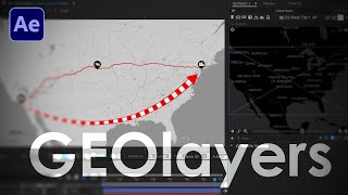


Get GEOlayers 3 -
aescripts.com/geolayers/?aff=47
thank you for your amazing tuts, I dont have Geolayers, and I'm trying to connect shapes like the one in this video, to a map imported from google earth studio, I zeroed the anchor point and the orientation values, but still the shape rotating differently, and not stuck to the exported trackers! can you help me to fix it? many thanks
Man i'm so glad i found your channel. Great Work !
Glad you enjoy it! Thanks for the nice comment.
Hi Boone, love your videos , thanks for all the tutorials - finally have bought and installed Geolayers 3 in the aescripts cyber sale using your affiliate link, looking forward to trying some mapping animations.
Cool! Thanks for using my link. Hope you enjoy the plugin.
太棒了,麻烦您多做一些关于GEOlayers3的教程,谢谢您
Definitely!
Great video, great channel. Btw, the Paris arrondissements spiral outwards by numbers. Try it in the animation!
I actually did that! Go check out Jay Swanson's channel and you can see it.
@jayswanson
Thank you for creating this video! been getting lot of helps from your tutorial using geolayers 3
Glad to help! Thanks for the nice comment.
@@BooneLovesVideo does this thing go on sale ever? or can i find it for free somewhwere? i cant afford geo layers but really need it!! :/
Great. Could you do more tutorials on GEOlayers3, thank you
Sure thing!
Nice video thank you ! I spent quite a long time looking for kml files, like arrondissements and quartier_paris... eventually found the files, but they kind of look empty, once in geolayers... Don't see any arrondissements... i think i'm gonna do it the old way, with googleearth... i was excited but now i'm fed up lol. I wish i could have your knowledge and... patience ! :) Cheers
Great video, I'm learning Geoplayers 3, can you share with me your sound effect used at 0:51 ?
我有个问题,希望你能回答我,kml文件从哪里下载的,谢谢了
Can you do a video on or direct me to how to script geolayers? I can't find any information, and I'm desperate enough to ask in youtube comments.
Hi Boone, just joined your Patreon, because your channel is filled with very useful information.
One question about this project: I am trying to replicate that, but then for Russian federal entities (oblasts). I found some geojson that I can use, but for my video I would need both the Ukranian Donetsk and Crimea to be in that map as well, but they are not included in the geojson. Is there a way to add shapelayers for both of them, so I can incorporate them in the animation? How would I do that?
Also, it doubles my shapelayers; for every layer I get an (empty?) layer with a +1 in the name. So instead of 84, I have 168 shapelayers. I just selected them manually and deleted. Dunno if it will bork sth, but I will see.
Welcome! Thanks for joining. I'm going to message you on Patreon. :)
Thanks!!
You're welcome!
where are the maps from? is the data that it locates free to use, or could it be copyrighted?
That is good content
Glad you think so. Thanks for the nice comment.
How I search for kml images data?
That's the most difficult part. Try here - www.naturalearthdata.com/
And as I did in the tutorial, do various Google searches.
Hello, can someone clarify the MapTiler’s Mapdata subscrption? The plugin cost 279usd and we also need to pay a subscription after 6 months on top of it to make it work? How are the features without this subscription thanks?
As far as I know, you lose most of the mapstyling features. You can't change the color palette very significantly, or turn on/off specific layers like roads, river/lakes, etc. You can still create country outlines and all of that via shape layers, and work with bing aerial satellite data. I'm going to get with the creator and see if I can get a list of what features you lose.
@@BooneLovesVideo hello thanks for the quick reply! You think I can overcome part of the mapstyling customization loss by customizing my maps using mapbox and than import it? BTW This product it's clearly not aimed at home users :(
@@JMsoo I'm pretty sure you can indeed do that via mapbox. It's quite a technically difficult workflow, but pretty sure it can be done. And yes indeed GEOlayers has a very steep learning curve.
@@BooneLovesVideo hello I tried the trial version of geolayers and imported the mapbox map I designed into geolayers it worked quite well well there is a tutorial on youtube and it is quite simple I will play withe trial version and decide if purchase it as I won't use it every time. However, after the end of six months included subscription I will just subcribe for for the time needed as it can be cancelled anytime, maybe. Thanks for your help :)
make a video for Pakistan's political map , cities , districts.
How did you find the opendata for France so easily? I'm trying to find a map with the neighborhoods of Duluth, MN and am striking out ha
Well, Paris is a well known huge city, so the data is more readily available. You might have to dig a bit deeper. You might be able to download that directly from within GEOlayers. Not entirely sure though. Perhaps I can create a video that shows how to properly research and locate data. I need to learn more about this as well.
thanks!
No problem, Dad. I know how much you love After Effects and GEOlayers.
@@BooneLovesVideo They are both my favorite!
Wholesome :)
Would you be willing to outsource this one? Im in Paris myself
Outsource?
👊🏻💥
The only thing stopping me from buying Geolayer 3 is the obligation to insert the map provider name in the corner. A no go for commercial projects :((
Actually they force you to use the MapTiler Cloud (200+ bucks a month) and still you have to insert the map provider name. I guess in the previous versions you could use your own maps
It's $20/month,, not $200.
@@BooneLovesVideo Just to clarify. $20 a month allows you to create maps without the watermark for commercial purposes?
@@UGwindbolt19 No idea. You'll need to check that out.
@@UGwindbolt19 @Boone Loves Video -- I was curious about this too. Did anyone figure out if the watermark can be removed?
How do you get geospatial data?
Check out this video - ua-cam.com/video/hPk3By84PMk/v-deo.html
What is wrong