How to Choose the Right UAV/Drone LiDAR Solution | Expert Guide & Tips

Вставка
- Опубліковано 10 вер 2024
- Confused about selecting the perfect UAV/Drone LiDAR solution? Our expert guide and tips will help you make an informed decision! Discover key factors to consider when choosing a LiDAR system, including accuracy, range, compatibility, and software capabilities. Learn how to evaluate your project needs and budget to find the ideal LiDAR solution for aerial surveys, mapping, and environmental monitoring. Don't miss this comprehensive guide to navigating the world of LiDAR technology. Subscribe for more UAV LiDAR insights, tutorials, and industry updates!
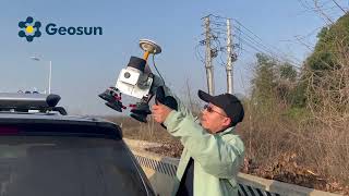
If you are interested in UAV/drone LiDAR mapping or mobile LiDAR technology, you have come to the right place! Geosun is one of the leading companies in UAV/drone LiDAR mapping solutions and mobile LiDAR scanning systems. Providing the most cost-effective UAV/drone LiDAR mapping products with free 3d point cloud annotation and 3d point cloud generation software, we are here to help you understand and succeed with your UAV/drone LiDAR, and mobile LiDAR needs!
Follow Us On Social Media:
➡ LinkedIn: / 70859796
➡ Instagram: / geosunnav
➡ Facebook: / geosunnav-110288717349485
➡Twitter: / geosunnav
Learn More:
➡ Visit Our Website: en.geosuntech....
➡ Contact Us: sales@geosunLiDAR.com
Don't forget to like, share, and subscribe for more exciting content! Leave us a comment below to let us know what you want to learn next.
#DroneMapping #DroneSurvey #SurveyDrone #MappingDrone #3DMapping #DroneLiDAR #LiDAR #AerialDrone #aerialmapping #lidarscanner


Like to see the data of these 4 lidar systems.
Hi Dr. Noli Sicad
We will share you the data link late
The link of data will be shared late