Це відео не доступне.
Перепрошуємо.
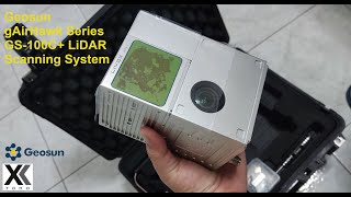
GS-1500N UAV/Drone LiDAR Installation & 3D Point Cloud Demo: Step-by-Step Guide

Вставка
- Опубліковано 16 сер 2024
- Discover how to install and utilize the GS-1500N UAV/Drone LiDAR system with our comprehensive tutorial. Learn the step-by-step process for mounting the LiDAR sensor and configuring software settings for optimal performance. Witness firsthand how to capture high-quality aerial LiDAR data and generate immersive 3D point clouds. Whether you're a GIS professional, surveyor, or drone enthusiast, this guide will empower you to maximize your LiDAR capabilities for precision mapping and modeling. Watch now and take your mapping projects to the next dimension!
If you are interested in UAV/drone LiDAR mapping or mobile LiDAR technology, you have come to the right place! Geosun is one of the leading companies in UAV/drone LiDAR mapping solutions and mobile LiDAR scanning systems. Providing the most cost-effective UAV/drone LiDAR mapping products with free 3d point cloud annotation and 3d point cloud generation software, we are here to help you understand and succeed with your UAV/drone LiDAR, and mobile LiDAR needs!
Follow Us On Social Media:
➡ LinkedIn: / 70859796
➡ Instagram: / geosunnav
➡ Facebook: / geosunnav-110288717349485
➡Twitter: / geosunnav
Learn More:
➡ Visit Our Website: en.geosuntech....
➡ Contact Us: sales@geosunlidar.com
Don't forget to like, share, and subscribe for more exciting content! Leave us a comment below to let us know what you want to learn next.
#LiDAR #DroneMapping #UAV #GIS #Surveying #AerialMapping #Geospatial #MappingTechnology #DroneTech #PointCloud #LiDARTutorial #DroneTutorial #MappingTutorial #GISMapping #SurveyingTech #GISCommunity#AerialMapping #DroneMapping #DroneSurvey #SurveyDrone #MappingDrone #3DMapping #DroneLidar #LiDAR #AerialDrone


thank you olive, you have Great Products.....my first experience with LiDAR is with gs-mid40. the cheapest LiDAR on planet earth
Thanks for your comments.
Yes, Geosun GS-MID40 is with most affordable LiDAR on the planet earth. Geosun endeavors to supply more applicable and affordable LiDAR solutions to benefit more world surveyor friends, meanwhile, ensures reliable satisfying performance.
Hi olive, on minute 1:37, should we pickup the take off point BEFORE we go to site, when we planning the mission?
Thanks also for your question, we could pick up the take off point before or after go to the site.