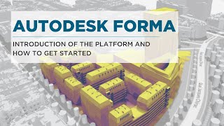
Autodesk FORMA: Complete Beginner Tutorial

Вставка
- Опубліковано 7 лип 2024
- Get all Revit Courses: balkanarchitect.com/?...
My Revit project files: / balkanarchitect
Get my Personal Revit Template + Family Pack: balkanarchitect.com/p/balkan-...
--------------------------------------------
This video is a complete beginner tutorial for Autodesk FORMA - a cloud based software for early stage planning and design. Autodesk forma will find topography, roads and building informations for the location of your project and then you can set up early stage design.
--------------------------------------------
Subscribe for more!
Please Like this Tutorial!
--------------------------------------------
Follow me on social media:
Instagram: / balkanarchitect
Facebook: Balkan-Archi...
Twitter: / architectbalkan
------------------------------------------
Patreon project file: / autodesk-forma-88364560
------------------------------------------
Timestamps:
00:00 What is Autodesk Forma
02:00 How to access autodesk forma
02:52 Exploring the interface
03:31 Starting a new project
08:28 Cleaning up the site
10:05 Placing a road
10:32 Placing the site
11:06 Placing trees
12:00 Proposal 1
13:48 Proposal 2
14:32 Proposal 3
17:08 Analysis in autodesk forma
21:06 Comparing Analysis in autodesk forma
22:45 Autodeks forma to Revit
66YT23


you definitely have your finger on the pulse when it comes to Arch technology. Many firms will be adopting this next year.
I followed the steps , its really add great value.
Thanks you a lot cause I am a last year student in ecological architecture field and those days I really needed a way to show how my envelope interact with environnement and nature . I WILL USE IT definitely
this is mind-blowing! Please more videos on the theme!
Thank you for this cool tutorial!
thanks a lot really loved your explanation, and I will be using FORMA for my proposal in internship.
You are my king
Super Fantastico, ormai sei un riferimento assoluto in materia! Grazie🔝🏆🏆🏆🍻
Hello Balkan. This is really cool. I should no longer use Maps and AutoCAD for these purposes. 😀
This is good to visualize potential of a site..location..And there be able to create the floor layout in Revit..and on a final note the model can be then added to Lumion or twin motion to add a fly through of the area and add vehicles ect..as a selling factor and proposal tool for the city permit..another words it is good for permit or Zoning presentation to the city.. once approved by the city engineering..Very good to visualize site potential.
youre too blessed
Thanks teacher handsome😊
es un software increíble para la planificación
very interesting , thank you. Is it possible to import the site borderlines from a dwg siteplan ?
Wow, bravo 👏 🙌
Nice tutorial, but can you show us how you get the roads to show in Revit? You can see the in Forma but they don´t come in to Revit
It is an interesting enough program. However, there are still many shortcomings. Since buildings are not raised on the topography, it seems to be working against sunlight analysis and energy efficiency management.
Thanks. The error that occurs results in not importing the roads. Is there a solution for it?
Hi, thanks for the vid, is it possible to analyze a 1km x 1km region?
❤❤❤❤
Thanks very much. Do you have a much more detailed video on the detailed use of the 3D Sketch option ? Thank you.
hello i saw your video and it's great, i was wondering if you could do one where you start from a proposal of Autodesk Forma and go to working in detail on Revit. thank you
Great videos. And now, taking into account the departure of Revit, we are only looking))))))😮💨
Hello Balkan does your balkan architects site have Dunamo tutorial videos ???
Can you copy paste in FORMA and how did you select per level to change the function?
Thank you for this vid, I have a question, can we model our building from rev it and import in to forma?
yes - export as an obj or IFC and bring in via the Forma library. There is an option to sync back revit data, but you need to duplicate your forma proposals so it doesn't overwrite it
Great video! However, i feel like this is like a more simple version of infraworks
Can we import data in the form of 3dm or skp into forma?
Hi Balkan ..is this same as Formits?? ..cheers!!!
How the streets were exported?
Hello >>>> thank you for you tutorials >>>> I've a question>>>> how we can Model a curved shape has vertical and horizontal curve in REVIT?
There is a sketch design feature in Forma where you can do splines and curves based on the FormIT engine. There is also a new Rhino beta workflow in the extensions
@@MrSamuelmacalister Can you show me the procedure by recording a video? thanks
I actually thought this is gonna be some AI stuff similar to Testfit. It doesn't really look like that. Yet. The (only) REAL benefit here seems to be the topo. Surrounding buildings are a 'nice to have' for now, as they are yet to be coordinated with the topo and that pretty much invalidates some analysis :)
If it’s free, it’s wonderful.
its included in the AEC collections
£192 monthly
How to rotate obj imported file?
Wow this forma is very nice but I've made a student account and it's finished the year or two can't remember
But why the building is not attached to the ground correctly?
I think that the software is just overlaying the building data over the elevated surface data, it would be really hard to automatically fit all buildings perfectly.
you can edit the site to flatten it to the correct msal@@balkanarchitect
@@balkanarchitect it is possible to move each building up and down to specify how they should meet the ground if you "release to basic building". You will then be able to access each part of the building and if you slightly drag-move it, then it will fall/jump to the terrain without moving it sideways. You can also use the move tool to move the building in the z direction
Do you know if this is accessible for Students?
I'm not sure, if you have a student license you can try. If you do, please let me know. I'm interested in this too!
Hello Balkan Architect
I don't know how to create a new hub. Do you care to show that?
Thanks for this astuces....
Is this service free???
Nothing is free my friend read my comment above
Its part of AEC Collections on subscription
CAD Mapper is a great tool for bringing map to any 3d software like Sketchup, Rhino, Autocad with layers and we can further design it inside our software. Forma force you to stick to autodesk software only.
I fail to see why this is a separate product from Revit, except for the fact that it doesn't look like the software was built on top of AutoDesk's garbage proprietary 3D engine. If you could actually reliably free model and snap to objects in 3D in Revit, this product wouldn't need to be.
Autodesk has claimed that Forma will expand to encompass and replace Revit in time. I'll see it to believe it of course, but they arent building major changes on Revit intentionally now, it's coming into maintenance mode I think - not end of life but end of meaningful change.
@@AussieBIMGuru have they released a timeline for when this junk will become a full BIM modelling system? Because right now it's a bad version of TwinMotion combined with a bad version of Ecotect circa 2010
@@henryglennon3864 I swear there was a product just like this years ago. I remember using it to mass up and test a stadium design and then import it into Revit. (I can't remember the name)
revit is 25 years old now, so we are developing the next gen BIM. It will take some time though :)
@@MrSamuelmacalister what have you idiots been doing for the past 25 years, then? Anything other than collecting rent and doing the bare, bare minimum to update your products. ArchiCAD is even older than Revit, but it didn't take them years of delays to release the ability to measure and reliability snap to objects in 3d. There are programmers making more credible BIM plugins for Blender than this.
This is just AUTODESK PROJECT VASARI.
haha - great observation. Not quite the same engine, but similar principals
Looks like Giraffe in 2020.
Basically what spacemaker was, so you're not far off!