How to Use gAirHawk 5.0 Post-Processing Software to Process Data Step by Step

Вставка
- Опубліковано 10 вер 2024
- In this tutorial, learn how to effectively utilize gAirHawk 5.0 post-processing software to easily process your data. From importing your data to advanced processing techniques, this step-by-step guide will help you navigate through the software's features seamlessly. Whether you're a beginner or looking to enhance your skills, this video will provide the knowledge needed to make the most out of gAirHawk 5.0. Watch now and become a data processing pro!
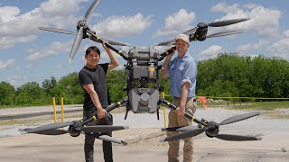
If you are interested in UAV/drone LiDAR mapping or mobile LiDAR technology, you have come to the right place! Geosun is one of the leading companies in UAV/drone LiDAR mapping solutions and mobile LiDAR scanning systems. Providing the most cost-effective UAV/drone LiDAR mapping products with free 3d point cloud annotation and 3d point cloud generation software, we are here to help you understand and succeed with your UAV/drone LiDAR, and mobile LiDAR needs!
Follow Us On Social Media:
➡ LinkedIn: / 70859796
➡ Instagram: / geosunnav
➡ Facebook: / geosunnav-110288717349485
➡Twitter: / geosunnav
Learn More:
➡ Visit Our Website: en.geosuntech....
➡ Contact Us: sales@geosunLiDAR.com
Don't forget to like, share, and subscribe for more exciting content! Leave us a comment to let us know what you want to learn next.
#DroneMapping #DroneSurvey #SurveyDrone #MappingDrone #3DMapping #DroneLiDAR #LiDAR #AerialDrone #aerialmapping #lidarscanner