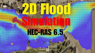
HecRas 2D flow modeling for beginners

Вставка
- Опубліковано 9 лют 2025
- HecRas 6.3.1 2D flow modeling for beginners
Here you can find a general explanation of HecRas 2D modeling of flow.
I talked about how to find the projection file, Ras Mapper, How to find the problems and solutions, What is the best type of mesh? , How to see the hydraulic connectivity of cells, Break lines, Refinement regions, How to modify the terrain or add a channel and bridge pier to the terrain, Dynamic time step, Hydraulic warm up and ramp, etc.
(NTNU numerical modeling and hydraulic course- 2023)
****
Watching more here:
• Hec_Ras
#hecras #hec_ras #flow #sediment #modeling #cfd #


Thanks a lot Behnam. Good job. regards!!
good to hear that :)
Thank you for the video, os it possible to get acces to the file to replicate it?
@@karelsanchez3476 Not for this one, but search on the net for any type of DEM file as topography and start to learn… good luck
Thank you sir .....U are such a blessing 🙏...keep helping students ❤️
It's my pleasure
Can you please make a video on steady flow for 2d model
And how to add lateral multiple structure like embankment shapefile data into the hecras to produce good result
I think I explained it a little in one of the videos. But I will do it soon if I find a time. Thanks for suggestion
Thanks a lot Behnam
My pleasure 😊
Thank you so much for your nice tutorial. Could you elaborate how could i set the elevation and dimension of embankment. Whether use terrain modification or breaklines in 2D area?
Thanks 🙏 Could you please explain more?
Thank you for the video!! can you give me please more information from where did you download the DEM?
I usually used data from lidar measurements. Produced by private companies
Hello sir,
I have been trying to generate TIFF files from DEM data multiple times, but whenever I upload them into HEC-RAS, the output appears blurry. I am unsure of what might be causing this issue and would greatly appreciate your guidance in resolving it.Could you please advise me on the correct process or settings to ensure that the TIFF files are clear and display properly in HEC-RAS?
It is hard to say something about it as I did not see it. But check the tif data in another softwares to check it.
@@behnambalouchi okay sir
sir, I have a question about boundary condition . Why did you choose flow hydrograph for upstream & Normal depth for downstream ?why not both are same or vise-versa?
Thanks for your following and subscribing. It depends to your river condition. And data you have. If you have normal depth DS you can use it, but if there is reservoir or see for example or a hydraulic structure downstream you should use the water hydrograph for example.
just wanted to ask do we have to import subbasins which were generated in hechms, in hecras and then do we need to define boundary condition for each subbasin separately or do we have to create a single 2d flow area perimeter for all the subbasins as whole, for 2D flood modeling? as we'll be using outputs from hechms which were generated for each subbasin
Usually, in hecras, you model less area compared to the hechms. So I think if you have good control over your topo and case you don't need to use hechms in general cases and projects and modeling. But I am not sure about your project
I not getting the 2d computational mesh after drawing 2d flow area. It is showing that current mesh contains no computational points. What should I do?
I recommend repeating the steps and checking everything more carefully.
I have a question. The DEM data does not show the real bathymetry beneath the water surface. So how can we run a 2D simulation with such DEM 2D data. ? is there a way to modify the 2D Area of the river main channel according to the real bathymetric data?
As I understand it correctly, yes you can modify it in hecras. But I think archis is better for it
Hi, sir Benham. I am a beginner and saw this tutorial of yours and I really appreciate it.
Is there any way that I can get your data and use it for practicing HEC-RAS? so that I could check my ways if it is in line with yours. Thank you!
I am not sure if I can share the data. So, please use another data set and practice. You can find other DEM file easily
Hi, Benham. I am new to the HecRAS model. I simulated the model but my water did not go downstream and just expanded in the area upstream. Do you know how to deal with this problem?
It is hard to add comments to it as I did not see the details. But repeat the steps. Maybe this is due to BC lines or Mesh. Make your mesh finer or use refinement mesh or breakline as I also mentioned in the video and explain it in another video. Check the results in detail to see what happened and don't give up. repeat it. Model a small and easy case first.
@@behnambalouchi Thank you very much for your encouragement. I have solved the problem. It's because of the computation settings (time setting). However, after changing the time interval to 1 minute, there is a sign of " Run-time error '7': Out of memory". I have changed several computers, it has the same problem. What do you think I should do? Thank you.
How to download the MNT ?
You can make it manually or make it by softwares like arcgis. I will make another video for it. Keep watching 🙏
Can you please share video for canal studies
Which canal studies? feel free to share
Good day sir, please I want to learn how to model using GSTARS3 for sediment modelling
I will make it one day, thanks
Great video👌
I have encountered a problem, I followed exactly how you showed but when I click on view>cross-sections it shows "no data for plot". Why might that be?
Try again
No Save option!
can you explain more? where?
@@behnambalouchi I wanted to save the video. Didn't find the option back at that time. IDK why. Now I see that!
@@TarannumKalamKhandoker I think on you tube you can not download it, just watch it on the you tube.
@@behnambalouchi With UA-cam Premium you can download a video. But the save option works for me! 😅