For anyone seeking to understand RTK technology, this video serves as an indispensable resource. The video’s presenter does an exceptional job of breaking down the intricate principles behind RTK, making the concept accessible to novices and experts alike. The concise explanations, coupled with graphics, ensure that viewers can grasp the core concepts in an engaging way. Thanks!
I love your videos mate, the way you talk I can understand very well, clear, calm, paused way to talk, knowledgeable and experienced man! Plus a good training and with the rights tools, equipments, live training in a real situation, like a specific scenario for leaner. Thanks mate from Australia, I wish over here we could have training like that!
Wow I finally understand. Thank you for the video. I just bought a Mavic 3 e with rtk module and got ahold of a ntrip provider and he is giving me a demo. He asked me what size of SIM card I need and it really through me off. I think I get it now from this video so thank you. P.s. your mobile monitor stations looks like the cats meow. Everything you guys are doing looks great and we will be doing business in the future.
Great video as always. I haven't seen anyone that explains how drones work as good as Steel City. It's easy to see why Steel City Drones sets themselves apart from other vendors.
THANK YOU for your clarity. This is the best video we have found on this subject. The only thing additional I would want to heard is are GCPs necessary if you have the D-RTK and Matrice 350 RTK package even as a backup?
With regards to cell tower, i recently flew Mavic 3E to gather data of cell towers for 3D modelling, i noticed that I have not once lose signal to the drone. However, the dish emitters did interfere and pushed my drone (RTK module installed but not connected to RTK services) slightly off course (especially when doing the 360 orbit video a few meters from the dish emitters). However, when flying without RTK module installed, i do not encounter any more interference , even when flying just 4m away from the dishes.
Great video and info on all of this. It's always great to learn.. do you have a video on explaining thermal camera drone and their differences from one to another?
Not sure if it was mentioned but its critical that the base station be placed on a known location. Which is why I'm going with NTRIP so I don't have to worry about that. Great video btw!
@@SteelCityDrones Another question - so far this hasn't been tackled from any other relevant YT content - let's say I want to survey an area with a distance of 20km with varying ground elevation, (1) would I still benefit from a commercial-grade RTK device (ie. D-RTK 2 base station)? (2) if there is a limit with regards to connectivity, would it be fine to move the RTK equipment to another point while the drone is waiting for the operator to move the RTK equipment? My question comes from us not being able to get a topographic surveyor due to the project site location and the nature of the project itself (raw water transmission lines). Our option is to use this drone setup instead, and that the D-RTK 2 would amplify the accuracy of the data.
Excellent video Question i have a Mavic 2 Enterprise Dual , Do i have Magnetic Protection/ PowerLine Protection ? I see on the chart , but does this still apply for the mavic 2 enterprise dual ? Thanks for your help ? Greatly appreciated
@@SteelCityDrones am a new pilot here in Cleveland Ohio i have a mavic 2 enterprise dual along with a mavic air 2 would you say these two drones can provide me with a successful bisness ? I appreciate your advice thank you so much
Great video. But now I know more, I have more questions. How close is too close for 1PUK ? Is there a specific distance from differing voltage lines? And same for heavy steel buildings?
If I have an RTK2 base station and would like to use it with M3E to get accurate volumetric measurements for stockpiles - Do I need to have surveyors come do a reference benchmark on my site, where I’ll set up the base station each time?
Great to hear. If we can help you with a drone purchase please let us know. We offer 24/7 tech support after the sale and free tutorial videos for all enterprise drones.
Great explaination of RTK as well as explaining the differences between the Mavic 3 Enterprise series and the Matrice. I plan on purchasing the M3T in March to get into commercial aerial thermal inspections as well as signing up with SAR organizations for my region and yes, I will be getting properly trained and certified for both. My question is, even though I'm not using the drone for surveying, can the 3T still benefit from an RTK module or is it overkill?
Does anyone have any good advice for using the D-RTK2 on a known point, and processing through PIX4DMatic? I am located in Virginia and have tried many times to set a point utilizing our GPS so I know the datum, and then set the D-RTK2 up on it. When I process it and check it to our GP points they are off 3-5' Horz. and vertically over 100'. Thanks for the help! Great videos!
great video, but just to recap ..i have a mavic3e with rtk module/antena on top, i also have a compatible third party gps, in what scenarious can I use the third party gps?
Great video! Question, are ground control points needed if you are using the RTK module with NTRIP or base station? Also the the M3 Enterprise RTK compatible with 3rd party base stations?
Many factors go into it such as if you are using terrain following, and how much elevation change there is in the project. You can get away without using GCP's if you use NTRIP and have flat elevation. But you always should be using check shots to validate your data. I have no experience using the M3 with RTK and 3rd party base stations. Best advice is to ask the manufacturer of the station.
Wouldn't it be possible for DJI (or a third party) to create a 2 puck external module to install into a Mavic 3 and gain several limitations? Just wondering...
Why can't we use 4G/LTE dongle connections on our drones like they do in some other countries for better connection, On DJIs website the DJI 4G Cellular Dongle says "Not available in your country/region."
Rather than running software for mapping, can the MAVIC multi spectral take a photo from say 300’ and capture a single multispectural photo. Or, does everything need to be processed?
Hi David. I have always wondered if setting up the DRTK base really makes a difference in terms of accuracy because I realized that one will still need GCPs. May you please explain the significance of using the RTK drone vs just a non RTK(normal GNSS mode). Thank you
I recently bought a Matrice 210 v2 Rtk drone with dual Zenmuse x5 and z30 setup. I want to use it to do some land survey and mapping with topography. Iwas wondering if it's absolutely necessary to use a land RTK GNS station or can I do it without?
RTK is not needed for survey flights. You will need to change your workflow accordingly to establish a GEO reference system. We are putting together a Survey Mapping online course coming very soon.
Thank you so much for the reply and I would love to take the course, I will doing much land surveying and mapping and could definitely use the knowledge!@@SteelCityDrones
The drone has to acquire RTK service from either NTRIP or a base station, it doesn't need both unless its a 3rd party base station such as EMLID or Trimble.
Why did the 2 puck RTK, M30 get handicapped with an Electronic Shutter, this is makes it not as capable to the mapping capabilities that the mechanical shutter on the one puck Mavic 3 Enterprise drone? Will the cameras on the m30 be upgrade-able?
Simple business they won't sell a drone that can do everything. They want you to buy several drones and make more money off of you. Well there is one the m300 but the payload cameras are just expensive as the smaller drones.
Great information! Two questions come to mind... If I want to do mainly roof inspections, would the 3E (with no RTK) be useful as far as the zoom capabilities or is there a better option for that area of expertise?
I always use post processing with my topcon gnss. Never had chance to try dji drtk modules. Do they capable of collecting static gnss data? If so m210 rtk base station might be useful for post processing.
It depends on how close you want the aircraft from the tower? The Mavic 3E has about 30% ability of the Matrice 30T and about 8% ability of the Matrice 300 in terms of Zoom ability-clarity. If you are comfortable with your aircraft 35-50 feet from the tower to get closeup detail such as reading stickers or surface rust on a fastener than the answer is yes. If you want the aircraft further back more toward 100 feet than you need a Matrice aircraft.
@SteelCityDrones thank you for answering. I am a new DSP in Singapore :) I didn't want to get an RTK as I am doing facade inspection and not mapping... but I realised the satellite coverage prevents my drone from continuing autonomous flight. Hoping RTK can change that
@@SteelCityDrones I would like to confirm that. The M2EA was RTK but did not have time sync and also had a bad RGB camera. I would like to see how the M3E stacks up against the M300 P1.
@@SteelCityDrones some use the mini as a mapping drone. Just because it is RTK does not make it a proper drone for survey. I learned that with the M2EA. DJI just want the consumer to buy more of their stuff…
@@SaanichtonMinistries You have never seen us claim that a consumer drone can't perform mapping jobs. With any consumer drone, there has to be a camera profile in the processing application like Pix4D and then you need to use the appropriate amount of ground control points.
We have been using this source to show what states have it. We found it to be pretty accurate. www.gpsworld.com/finally-a-list-of-public-rtk-base-stations-in-the-u-s/
@Steel City Drones I figured you were using a source, I was just sharing that CT does, in fact, have a free NTRIP service called the ACORN network and managed by UCONN. So it's not 100 % accurate, ACORN isn't brand new either, it's been available in its current configuration for free since before 2019.
From our research it does appear that Drone Deploy is offering free NTRIP RTK service to their customers in which you would not need the DRTK2 base station.


I would say this is the best video I have found on our TK technology. Thanks very much for the hard work and putting this together.
For anyone seeking to understand RTK technology, this video serves as an indispensable resource. The video’s presenter does an exceptional job of breaking down the intricate principles behind RTK, making the concept accessible to novices and experts alike. The concise explanations, coupled with graphics, ensure that viewers can grasp the core concepts in an engaging way.
Thanks!
I love your videos mate, the way you talk I can understand very well, clear, calm, paused way to talk, knowledgeable and experienced man!
Plus a good training and with the rights tools, equipments, live training in a real situation, like a specific scenario for leaner.
Thanks mate from Australia, I wish over here we could have training like that!
This was the most useful information I’ve seen on RTK anywhere! Thanks for making this video!
This video is valuable for its blend of technical depth and simplified explanations
I learned SO much from watching this video. I’ve been very confused about the different kinds of enterprise drones and RTK.
Wow I finally understand. Thank you for the video. I just bought a Mavic 3 e with rtk module and got ahold of a ntrip provider and he is giving me a demo. He asked me what size of SIM card I need and it really through me off. I think I get it now from this video so thank you.
P.s. your mobile monitor stations looks like the cats meow. Everything you guys are doing looks great and we will be doing business in the future.
Just FYI: The Network SIM dongles you see for the smart controllers are not FCC compliant (legal). Also DJI does not support them in the NA versions.
Do you have a base station?
Im an airplane pilot and also part 107 pilot and basically RTK is like an airplane’s WAAS but for drones. Good stuff, thanks for the info
Very well presented and edited video.
Explained in the best possible way!
Really enjoy your information David.
I can understand you and I also completed watching. Very good.
Great video again.
Great video as always. I haven't seen anyone that explains how drones work as good as Steel City. It's easy to see why Steel City Drones sets themselves apart from other vendors.
THANK YOU for your clarity. This is the best video we have found on this subject. The only thing additional I would want to heard is are GCPs necessary if you have the D-RTK and Matrice 350 RTK package even as a backup?
Yes they are for accurate mapping ground truthing
Fantastic information, thank you for your content Sir!
With regards to cell tower, i recently flew Mavic 3E to gather data of cell towers for 3D modelling, i noticed that I have not once lose signal to the drone. However, the dish emitters did interfere and pushed my drone (RTK module installed but not connected to RTK services) slightly off course (especially when doing the 360 orbit video a few meters from the dish emitters). However, when flying without RTK module installed, i do not encounter any more interference , even when flying just 4m away from the dishes.
Brilliant explanation of RTK, Thankyou.
Great video and info on all of this. It's always great to learn.. do you have a video on explaining thermal camera drone and their differences from one to another?
This was needed. Thank you.
Not sure if it was mentioned but its critical that the base station be placed on a known location. Which is why I'm going with NTRIP so I don't have to worry about that. Great video btw!
You may consider post processing. Ntrip gnss may be very far away which prevents trustable fixes and coordinate information.
I know this is a year old video (at the time I'm writing this) but where do I get a TV Demo setup like this? --> 20:31
On our website, we custom make them. www.steelcitydrones.com
13:01 correct me if I am wrong - having 2 pucks does not mean a more accurate positioning. Instead, it provides protection against metal and power?
Correct.
@@SteelCityDrones Another question - so far this hasn't been tackled from any other relevant YT content - let's say I want to survey an area with a distance of 20km with varying ground elevation,
(1) would I still benefit from a commercial-grade RTK device (ie. D-RTK 2 base station)?
(2) if there is a limit with regards to connectivity, would it be fine to move the RTK equipment to another point while the drone is waiting for the operator to move the RTK equipment?
My question comes from us not being able to get a topographic surveyor due to the project site location and the nature of the project itself (raw water transmission lines). Our option is to use this drone setup instead, and that the D-RTK 2 would amplify the accuracy of the data.
Great video! So extensive and honest. Very good.
Great video. So much useful information. Thank you so much!
Great Video for sure David !
Thank you!
Excellent video Question i have a Mavic 2 Enterprise Dual , Do i have Magnetic Protection/ PowerLine Protection ? I see on the chart , but does this still apply for the mavic 2 enterprise dual ? Thanks for your help ? Greatly appreciated
No sir.
@@SteelCityDrones am a new pilot here in Cleveland Ohio i have a mavic 2 enterprise dual along with a mavic air 2 would you say these two drones can provide me with a successful bisness ? I appreciate your advice thank you so much
@@BRO-vk7oi no sir
Muchas gracias muy buen video. Ahora tengo más claro todo.
I prefer the M30 but it is inferior to the E3 for mapping. Why put two pucks in an inferior drone that cost so much more?
So that people buy 10 different drones, batteries, chargers, remote controllers etc etc instead of just one platform.
Great video. But now I know more, I have more questions.
How close is too close for 1PUK ?
Is there a specific distance from differing voltage lines? And same for heavy steel buildings?
If I have an RTK2 base station and would like to use it with M3E to get accurate volumetric measurements for stockpiles -
Do I need to have surveyors come do a reference benchmark on my site, where I’ll set up the base station each time?
That is a great, clear description. I have been looking for something like this. Thank you.
Hello! I want to get a online training session from you. How can I get this training?
Perfect video 4 days before probably purchasing one
Great to hear. If we can help you with a drone purchase please let us know. We offer 24/7 tech support after the sale and free tutorial videos for all enterprise drones.
@@SteelCityDrones I guess the delivery to Switzerland might be tricky, but in general I likely will use your videos :)
Great explaination of RTK as well as explaining the differences between the Mavic 3 Enterprise series and the Matrice. I plan on purchasing the M3T in March to get into commercial aerial thermal inspections as well as signing up with SAR organizations for my region and yes, I will be getting properly trained and certified for both. My question is, even though I'm not using the drone for surveying, can the 3T still benefit from an RTK module or is it overkill?
May I ask where you’re getting your training for SAR and Thermal? Will you be doing this online or in person? Thanks!
Good video, please can the drone use the normal DGPS base station for work ie Hi Target V30 plus as a base station?
Thanks a lot for the information..
Does anybody know options for drone positioning without any gps signal? For example in underground or in huge covered building.
YOu would be relying on the vision system cameras to help maintain position.
Does anyone have any good advice for using the D-RTK2 on a known point, and processing through PIX4DMatic? I am located in Virginia and have tried many times to set a point utilizing our GPS so I know the datum, and then set the D-RTK2 up on it. When I process it and check it to our GP points they are off 3-5' Horz. and vertically over 100'. Thanks for the help! Great videos!
great video, but just to recap ..i have a mavic3e with rtk module/antena on top, i also have a compatible third party gps, in what scenarious can I use the third party gps?
Mapping only
I am already using the rtk module for that with great succes, but how can the third party gps help me more?
@@lowbass5 A one puck antenna system will only help you with positioning, so the answer is no.
Great video! Question, are ground control points needed if you are using the RTK module with NTRIP or base station? Also the the M3 Enterprise RTK compatible with 3rd party base stations?
Many factors go into it such as if you are using terrain following, and how much elevation change there is in the project. You can get away without using GCP's if you use NTRIP and have flat elevation. But you always should be using check shots to validate your data. I have no experience using the M3 with RTK and 3rd party base stations. Best advice is to ask the manufacturer of the station.
Great explanation.
Good explanation ! Thnx !!
Wouldn't it be possible for DJI (or a third party) to create a 2 puck external module to install into a Mavic 3 and gain several limitations? Just wondering...
Unfortunately its not possible.
Why can't we use 4G/LTE dongle connections on our drones like they do in some other countries for better connection, On DJIs website the DJI 4G Cellular Dongle says "Not available in your country/region."
FCC laws and regulations
How about LiDAR? Does it work the same with RTK GPS? Does it require connection to the GPS satellite and base station as well?
Lidar is always highly recommended for Lidar and its a requirement for DJI Lidar cameras.
Rather than running software for mapping, can the MAVIC multi spectral take a photo from say 300’ and capture a single multispectural photo. Or, does everything need to be processed?
You only need processing if you are stitching multiple images together.
Hi David. I have always wondered if setting up the DRTK base really makes a difference in terms of accuracy because I realized that one will still need GCPs. May you please explain the significance of using the RTK drone vs just a non RTK(normal GNSS mode). Thank you
Yes we cover that in the video.
04:12 How the compass affects drone flight safety
05:55 How RTK improves Wind Performance
Thank you Dave! Had to to re-watch. It makes sense now. Big thanks !
I recently bought a Matrice 210 v2 Rtk drone with dual Zenmuse x5 and z30 setup. I want to use it to do some land survey and mapping with topography. Iwas wondering if it's absolutely necessary to use a land RTK GNS station or can I do it without?
RTK is not needed for survey flights. You will need to change your workflow accordingly to establish a GEO reference system. We are putting together a Survey Mapping online course coming very soon.
Thank you so much for the reply and I would love to take the course, I will doing much land surveying and mapping and could definitely use the knowledge!@@SteelCityDrones
How does/will the additional 4G module help the Mavic 3 Enterprise in the mentioned hazards, bridges and dish towers?
It doesn't, its illegal to use in the US.
SO, if I’m in Texas with free NTRIP and an RTK module on m3e then physical $5000 base station isn’t needed
The drone has to acquire RTK service from either NTRIP or a base station, it doesn't need both unless its a 3rd party base station such as EMLID or Trimble.
Do you need a constant internet connection if you are using an NTRIP connection?
Yes you do.
Why did the 2 puck RTK, M30 get handicapped with an Electronic Shutter, this is makes it not as capable to the mapping capabilities that the mechanical shutter on the one puck Mavic 3 Enterprise drone? Will the cameras on the m30 be upgrade-able?
Simple business they won't sell a drone that can do everything. They want you to buy several drones and make more money off of you. Well there is one the m300 but the payload cameras are just expensive as the smaller drones.
Does the base station need to be set up on a control point with known coordinates, or can it be setup in a random location?
Am wondering the same
Great information! Two questions come to mind... If I want to do mainly roof inspections, would the 3E (with no RTK) be useful as far as the zoom capabilities or is there a better option for that area of expertise?
That would be a good option.
good video are you saying you have issue flying around cell tower
Certain cell towers create flying issues that can zap the drone. However they are unrelated to RTK issues.
So i have a Mavic 3E with RTK module. I can use the RTK module with Ohio’s NTRIP (CORS) Network and not need the D-RTK2?
Yes that is correct. You need either NTRIP or DRTK2 base station, not both.
Excellent video!
Do you think it is possible to use the DJI M30T with the old Matrice 210 v1 RTK base station?
No it can't work together. It has to be the DRTK2 base station
I always use post processing with my topcon gnss. Never had chance to try dji drtk modules. Do they capable of collecting static gnss data? If so m210 rtk base station might be useful for post processing.
Very informative! Is DJI Mavic 3E good for cell tower inspection ?
It depends on how close you want the aircraft from the tower? The Mavic 3E has about 30% ability of the Matrice 30T and about 8% ability of the Matrice 300 in terms of Zoom ability-clarity. If you are comfortable with your aircraft 35-50 feet from the tower to get closeup detail such as reading stickers or surface rust on a fastener than the answer is yes. If you want the aircraft further back more toward 100 feet than you need a Matrice aircraft.
@@SteelCityDrones many thanks.
After buying a DJI RTK base station... do I still have to pay any subscription fee thereafter to get that satellite coverage?
No you don’t have to pay for any subscription services. That would only be for NTRIP
@SteelCityDrones thank you for answering. I am a new DSP in Singapore :) I didn't want to get an RTK as I am doing facade inspection and not mapping... but I realised the satellite coverage prevents my drone from continuing autonomous flight. Hoping RTK can change that
I thought DJI was advertising accurate mapping with the RTK module, and no bay station
Yea sir you can get accurate mapping with the RTK module with the M3E.
I wonder why drones don't use INS based navigation?
What about time synchronization? Does the Mavic 3 have that option?
Yes it has to have it because Mavic 3E is a mapping drone.
@@SteelCityDrones I would like to confirm that. The M2EA was RTK but did not have time sync and also had a bad RGB camera. I would like to see how the M3E stacks up against the M300 P1.
@@SteelCityDrones some use the mini as a mapping drone. Just because it is RTK does not make it a proper drone for survey. I learned that with the M2EA. DJI just want the consumer to buy more of their stuff…
@@SaanichtonMinistries You have never seen us claim that a consumer drone can't perform mapping jobs. With any consumer drone, there has to be a camera profile in the processing application like Pix4D and then you need to use the appropriate amount of ground control points.
Do you know if there is a free NTRIP network in Canada?
Sorry no data for Canada.
How much distance can the RTK base station reach?
When the aircraft is 400 feet high with complete line of sight they rate it for several miles.
Can anyone give me info on using Carlson brx7 base with matrice 350.
The dealer you purchased it from will know exactly for sure.
Дякую за відео, вітання від птахів Мадяра
І шо хлопці. Можна щось придумати щоб спозиціонувати дрона в наших умовах коли супутників багато)))
Завжди думав про базові наземні станції з відомими корами...
awesome !!!!
Thank you
How much will this drone cost?
Not sure what drone you are referring to. This video is discussing RTK technology that many drones use.
Is that Pittsburg steel? It ain’t Bethlehem.
The question is not whether I need it but can I afford it? The answer is: NO! End of case (for me). Thank you nonetheless
RTK is just a tool for certain applications.
CT has free ntrip network
We have been using this source to show what states have it. We found it to be pretty accurate. www.gpsworld.com/finally-a-list-of-public-rtk-base-stations-in-the-u-s/
@Steel City Drones I figured you were using a source, I was just sharing that CT does, in fact, have a free NTRIP service called the ACORN network and managed by UCONN. So it's not 100 % accurate, ACORN isn't brand new either, it's been available in its current configuration for free since before 2019.
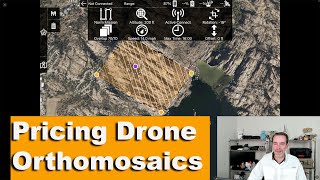
H😅do you guys price a job?
Watch this ua-cam.com/video/frzcZ8Ee13M/v-deo.html
If you don't have GCPs certified by a licensed surveyor your work is useless.... Unless you're a licensed surveyor and you trust RTKs....
The methods and workflows we teach using OPUS anyone is able to verify the data and audit the trail.
HaHaHa. ROFL!Selling 69 dollar hardware for 700 bucks that's wonderful. DJI has somehow found the perfect cash cow...
Or you can just resort to the old reliable way....GCP's
Great job, very clear
Do the RTK network areas that Dronedeploy offers negate the use of a GC station or GCPs?
From our research it does appear that Drone Deploy is offering free NTRIP RTK service to their customers in which you would not need the DRTK2 base station.