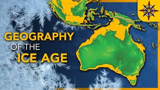
The world map 10000 BCE: Atlantis, The black sea flood, end of the ice age and Eye of the Sahara

Вставка
- Опубліковано 7 тра 2023
- Hello and welcome to a new italian p&c video, today we'll be looking at the map that shows the world in the year 10k according to many different sources.
to join the channel's server, click this link: / discord
(I did not make this map, it's mate888's: www.deviantart.com/mate888/ar...) - Ігри


Welcome to a new series yall! Leave a comment to help out the algorithm spread this video! If it gets to 5k views in a week I'll make more
yes yes master Italian I'll comment
@@salt-shin tis good
atlantis was real change my mind
❤ love your content!
Italian do u have email where i could contact you? I wanted zo ask smthng
New video? new series! Looks great already
It is what is left of Atlantis. Google Earth shows the island continent chain running north to south in the middle of the Atlantic ocean. Florida was a part of it. Look to Florida more than anywhere else. Anyway ready for the next global land/water shift? Coming up sooner than you realize and in your lifetime..:
Right!
“Atlantic” ocean.
“Atlantis” Ocean.
🤔
There's a gentleman that does a detailed analysis of areas of the Azores that have sunken and how it correlates to Plato's discriptions. It's interesting as it's all underwater and matches, as does the eye of the sahara.
the eye of sahara is in my opinion more convincing. It just doesn´t make sense that America is not known on any of these ancient maps, but Atlantis shall have been in the middle of the atlantic ocean or even on the continent America. The Herototos map also clearly locates it in africa.
The glory of Agartha's story is so huge! I really hope you cover it in a video in the future, it really deserves it's own.
Thank you from Australia. I appreciate the way you discuss this map (& others). Please continue.
search Terra Infinita
i never comment on anything but i just wanted to say thank you for taking your time to make the content that you do, i enjoy watching your channel alot
Very enticing. I'll do some research on the eye of the sahara. Thanks for bringing this to my attention!
Change of usual content, but still much appreciated. I like this map being blunt about atlantis' existance
Thanks P&C another cool vid.
Great video, can t wait for the next one!
Very impressive. It's even showing the Bosnian pyramids.
Stoked. Keep it up. As well as. Id love to read all of the Lore of xenoasia. How can i do so?
Keep up the good work!!
Dankeschön 👍🙏💜
Even though im not a fan of youtube shorts, cutting a few parts out of each video and posting them as shorts may help with drawing viewers to the main video
Hello @Italian P&C ..firstly I want to thanQ for your very detailed analysis of the Worlds Beyond the Icewall!! Bravo! I'm super intrigued..I'm just about to begin Part 2 series..I've been digging aroudn for a couple of years now on this subject matter and then a few weeks ago, your channel showed up in my algorythm! Most likely due to previously finding Nos Confunden.. I have a question that I've not yet been able to find an answer to or anything significant to rule out or in my quandry...perhaps you've covered this? 👉👉My question: Has the Ice Wall always existed along with the 4 gates? where before the "reset" were all the lands beyond our original earth realm, accessible? Or was the Icewall "created" during the "reset" prior to the Treaty of 1961? I'd appreciated any resourses/theories/historical archives, if there is any. ThanQ, I'm really enjoying your channel! 🙏✨
thanks for informations!
World War II was a defense against expansion, as was the Fomor war against the Tuat de Danaan.
Thank you.
AWESOME WORK---THANKS
The Atlas Mountain Range was named after King Atlas. The first King of the Atlantean Empire
The fact damascus might have had people then
According to "Aristotle's Ecumene", highlighted by a recent piece of research,"The pillars of Hercules" are near the kerkennah islands ( on your map, between Sapharsi and Lapesh, and not at Gibraltar.)This would repoint the search for Atlantis, according to Homer ,into Africa and ultimately Mauritania...The climate in North africa was green but there is evidence of a tidal wave, ( see Google Earth) with striations across Mauritania into the atlantic. .Geologists have also noticed giant sand waves in the same area.
This rocks
I was looking for the link of this map so I can study independently
Can you please link the source?
Billy Carson just released a video on Atlantis.
Yes the flood myth origin is as he said the result of the floods of the black sea caused by glaciers melting in the enr of the latest glacial era ! Glad to see you're so informed on the topic
Great to see you liked the video
@@italianpc4119 yeah it was great. A lot of history everyone needs to know about😄
Not necessarily true, Altai flood explains why Native Americans share Eurasian flood myths, including Noah's ark. It's the region where half of European ancestry and most of Native American ancesty comes from, where white skin and blond hair originated at least 18k years ago.
There have been many floods. The Black Sea is a local level. There have been many world floods
there are >200 flood myths counted, f.i. also Mayan
I wonder if at one point maybe after this map the water level went down and Atlantis became landlocked and only the rivers ran though the eye. Which is clearly a port
So how does this work when compared to the Nos Confunden Map where Atlantis and Lemuria are clearly located elsewhere?
Nobody knows any of this shit for sure it's just theories but..but me personally although I enjoy the nos map and the two books about it..they are just fiction I'd put my money on this map being real before the nos map
Oh wow this is new. Let's see what this is about
Please could you write the name of the source of your map? How was it created ? On what evidence is it based please ?
10:58 u can clearly see just by looking at satellite view zoomed in on it the there was CLEARLY square structures built in those rings. They lying hard to us about that place. And look around it from satellite view u can even see other circular smaller cities that used to exist near it aswell
The sea level was 350 m lower. when the comets hit the northern ice caps of America, Russia and Europe, this ice cap of 2 km high vaporized in a matter of days, resulting in a global water/mud precipitation and rise of sea level in a time frame of a few years. All around the world you find sunken cities at the coast, which makes sense. Those civilizations sunk practically over night.
Doggerland, connected the British isle with western-europe, that is correct. What I don't understand is how western Africa seems to be swallen by water in this map, there should also be more land visible there, not more water.
there was no desert in those years in the Sahara, it was green, with lots of big rivers and lakes
another slay video⁉️⁉️⁉️
Incredible analysis! So many informations! THANKS for spreading the TRUTH about Atlantis!
He wasn't spreading "truth" about Atlantis he was just analysing a map and you are dumb enough to believe it
Pelkodomos. Interesting. Since we Poles call our households: "domostwo" domos-two. "Dom" is house in Polish (unlike domes in the rest of the indoeuropean countries, meaning church or cathedral).
So, Pelko-domos. Polak for male and Polka for female. That's how we call ourselves. ;) "Pelko" sounds similar. ;) .... minding all those 3000 years of language disfiguration and in pronunciation. Btw. none of the other Slavic countries call a house with "dom". Interesting.
Serbs does. Most of the south slavs actually, kuca, dom,
The story of Atlantis comes from the Egyptians through Plato. And it is not an island in today's terms but "Island" in Greek terms 2,000 years ago meant any land you reached going across water first. Even if it were just a river. But the big indication that Atlantis is on the continent of Africa is in Plato's account of Atlantis he talked about the many "elephants" in the city of Atlantis and around it. Also we know the Sahara desert only formed around 7,000 years ago. Before that, the Sahara was a lush green tropical "paradise" with rivers and large lakes. But for "elephants" to make it to an island would mean "ancient man" brought elephants on boats to the island of "Atlantis". And that just doesn't make sense. Furthermore, Plato said people came 24 hours a day, both day and night. Well, the people coming at night would not have been on a boat. But would have come across land.It was far too dangerous to pull your boat into an unfamiliar port in the middle of the night. I think we can be fairly confident the Richat Structure or Eye of the Sahara is Atlantis. One it sure looks like the description of Atlantis. But the biggest piece of evidence it is Atlantis is there is a fresh water well in the center of the Eye of Sahara even today. That's the number 1 thing you must have to build and operate a "city state".Fresh Water.
❤❤❤
The Irish are familiar with the Fomorians , the Nemedians and the Snakes . The druids are the snakes . ?
Where is : Greater Adria , Doggerland , Garden of Eden etc
B.C stand for Before Cataclysm
Make a aoi scenario with this🗿
😂😂😂😂😂😂😂😂
Hi friends! :) I just wanted to let you all know that "Atlantis" wasn't a place, it was an Age. The Atlantean age. It was world wide and this is why people think they find it here or there... it was everywhere. I spent my last incarnation there and now I am back.... Atlantis was not a place, it was a time and an age long ago. Also known as the Golden Age. And that age will come again. I'm sending love to all who need it. Thank you for your coverage of these topics Italian P&C ^_^ The truth will come to light soon enough.
WRONG.... Before the KNOWN flood the WORLD was called ATLANTIS. after the flood the NEW WORLD was re- named New World "EARTH" as it was re-born after it was complete defaced by the flood. Now called EARTH formally known as Atlantis... Hence World Atlas of short. The New age New World science was in control of the word, ;leaving the spiritual world behind. Birth of Science EARTH.
Atlantis was a place. It is shown here on this map. It is also shown on the Herodotos map.
It was AFTER it was an age... where do you think the survivors went? Thanks.@@segoiii
So this is what the Earth looked like 12000 years ago?
No. This map is grossly inaccurate. It should look similar to today with the continental shelves also above water. Additionally, water has weight. That massive weight in the middle of the Atlantic depresses the sea floor a greater amount there, many thousands of feet, than the edges of the Atlantic leaving the Azores plateau above sea level prior to the northern glaciers melting. The middle Atlantic is the boundary edge of floating plates further increasing the depression. It is measured that small volcanic islands depress the sea floor and that Antarctica would rise if it's ice cap melted. The North American continent is measured to still be rising 11600 years later. Yet, everyone conveniently ignores the flexibility of the sea floor in regards to sea level rise to push their false agendas.
The dayto back
Comment for algorithm boost
Atlantis was not alone in being developed(Atlantis still is. it is NATO) they were at war with Hyperborea, Agartha. Also the name of the AS (ASia) and they name RASA. That's why the RASsia conflict with NATO is still going on. And the last war destroyed the world to rubble and the Stone Age.
My thoughts as well regarding Atlantis now NATO
The Farmer Kingdom might be the Aryan Kingdom
24-May-2024. 1:09 PM. FRIDAY.
Apr 25, 1023
How does one access this map?
the reader said it's made by meghtiteiteite I think. It might be an ancient author, I'm positive
I from Portugal
9:19 AM-13-May-2023. SAT.
An asteroid impact in Green land and the Burckle Asteroid hit also in Indian Ocean made the Great Flood of Noah
The Bible Genesis is True…..
Your Map is Correct….
Atlantis is like New York Today….
If you want to find Atlantis look in Africa
Yep that's what's in the video
Europe and whole world was atlantis back then
@@midnightblue3285 no. Atlantis was at war with Agartha. Agharta is nordiks atlantida is drako
@@lightislight9 Agarta is atlantis, and atlantis is invaded by the dracos,
Atlantis have many names
Atlantis and annunaki atlantis powers are divided into reptilian and none reptilian and hostile reptilian and none hostile archon reptilian, with agartian heritage together, later when its tottaly become multi global emppires humans are lived in the atlantian, agartian, lemurian global unified empire
@@midnightblue3285 Ag Ar Ta. White(argentum) Arians of Tartarya.
Perhaps through Atlantis the invasion began. But in addition to Atlantis there was also ASia, the country of the Ases (AS/RASA) with its capital in Asgard in the center of Eurasia in the Urals region or easter, most likely the Putorana plateau. Where one of the first blows was struck, resulting in climate change, floods and population migrations
Hmmmm
So where is the Americas on this map
In the west, you can see part of it shortly in the start of the video. If this video gets 5k or 6k views in this week I'll continue the series on this map and showcase the rest of Asia as well
As the Americas in the next videos
@@italianpc4119 how did this guy not see them it's in the video🤣
My bad sorry
The Atlanteans are draconians who infiltrated the garden and seduced the Adams and Eves into starting a rebellion. The Adams and Eves escaped from the Eden, the parks where they were cloned for certain purposes.
The Atlanteans are Draco. That's why they like sizzling names. Such as ish. English for example.
Mudfossil university on UA-cam channel has information on earth
every body was black at that time btw
No
I believe Not!
No races came from other races, we were ALL created equally!
@@ChiGirl43 no. Some cant survive the équatoriale sun.
No, sorry, this was not Atlantis. sheesh. The civilization that inspired the story was located on the now submerged Cyclades Plateau. Ocean geographers can help you with this if you talk to them. (FYI... even Strabo said that Germanic tribes had erected "pillars of Hercules" in some of their villages. These "pillars" were all over the place and were just stones, pillars, or carved wooden totems dedicated to the son of the storm god, or the storm god. Everyone is just sick of everyone trying to claim Atlantis as "theirs" because they are so jealous of the Greeks, their history, and their accomplishments. This is why there will never be any serious study of this pre-flood civilization, true historians and archaeologists won't touch it for fear of ridicule.
It's already been proven by geologists that the eye of the Sahara is just a geological formation.
boost
Baalansi is nowadays Valencia in Spain. Also Baalseron is indeed Barcelona, and Baalarish is indeed the name of the Baleares Islands . Then Zibasi i can only guess it could be Cádiz near Gibraltar, and Otsoar and Adrarish, no idea. Jentilak Clans, i asume they are the Basques, because Jentilak is a basque word refering to the gentil peoples, or non believers .
Thank you.