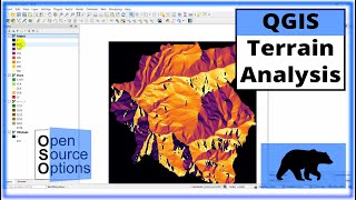
QGIS 3 Lesson 2 Using slope analysis tools for rasters in qgis

Вставка
- Опубліковано 18 тра 2020
- Data available at www.dmad.org.tr/qgis-3-lesson-2
Hi and welcome to Lesson 2 in DMAD - Marine Mammals Research Association's third free QGIS course. This course is for intermediate users and assumes previous knowledge. If you're new to GIS or haven't used it for a while then I suggest flicking through a few of our previous lessons. In today's lesson we're going to use slope analysis to look at the steepest part of our raster.


You have been instrumental to my PhD work, your guidance has been extremely helpful. God bless you.
Thanks it's useful
Thank you very much, it's very interesting! I wonder why the lake at the southwest area is white on the slope analysis, does it only reflect the slopes on land or is there another reason for this?
Hi Lucía, the area of white in the south west is actually Boka Kotorska Bay and so it part of the sea so the white is just the background of QGIS
@@dmadmarinemammalsresearcha3966 thank you for the reply! I actually meant the Skadar Lake area (which is the SouthEast, I wrote it wrong last week - sorry about the confusion) which does show in the "MNE_UTM34" layer under the slope analysis. Thank you!
Hi Lucía, no problems! The lake itself appears black (flat) because the lidar data just reflects of the surface and is not a true 'land' value. There is a thin (and quite unusual) range of mountains that runs just south of the lake which is white. Could this be it?
@@dmadmarinemammalsresearcha3966 Yes! I see what you mean. So basically I got confused because the lake area is a 0 value and when we set the transparency to get rid of the black area around the map (minute 5:37 in the video) it gets rid of the lake area as well, so you can see the underlying "MNE_UTM34" layer (and if you switch it off it's just white - background colour). But thank you very much for the explanation, it has helped me understand how that happened. Once again, thanks a million for this course, I am enjoying it very much!
@@luciacaldas4587 ah I understand! You're extremely welcome 😊