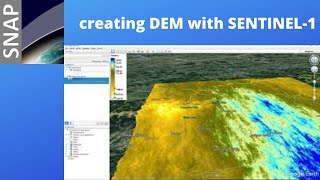
Mosaic Sentinel 1 images in the SNAP

Вставка
- Опубліковано 5 лют 2025
- An image mosaic is a technique that combines several images with overlapping parts (the images may be obtained at different times, at different viewing angles, or by different sensors) into a large-scale seamless high-resolution image. in this video, we've thoroughly shown how to Mosaic two sentinel-1 images in SNAP which is one of the powerful software to process sentinel images. At first, we pre-process sentinel images one after another with both manual and semi-Automatic methods, then we mosaic the pre-processed images at the end.
You can ask your questions about the video in the comment section.
====================================
Subscribe to our channel and Like the video:
✅ / channel
_ _ _ _ _ _ _ _ _ _ _ _ _ _ _ _ _ _ _ _ _ _
Share the video with others:
✅ • Mosaic Sentinel 1 imag...
=========================================================
Mosaic Sentinel 1 images in the SNAP
#Mosaic_Sentinel_1 #Mosaic #Mosaic_Sentinel_1_image #SNAP #Sentinel_1 #RADAR #Radar_image RS & GIS #RSandGIS


An Absolute Beginner's Guide to SNAP (Thorough Tutorial) - SeNtinel Application Platform
ua-cam.com/video/IqqH4UEVGmY/v-deo.html
Great tutorial. Although multi-looking is not necessary. It's already GRD data. ML is for SLC products where the range and azimuth resolutions are different. Also please include thermal noise removal and border noise removal steps as for areas with low elevation (oceanography applications) that distortion may occur
Hello
Thank you very much for your criticism and suggestions
Regarding the pre-processing of radar images, there are 2 other videos in the channel, and I am sending you the link of these two videos, it might be useful
SAR Images pre-processing (Sentinel-1) in the SNAP
ua-cam.com/video/x0JSunKthJI/v-deo.html
An Absolute Beginner's Guide to SNAP (Thorough Tutorial) - SeNtinel Application Platform
ua-cam.com/video/IqqH4UEVGmY/v-deo.html
@@rsgis6997 thank you. You’re doing great and it’s not criticism brother. I was scrolling UA-cam and your video came up. Watched it so thought to inform you about GRD thermal and border noise removal as well as multilooking. Rather a speckle filter should be applied.
And bunch of thanks for the links. I’ll definitely watch them share my feed back. Keep up the great work.
@@MuddasirShah Hello
Thank you
Thanks for this tutorial👍👍👍
My pleasure 😊
is there a way to merge subswaths of a single SLC product ?
Yes, if you write the subswaths in a file and import the file into the software, it can be merged
Hello!
I've stitched together several Sentinel-1 tiles in SNAP using the Mosaic tool. However, the resulting mosaic has some line gaps. Is it possible to create a gap-free mosaic, and if not, how can I fill these gaps using the adjacent pixels in SNAP?
Thank you.
Hello
You make a mosaic of two images
Like the video
all bands were not selected ,if i select one then another one was automatically unselected ...please tell me the solution .
When you select, you must also hold the Ctrl key
Or you can drag all bands with the mouse
Or don't select any of them at all and they will all be selected
Thank you
@@ulfatullahsk2887 you're welcome
How can I extract valleys buried under the surface of the earth using Snap and the Sentinel 1 radar?
You can extract DEM using Sentinel 1 images
@@rsgis6997 Can you explain more please?
How i can explore voids underground
Maybe DEM extraction can help you