Hi Billy, I had this drone for about 7 months and had several job redo's because it would not hold a -75 degree angle during a programmed mission flight. After much communication going back and forth and one drone replacement Dji finally as of 8/25/2023 admitted there's flaw in the Pilot 2 software. I was told their working on an update but don't when it will be release so pilots be aware so DroneDeploy was my saving grace! Thank you Billy and especially DroneDeploy!
I have done two jobs now with the M3E and it completes jobs so much faster than the Phantom 4 pro, uses fewer batteries and less photos. I also use the D-RTK 2 base station which gives me super accuracy, it is a mapping beast !
Hey Billy, love your work. You should do a mapping comparison video between the M3E & Air 3. Would love to see how noticeable the rolling shutter distortion is with the electronic shutter on the Air 3, doesn't seem to be many vids online going over this.
Been using my M3E for almost 6 months now and have been very impressed. DD unlocking everything the drone has to offer has been a godsend. If you've been on the fence, get off. This drone is a true game changer.
Hi. Can the output of the mapping be converted into a contour with 1m interval? I plan to purchase and use it to generate a contour and load it in another software (ArcGIS)
Very informative, thank you! How often do you do mapping for customers? Can you do a short video please explaining how customers approach you and what they usually ask for and want to see and how often? 🙏
Great video! Too bad DroneDeploy is so expensive. I use Metashape and with the pilot to app I don’t really need anybody to do my missions. I wish pilot two had a façade mapping tool. That would be the only thing I need.
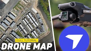
Your images only is showing the sky more than anything because in a few of your flights you choose more than 200ft of height. When you were going a manual flight, you chose the height and proximity of the drone towards the site!!! Anyway good video, thanks.
I really like the M3E and DroneDeploy. My only issue I’ve had with the M3E is that it doesn’t have the flight and recording modes that the Mavic 3 does. I normally use it for missions related to our construction projects, but it would be nice to be able to be able to have those other modes and settings as options. DroneDeploy has been good so far except for one big problem. When I fly in restricted airspace, I have yet to get DD to work. Every time I have got on site and have had to program the DJI app, which works fine but takes longer and is more complex. Maybe there is some workaround, but I haven’t had the time to troubleshoot that. Other than that, the M3E and DD are a perfect match. When I go into DroneDeploy’s Advanced tab, I like to look through the different camera options and see how much faster the M3E is than other models (and fewer batteries). The Mavic 2 Pro is the default camera and when I switch it to the M3E, the required time and batteries is cut by about half.
I have been waiting for the project queue feature since they started dronedeploy. Once a year I made sure to put a request in to add that feature! It has finally paid off!
Nice Job. Enjoy your videos. I am a small business that has been using DD since early 2016. I am exclusively a Thermal shop and DD is the best software by far for thermal orthos. Unfortunately, all these new great feature that DD comes out with are only available with the Enterprise subscription. Priced at over $10,000 annually, it leaves all of us small business behind.
Hello and good morning Billy. I'm interested in getting into mapping. I'm currently flying an inspire 2. How do I go about learning and getting qualified to do mapping operations? Any help would be appreciated... I'm located in Dallas Texas. Thank you.
I hope one day that drones like the Mavic 3 Classic or Mavic 3 Pro will have drone mapping ability in the future. That would open up so many jobs for some of us that don't have 5k plus just sitting around. Drone mapping is so sick!
It sucks that DGI dropped base M3 functions for the E such as active track. 2 years on and even though engineers have said they’d look at updates nothing…. I won’t buy an E.


Hi Billy, I had this drone for about 7 months and had several job redo's because it would not hold a -75 degree angle during a programmed mission flight. After much communication going back and forth and one drone replacement Dji finally as of 8/25/2023 admitted there's flaw in the Pilot 2 software. I was told their working on an update but don't when it will be release so pilots be aware so DroneDeploy was my saving grace! Thank you Billy and especially DroneDeploy!
Another winner.
Thank you for not changing your format and keeping it straight forward and informative.
I have done two jobs now with the M3E and it completes jobs so much faster than the Phantom 4 pro, uses fewer batteries and less photos. I also use the D-RTK 2 base station which gives me super accuracy, it is a mapping beast !
wtf this is amazing. That 3d stuff is insane!
Hey Billy, love your work. You should do a mapping comparison video between the M3E & Air 3. Would love to see how noticeable the rolling shutter distortion is with the electronic shutter on the Air 3, doesn't seem to be many vids online going over this.
Thank you Billy!, this is exactly! the video I've been waiting for.
Been using my M3E for almost 6 months now and have been very impressed. DD unlocking everything the drone has to offer has been a godsend. If you've been on the fence, get off. This drone is a true game changer.
Hi. Can the output of the mapping be converted into a contour with 1m interval? I plan to purchase and use it to generate a contour and load it in another software (ArcGIS)
Very informative, thank you! How often do you do mapping for customers? Can you do a short video please explaining how customers approach you and what they usually ask for and want to see and how often? 🙏
Hey Billy, have you figured out the best way to hotspot your RTK correction stream? Every Magic 3E/T/M video I’ve seen just skips over that step.
Great video Billy
Great video! Too bad DroneDeploy is so expensive. I use Metashape and with the pilot to app I don’t really need anybody to do my missions. I wish pilot two had a façade mapping tool. That would be the only thing I need.
What would you charge for the map, potentially a 3d model, pictures, video and panorama?
Your images only is showing the sky more than anything because in a few of your flights you choose more than 200ft of height.
When you were going a manual flight, you chose the height and proximity of the drone towards the site!!!
Anyway good video, thanks.
The video planning still needs work.
I love my Mavic 3 Enterprise. Amazing drone.
Very, very intersting!! What pricing plan do you need to get access to these functions?
I really like the M3E and DroneDeploy. My only issue I’ve had with the M3E is that it doesn’t have the flight and recording modes that the Mavic 3 does. I normally use it for missions related to our construction projects, but it would be nice to be able to be able to have those other modes and settings as options.
DroneDeploy has been good so far except for one big problem. When I fly in restricted airspace, I have yet to get DD to work. Every time I have got on site and have had to program the DJI app, which works fine but takes longer and is more complex. Maybe there is some workaround, but I haven’t had the time to troubleshoot that. Other than that, the M3E and DD are a perfect match. When I go into DroneDeploy’s Advanced tab, I like to look through the different camera options and see how much faster the M3E is than other models (and fewer batteries). The Mavic 2 Pro is the default camera and when I switch it to the M3E, the required time and batteries is cut by about half.
I have been waiting for the project queue feature since they started dronedeploy. Once a year I made sure to put a request in to add that feature! It has finally paid off!
Very informative! Thanks for sharing!
Great presentation. Thx
Nice Job. Enjoy your videos. I am a small business that has been using DD since early 2016. I am exclusively a Thermal shop and DD is the best software by far for thermal orthos. Unfortunately, all these new great feature that DD comes out with are only available with the Enterprise subscription. Priced at over $10,000 annually, it leaves all of us small business behind.
What if I have the Mavic 3 Pro w/ RC Pro? It seems that it may not be compatible with this drone yet. Any rumors of it being compatible in the future?
Hello and good morning Billy. I'm interested in getting into mapping. I'm currently flying an inspire 2. How do I go about learning and getting qualified to do mapping operations? Any help would be appreciated... I'm located in Dallas Texas. Thank you.
Could you do a video tutorial on Stockpile capture and software production?
hey, is there a higher accuracy if I use DJI RTK for photogrammetry (3d Modell) with software like reality capture?
Hi Billy i see a few combos in dji for this drone wishone you recommend
Does DD support the DJI AirSence capability? I've been using the Pilot 2 app for my missions because they didn't use to.
No it doesn’t
I'll be honest, i feel like i'm constantly re-uploading with drone deploy. Do photos overwrite previous uploads?
7:07 can this be converted into a 1m contour and have it loaded in ArcGIS Pro?
Can't you still fly repeatable, manual waypoint missions?
🔥🔥🔥
I hope one day that drones like the Mavic 3 Classic or Mavic 3 Pro will have drone mapping ability in the future. That would open up so many jobs for some of us that don't have 5k plus just sitting around. Drone mapping is so sick!
That would be nice.
Did Drone Deploy fix the dewarp feature on this update on the dji rc pro?
Yeah they did, maybe @granthagen4671 can provide more insight
Oh yell, I had that problem too! cost me many redos😢
Thanks for the video, you talk really fast
Hlo how are you---
It sucks that DGI dropped base M3 functions for the E such as active track. 2 years on and even though engineers have said they’d look at updates nothing…. I won’t buy an E.