Creating a WebMap using QGIS2WEB

Вставка
- Опубліковано 11 лип 2024
- In this tutorial, you will learn how to create an interactive webmap using the qgis2web plugin of QGIS software package.
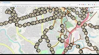
qgis2web plugin is able to generate web maps off of a QGIS project either as OpenLayers, Leaflet or Mapbox GL JS. The generated webmap shall replicate the different components of the QGIS project such as different GIS layers, styles and formatting and the project extent.
This webmap can be accessed using your internet browser (Firefox, Chrome, Edge etc.), which means you can comfortably pack an entire QGIS project and pass it onto somebody else, and they would be able to open the project and view its aforementioned components interactively, without having to use a dedicated QGIS software package.
#qgis #webmap #geodeltalabs


Great Tutorial Sir, Thank you so much sir for giving us this type of informative tutorial.
Great tutorial, as usual.
Thanks
as always great tutorial, thank you very much
how can i upload the html in my wordpress website?
clearly explained.Apreciable.Salute .
thanks a lot for this impressive tutorial....
Thanks, this helped a lot in creating a leaflet map, however, as I am working with data on Montréal, I have numerous diacritics (accents). They appear on the map when it runs from computer, but when I upload to my site in the pop up they are replaced with a combination of capital letter and an odd symbol. This causes considerable difficulties when searching for people by name, one of the purposes of the map.
Great Lecture!
I am very grateful buddy, thanks alot
Thank You for this
Great one 👍🏻
great lecture, thanks
thank you for this tutorial, i learned to much
👍
Thank you!
Thank you for the nice and easy to follow qgis2web tutorial. I am wondering if it's possible to display pictures as well as text in the interactive map?
Always I have seen that your videos are complete in describing the subject in question. Thank you for this. But I have a question. I am to map project sites (about 8 projects) which is basically showing the district they operate in. Some projects operate in all districts of the country. Some in few districts but sharing the same districts with those operating in the whole country or even with those operating in neighboring districts. Would it be possible to show this with symbology (categorical) for print out maps? What do you advise me for webmap also? Thank you in advance.
Wonderful tutorial +999
Thank you for the tutorial. How can I add queries on my map such that the user on the front end can use the map for analysis? For example, I have a map of towns and the populations of these towns. I want the user to be able to search all towns with more or less than x number of people where x is the any number they choose. Then the map will highlight towns that meet that condition maybe in a different color.
excellent
Hey, really enjoyed you video, and learned a lot. Since I'm very new to QGis I was trying what you did on my own map, but the QGIS2web plugin wont display my layers...is there a reason why my layers dont show?
Hello, great tutorial! Nevertheless, the question is why the set transparency (QGIS: 50%) of the colored background layer doesn't work in my webmap?
Great tutorial.
Thanks
Thanks
great one.Thanks. By any chance can we get the banks file for practice
Can you use a local raster? a geotiff 10gb for example with pyramids and tiles? created with web optimized tiff option
Thank you broo
You are welcome
Is it possible to embed an image to be in the pop up on a specified point
how did you put that purple filter? is there a video tutorial?
You can create a video to use QGIS in AWS?
I didn't get georeference in raster tab..? Is it available somewhere else..!
Where can i get this dataset to play with??
Whatever I preview the basemap doesn't show up, even in layers which are to be published the base map doesn't appear at all, help please
mostly I used ArcGIS. could you make same video for that ?
How to embed web map on blogger?
Sir Please create a Full lecture on ArcGIS Advanced level
Thanks for the tutorial. Query how do you get the map online so that I can just share a link and anybody can get to see my map.
I think this is the big looming question here... this plugin seems to only generate an index of files that open the map in HTML, but it doesn't actually host the indexed files anywhere on a server and thus, others can't just open the file from anywhere.
However, I do wonder if you can use the sharing feature of say OneDrive to create a shared URL to the index file, to see where you can give people that to open the map. I don't know if OneDrive would allow the index file to open the other GIS files within the directory since they would normally all have their own individual share link.
The other option might be to create the cloud share link at the folder directory level rather than the index file, and the presumably just tell clients to open the named index file to open the map. A little clunky but I suspect it would get the job done..
can you upload all files that is needed to complete the tutorial?
I love your accent
Thanks :)
Sir can you give the same thing in arcgis that helps me lots