One of the phenomenal things is once the camera is past Port Moody all of that stretch of the highway to Coquitlam is practically unrecognizable compared with the area today. You see trees, trees, and more trees in 1966.....none of that remains.
I remember my first job in that area in 1980 and being impressed at all the forests. Within 10 years, they were all cut down for strip malls and condos. Coquitlam preserved almost nothing.
I feel so fortunate that this is not only a glimpse into the past but into my own memory as I recall this area when it was like this. It saddened me as I read the "Keep BC green" road marking along a wonderful green stretch of road that is now over developed and actually pretty ugly.
I'm glad to have lived in Vancouver before the beginning of the end, aka Expo 86. It really nice to see all the familiar landmarks go by, even if they are just a memory.
I was 11 yrs. old in 66 and as I was watching I was remembering a few landmarks and as it went by Sperling and Hastings there was my Dads gas station at the Y where Hastings and Barnet Hwy. split. Great score on the film
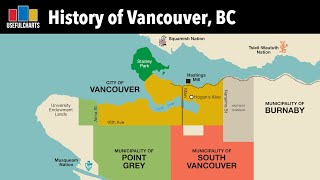
Another excellent virtual drive. I recognised a lot of landmarks. One is the BA (British American refinery, going through Port Moody, BA had alot of gas stations, as did another one along the route, Royalite. The grade was easy so me and my friend rode our bikes east to west to Vancouver. The Heights had the Girl Sign (Helen's Shop), the sign has been restored and is a landmark in Burnaby Heights. The buses are BC Hydro buses.
Another fabulous trip in the time machine. I was only 6 years old when this film was taken about to start grade 1 at Upper Lynn Elementary in North Van!
The video begins at Cassiar Street and ends at Lougheed Highway with Safeway stores that are no longer there. The power lines running down Boundary were not there yet. It is hard to find buildings in the Video that are still standing - The Legion is one.
The 1 block stretch of Hastings just past what is now Kensington Plaza from Grove to Sperling on the passenger side of the video is exactly the same now as then. Same buildings. Amazing
Hi Derek - have a look at the footage from the Time Machine video for Highway 7 between Burnaby (Boundary Road) and the junction of 7A via Coquitlam here: ua-cam.com/video/ozKHA0PhsJY/v-deo.html
I can see that especially being the closest highway to the city at the time. Ironic because coming down from the interior I find Barnet's curves to be pleasantly fun and not scary at all. Lower Mainland roads do get slick like something else when it rains though it can be like what winter condition slippery feels like. The reason LM drivers "speed all the time even though the speed limit is SFA everywhere" is the speed limits are based on rainy conditions and then just discretionally enforced on a sunny day


One of the phenomenal things is once the camera is past Port Moody all of that stretch of the highway to Coquitlam is practically unrecognizable compared with the area today. You see trees, trees, and more trees in 1966.....none of that remains.
I remember my first job in that area in 1980 and being impressed at all the forests. Within 10 years, they were all cut down for strip malls and condos. Coquitlam preserved almost nothing.
It's crazy, we grew up here in the 70s and even Burnaby had a lot of forested land
Looked like truly a stretch of "open highway" back then not a residential ish street ish thing.
I feel so fortunate that this is not only a glimpse into the past but into my own memory as I recall this area when it was like this. It saddened me as I read the "Keep BC green" road marking along a wonderful green stretch of road that is now over developed and actually pretty ugly.
I'm glad to have lived in Vancouver before the beginning of the end, aka Expo 86. It really nice to see all the familiar landmarks go by, even if they are just a memory.
I was 11 yrs. old in 66 and as I was watching I was remembering a few landmarks and as it went by Sperling and Hastings there was my Dads gas station at the Y where Hastings and Barnet Hwy. split.
Great score on the film
I remember the gas station , I lived in Parkcrest 50's into the 60's .
Another excellent virtual drive. I recognised a lot of landmarks. One is the BA (British American refinery, going through Port Moody, BA had alot of gas stations, as did another one along the route, Royalite. The grade was easy so me and my friend rode our bikes east to west to Vancouver. The Heights had the Girl Sign (Helen's Shop), the sign has been restored and is a landmark in Burnaby Heights. The buses are BC Hydro buses.
Hi Paul - thanks for your comment. We found it crazy to see just how much change has happened in Port Moody and Coquitlam too. Glad you liked it!
Another fabulous trip in the time machine. I was only 6 years old when this film was taken about to start grade 1 at Upper Lynn Elementary in North Van!
Truly breathtaking to watch. If only time machines were real😫
SO glad I grew up in North Burnaby in the 50's / early 60's.
This route is a congested nightmare now. Looks lovely back then 👍
Thanks again for posting these pieces of our past highway systems, so cool to see 👍🇨🇦
Thanks for watching!
felt like i jumped in a time machine and went back to 1966
The video begins at Cassiar Street and ends at Lougheed Highway with Safeway stores that are no longer there.
The power lines running down Boundary were not there yet. It is hard to find buildings in the Video that are still standing - The Legion is one.
The 1 block stretch of Hastings just past what is now Kensington Plaza from Grove to Sperling on the passenger side of the video is exactly the same now as then. Same buildings. Amazing
Any old pictures or video of the Dairyland plant on lougheed and Sperling? It will be demolished by the end of this year
Hi Derek - have a look at the footage from the Time Machine video for Highway 7 between Burnaby (Boundary Road) and the junction of 7A via Coquitlam here: ua-cam.com/video/ozKHA0PhsJY/v-deo.html
"use your ashtray, keep BC green"
is there footage from Dawson creek to Fort nelson BC in 1966.
Hi there Harry! We didn't find Dawson to Fort Nelson in these reels but we did find Chetwynd to Dawson: ua-cam.com/video/aBFqbbDtTto/v-deo.html
Is there a way to slow this down?
I'm sure some video experts out there must know how to slow down footage.
"USE YOUR ASHTRAY KEEP BC GREEN"
Long before the Barnet was widened
Barnet Highway - you can see why there were so many bad accidents involving young drivers going too fast.
Were there alot of bad accidents at the time?
I can see that especially being the closest highway to the city at the time. Ironic because coming down from the interior I find Barnet's curves to be pleasantly fun and not scary at all. Lower Mainland roads do get slick like something else when it rains though it can be like what winter condition slippery feels like. The reason LM drivers "speed all the time even though the speed limit is SFA everywhere" is the speed limits are based on rainy conditions and then just discretionally enforced on a sunny day
Barnet Highway.