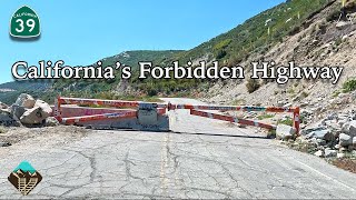
The Abandoned OLD 166 - A deeper look at this historical deadly California road.

Вставка
- Опубліковано 27 лип 2024
- BTUFF EXPLORATION - DEEPER INTO OLD 166. The Old 166 was a beautiful road but very dangerous. It claimed the lives of many people. In the mid 70s it was abandoned for a safer road. Now it's being reclaimed by Mother Nature. We took our drone up to take a deeper look at some of the road that must have been an amazing accomplishment to pull off at the time. We also look at a couple of monuments on 166 that are unreal. I was amazed at the rock structure that I thought looked like radiator springs. You may be surprised what it really looks like. I didn't think my drone would make it but we got a full 360 view of it! Amazing. I hope you enjoy these as much as I like making them. I'll be going back and doing more footage later. There's something interesting around every corner. Sit back and join us on an adventure through California's past at the Old 166.


I remember my parents taking old 166 to Bakersfield like every other weekend..I remember getting car sick a lot! Nice to see my old puking grounds!
I grew up in Cuyama Valley in the mid 60's and remember when they finished the new 166 road and closed the old one. I remember getting really car sick when coming back from the coast from our boy scout camping trip. The roads definitely had a lot of curves and at one point there was a triple curve where you had to be really careful. If I remember correctly there was a building at the top middle portion of the highway where you could stop and get sodas and beer. The driveway of the building was nothing but pull tabs from the metal cans.This was before aluminum. Thanks for sharing and look forward to more videos.
My dad and me hiked up to the Rock formation that you showed at about 10 mins in, back when I was a kid, about 10 years old. Was by far one of the toughest hikes I’ve ever done, there was no trail going up , so we just followed an old water runoff that kind of created a path for us. Beautiful views though. Used to go shooting our guns out there across the road from the rock formation as well at the creek bed to the left of that small bridge you see at 13:21. That’s crazy seeing it now. Went there for years to shoot target practice.
I heard a story of 2 CHP Officers that were killed near State Route 166, if not on it.
Two CHP Officers, Britt Irvine and Rick Stovall, responded to a possible accident near the Cuyama River. Due to storms from El niño, a section of State Route 166 was chewed off and their patrol car plunged into the raging Cuyama river. Dispatch from the Santa Maria Area Office (14) lost contact and immediately called for an interagency search for both officers. 10 hours later, Irvine and Stovall's patrol car was found 100 yards from the roadway they were on earlier upside down buried in silt with only the tip of the wheel visible. Their bodies were found still seat-belted to their seats. Today, a portion of State Route 166 between US-101 and State Route 33 in California is named, "CHP Officers Irvine and Stovall Memorial Highway".
EDIT 1: For anyone that wants to know what El Niño was, it consisted of multiple powerful weather patterns. It resulted in droughts, flooding, and other natural disasters (in this case, mudslides and severe rainstorms with fog) across the world.
Thanks for sharing ! Nice to see more detail along 166, a road I've been down dozens of times. I've done some hiking in and around there in some spots.
I'm very impressed with your drone. Excellent video quality and flying ability. Incredible actually. That said, this old route 166 is impressive and scary!!!!
I love CA-166. Tepusket road off it is one of those hidden gems get you to San Marcos pass real quick.
Making me home sick, I lived in Southern California for 30 years, it's beautiful.
Wow great scenery film with the drone it really is awesome , rode my Harley many times thru 166 , awesome job !
I may be mistaken, but I did not see anyone mention the old 1920's gas station that was at the 20-25 mile point from Santa Maria. The last time I saw it was in the 1970s. There were two old red pumps with the glass tops, parts of the station building and what looked like remnants of a small motel. You could get to it right off of new 166 since people had to get to their homes. I have some pictures do not know where though. I had the thought of taking one and making it into a beer dispenser, what a dumb idea for a young guy that was. I was told someone finally took them an tore down any of the buildings that were there so it might be hard to find the spot now. Maybe just the concete for the pump foundation left. That rock peak I think was named as an Indian head or a wolf , but too long ago. We sometimes a a group would just go to the Buckhorn in New Cuyama restaurant at midnight for the hell of it a have some coffee and sometimes something it eat if we had enough money. That was the only excitement left after cruising up and down Broadway in Santa Maria all night racing stop light to stop light and trying to pick up girls. Back when gas was 26 cents a gallon.
Those boulders would be tricky to climb on😮
The old bridge was the old 166, the cut in the river by where you were talking about the cut in the hill side was approved by Congress, so that the water could flow thru instead around washing out the 166 durning rainy season. that rock that you call the monument, use to have the tail section in the 60's at the bottom of it from a plane from Bakersfield crashing into it . Yes those roads are used by the ranchers
It would be fun to explore that old road riding on a 4 wheeler ATV.
I tracked down the locations of all the footage used in this video. I can confirm that they are all sections of old 166. The bridge at the beginning was rerouted in the late 50's as it, along with a small section of the original road, were in the newly created reservoir. Which is why it is sometimes under water. The other sections were rerouted sometime in the late 60's to early 70's.
I drive there almost every other day hauling crude oil as a truck driver and going west like 8 miles before the first bridge you could see a old steel bridge on the lift like 2 miles in to the woods ive been trying to do some research but haven't found anything on that bridge if you do i would truly appreciate it thank you and great video thanks.
There’s two of these videos. I might talk about it on the other one.
0:20 - see 35.02275,-120.30436 on Google Maps, especially with Satellite, 3D, and Street View
2:11 - 35.02170,-120.26350
2 of my uncles were killed in a gas explosion between Cuyama and New Cuyama while driving a moving Van to Bakersfield from Santa Maria in 1977 on the 166
They still talk about it at the Buckhorn Saloon
@@aaronhuffstedtler418 Really? What happened?
That is....what happened. Van touched off a natural gas line. Boom! They were just driving, doing their job. Too much to text, man...and not a very pleasant memory.
I can imagine if this road was carved out before the invention of the automobile. Let alone the automobile. Kind of reminds of the La Sal Loop road in Moab. Very 👻 and 💀. But man the views. Would to hike it through. That would be cool.❤️😊
I’m wondering the length from one end to the other ........ THATS a lot of “hanging on “ to the steering wheel
Yes those are buzzards or more correctly Turkey Vultures. Everybody calls them buzzards though.
They could be hawks.
Can we legally travel through there on bikes?
It's legal as long as they don't catch you :D
Probably varies depending on the section. For most of it, you wouldn't find much opposition. Some sections are on private land that is still in use. For example, there is a small housing track that adopted a portion of the old road for their residential streets. It's gated, so I don't imagine they would be very receptive to it. Some sections are underwater when the reservoir is full. But yes, you could ride most of it without issue.
You won't get shot, just ask permission some ranchers r super nice
Buzzards might puke on you but i aint never heard of one attacking a human, one buzzard flew into a truckers window coming down Cuesta Grade, the window was half way up, buzzard got stuck in the window and puked all over the driver ( worked fo my buddy) amazingly he didnt wreck his truck with a buzzard puking all over him but he held the wheel straight.
Vultures
That's for cattle and cattle farmers horses
The Cuyama locals called they rock formation monkey turd rock or saddle horn rock.
That is for cattle..
The old 166 was bad. I hated driving over to Bako on that road. ""It just sucked"
This comment below gives you the original information about the rocks on Hwy 166 and what they are called.
Vultures