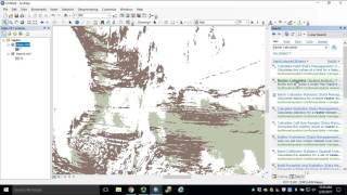
I converted my 1m DEM to feet then I clipped it to my quadrangle. I used the focal statistics tool on the calculated and clipped DEM. When I proceeded to use the contour tool it said the task didn't work. What am I doing wrong??? two errors came up: Error 010213: 'error reading raster' and 'Error 010067: error in executing grid expression'
it means that if Contour in the dataset is 10, 20, 30,40feet ... it will take away the 1,2,3,4... and give out a 0... If the countour is just like 5 there is no tenner to take away. and the index wil be 5 again ... so by selecting all index =0, he select every counter line for 10, 20,30 ,40 feet :D


Man you are so helpful !, this video was so informative and well structured and easy to follow. I appreciate you so much
Your tutorial is great, it made my life much easier. Thanks!
Thanks
A very helpful tutorial! Thanks for keeping this up.
Very helpful! Thanks for creating!
Very useful and well organized!
Very nice helpful tutorial thanks for sharing!!
@10:12 How can this modular expression be utilized in ArcGIS Pro? The "mod" function isn't available.
Great tutorial :)
Very useful tutorial
Thank you. Very good tutorial!
great tutorial. thanks
Thank you very much
Contour interval is in meter or feet?
How do I get this into leaflet?
I converted my 1m DEM to feet then I clipped it to my quadrangle. I used the focal statistics tool on the calculated and clipped DEM. When I proceeded to use the contour tool it said the task didn't work. What am I doing wrong??? two errors came up: Error 010213: 'error reading raster' and 'Error 010067: error in executing grid expression'
Good video, thanks
Why converted to ft
Great job thx a lot
Great! Thanks!
hello sir... i just like wanted to ask.. what is the reason why you used 10 as a modulous in the field calculator for [contour] mod (10) ??
it means that if Contour in the dataset is 10, 20, 30,40feet ... it will take away the 1,2,3,4... and give out a 0... If the countour is just like 5 there is no tenner to take away. and the index wil be 5 again ... so by selecting all index =0, he select every counter line for 10, 20,30 ,40 feet :D
@@martinchristensen1306 thank u.. are u a geodetic engr?
why are you multiplying the dem with 3.28084
Thanks
Why 9 x 9