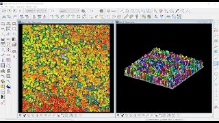
Mobile Mapping Systems - matching of point cloud by using tie lines and tie points (TerraMatch)

Вставка
- Опубліковано 9 лют 2019
- How to Match Separate Points Cloud by using TerraMatch tools
TMatch
MicroStation
TerraSolid
TerraMatch
Mobile Mapping Systems
LiDAR Applications
Matching point cloud
Separate point cloud
lidar
MMS
geomatics
engineering
civil engineering
surveying
tie point
tie lines - Наука та технологія


Hello thanks For this video &very use in my project, one more doubt i have Drone point cloud data only showing in field X Y Z valves but i need to intensity values in field .
Hi
Send mebsmall sample data to check the possibility to showing the intensity color values,
ge.qusai.projects@gmail.com
Hello, and thanks for these videos. I have a question, how do you match
the point clouds ? After the tie lines are you using "Find Tie Line Match" and then you apply the corrections?
Hi,
Yes, it's correct, but you have to be sure of the other specifications such as : classes, quality, trajectories and use the define project.
For any quastions ge.qusai.projects@gmail.com
:)
حلو يعطيك العافية. انا مهندس LIDAR بفرنسا وبستخدم Terrascan TerraMatch TerraModel .... بتقدر تضيف كمان Filtre bad position مشان التأكد مافي اسطح غلط detected ,بس بالتسبة لمشكلة ال rotation عندك حل ألها ؟
الله يعافي عمرك مهندس, اكيد كلامك مية مية, انا بعمل الفيديوهات بشكل عام, واذا اي شخص عنده اي سؤال انا بالخدمة...
بالنسبة لموضوع الrotation على اي محور عندك rotation؟
لانه بتنحل من خلال الStandard deviations - Roll, Pitch, Heading
وهل الداتا اللي عندك من Mobile Mapping ام من Airborne ؟
@@Qusai_Al-Nsour شكرا صديقي
بالنسبة للrotation
فهو عل محور Roll
والجهار المستخدم
BackPack bMS3D LD5+ - Viametris
مابعرف إذا سمعان فيه
شكراً سلفاً لمساعدتك
@@amirgeofitexpert2935 اه اكيد سمعت فيه, بس ما اشتغلت ع الداتا تبعته,
ان شاء الله الموضوع بنحل, ما في شي مالهوش حل, الا اذا شفت الداتا .
بالخدمة مهندس
@@amirgeofitexpert2935
اكيد , الي الشرف مهندس, بنتواصل اكيد
May I request the software ?
Yes
How can I get it ?