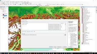
QGIS 2 Lesson 12 - Using the raster calculator

Вставка
- Опубліковано 2 сер 2024
- Data files used in this lesson can be found at www.dmad.org.tr/qgis-2-lesson-12
In this lesson we will look at how we can use the raster calculator to make conversions between feet and metres and also use it to select part of our raster that is higher than a certain value. The same techniques could be used to select rasters of any range.


It really helped! Seeing you from BCS, Mexico :3
This is a really helpful video! Thank you :)
Thank you 😊
You're very welcome Rebecca
Hey, I really liked your video lessons. I am working on a project and would like to discuss some questions with you regarding this software.
Is it possible to arrange a meeting with you?
Looking for a positive response.
Hi Tim, could you please type the expressions used in the three examples of raster calculator of this lesson? When trying to convert meters into feet, Qgis shuts down in my computer. Thanks.
Hi so the best way to avoid any mistakes is to double click your raster file rather than typing it in but it is very simply: "rasterfilename" * 3.28 for the first one. The second one: ("rasterfilename" >= 1500) * ("rasterfilename") and the third is exactly the same as the second but with 300: ("rasterfilename" >= 1500) * ("rasterfilename"). "rasterfilename" obviously should be replaced by the name of your raster. Hope this helps!
@@dmadmarinemammalsresearcha3966 Thanks so much for this. Exactly what I needed too!
How to use int function in qgis
Hi @Aariz Ahmed, I'm afraid I don't fully understand your question. Generally speaking, the int function refers to an integer so if you wanted a return of a value as a 'whole' number you might type int(my_number). Does that make sense?
@@dmadmarinemammalsresearcha3966 yes I am asking for integer function in qgis
@@aarizahmed4514 so as far as I understand your question then all you would use the integer function which is simply int(your_value). To give an example say we were looking at a measure of pollution (let's call it @pollute) and it was to 3 decimal places we would simply use the command: int(@pollute) and it would round the values from 3 decimal places e.g. 1.876 to an integer or whole number e.g. 2. Hope that helps!