Це відео не доступне.
Перепрошуємо.
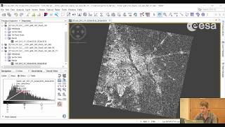
Extract Urban Built Up Area Footprint from SAR Data Using ESA SNAP. Part 2 Coherence Analysis

Вставка
- Опубліковано 29 лют 2020
- How to extract Built Up Area or Urban Footprint from SAR Data ( Sentinel 1 SAR ) using ESA SNAP. This is the second part of the SAR Analysis for urban mapping that I made for this channel. This time I will exploit SAR coherence to map the built up area
About the first part, check this link: • Extract Urban Built Up...
Music by : www.bensound.com


About the first part, check this link: ua-cam.com/video/bEcF92WGLsE/v-deo.html
if you are curious about wheere to looking for multitemporal SAR imagery data provider, check this link ua-cam.com/video/sNLqD7f6fhU/v-deo.html
Hello GEO2004, Thank you for making this tutorial. Can you please make a video on using ISCE for subsidence mapping using InSAR?
Consider that cool idea, I will try to dig it
Hey!
Besides Coherence Analysis and Speckle Divergence, are there any other methods to extract urban built up areas or urban footprints from SAR images/data? Thank you :)
Yes, there are others, supervised/unsupervised classfication will works, image segmentation is also another good choice, if we talks particularly on radar data, there is polarimetry analisis that is also can be considered
In your opinion which one gives better results? This or Pt 1. Speckle Divergence Method
Coherence is better because there are some kind of backscatter validation of multiple scenes recorded at different times
@@GEO2004 thanks for the input sir. However if u would like to compare, which one is better, urban footprint using sentinel 1 sar or classic optical method using landsat 8. For example like in this vid : ua-cam.com/video/IsG4NXyFJfI/v-deo.html
Both of them are good, sentinel-1 has its own strength and landsat-8 also has another strength,
For example, sentinel-1 can detect rural settlements covered by vegetation which normally can't be detected from landsat-8 with its nadir viewing.
And by using landsat-8 you will get more compact footprint result which normally hard to obtain from SAR due to radar speckle noise.
@@GEO2004 I ve tested the Landsat-8 method before but I found that certain features such as paddy field gives the same reflectance as buildings. It quite confusing a bit.
You should try to use image segmentation instead of image classification, because built-up landuse have different textural pattern than paddy fields
Hello. first of all thank you for this video, its really helpfull.
But i got problem.
I followed your instructions easily and manage to create coherance change map but problem was 2 images was overlapping. So i check the datas and realize center of the images are like 200 meters away from eachother. So it affected all the result.
I did some search and see that i can use coregistration to solve this issue but when i did coregistration it automaticly doing orbit, slicing, backgeocoding etc and as a output it gives me only 1 file. Which i need 2 to do your training. So i tried to split them by creating 2 of them and deleting one image from one folder and other image from second folder but in the end i encountred other problems.
Can you give me some advices please ? I have a deadline and i need to finish this somehow.
Thank you in advance!
Thank you for trying to explain the problem, I should admit that I don't really understand what do you mean with 2 images were overlapping,
You know if you want to generate coherence map, at least you need minimum 2 scenes of overlapped images right? And S 1 TOPS coregistration is so robust so an offset of coregistration shouldn't possible, moreover if you already applied the precise orbit processing (apply orbit file step),
Can you elaborate further?
@@GEO2004 Sorry for my wrong choise of word. I forgot to say "wrong overlapping". When i get the results i see colorful result and for example there are same buildings 200 meter away from eachother. Like i got 2 images overlapping wrongly like 200 meter apart. And the reason is my sar images centers are not same. To fix that i tried coregistration but had problems with that too
In your video as soon as you import files to SNAP, they have the same center. How can i achieve that?
Have you mistakenly using two images in different acquisition mode? I mean you combine ascending and descending images while actually they should be in same acquisition mode (both should be ascending or both should be descending)
about the imported files to SNAP step, I didn't do anything, originally they should be overlapped and have kind of similar image center, maybe the way you selecting the images pair are wrong
Can you please tell that how to do the decomposition of Sentinel data on SNAP?
You mean polarimetric decomposition? That is quite difficult because decomposition is depends on the analysis purpose
@@GEO2004 Ok Sir, In case If you find anything on that please tell us. Thanks.
all right
How can open urban foot print band in arc map.
Export the result to arcgis supported format like geotiff or envi format
@@GEO2004 Thank you very much.And I have another problem.at last how did you find threshold values as mean- -10 and other one 0.6 (from where)
if it is specific to my video case, I was just guessing it using trial and error until I find the most satisfying values.
However on actual remote sensing research or operational tasks, this guessing method is not so sound scientific, so I think you must derive these values using standardized methods like performing the training sample generation then get the descriptive statistical parameters (mean, median, modus,, variance, normal distribution etc) by inspecting the samples scatterplot, and then you can find the best values from those parameters.
Another known method is to employ The JeffreyMatsushita separation index (JIMI) to get the best values to distinguish urban and non-urban radar backscatter values.
There are also numerous other calculations or indexes about this matter, you can dig it from the published remote sensing papers.
thank you,, is it a requirement that the two images must have the same orbit to be coherent?
Absolutely,
@@GEO2004 i mean the absolute orbit has to be the same? or is it the same after apply orbit file?
Oh, I am sorry, you mean the orbit file? It will automatically downloaded,so you dont have to concern about it.
Nice! Keep it up! Would you like to be UA-cam friends? :)
Can we convert it into vector file
Of course, with some cleansing efforts