Learn Drone LiDAR Mapping (Join a Group Discussion!)

Вставка
- Опубліковано 29 чер 2024
- ➡️ Sign Up Now: www.rockrobotic.com/talk-to-s...
I enthusiastically invite you to join an interactive weekly LiDAR mapping group discussion. Dive deep into everything ROCK Robotic has to offer, from innovative LiDAR mapping products to specialized data processing services. This is your chance to learn directly from the source and engage with a community of like-minded professionals.
📌 What to Expect:
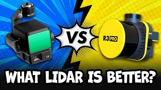
✅ Insightful Discussions: Explore a range of topics related to our groundbreaking LiDAR technology. (Aerial, SLAM, Mobile Mapping, Photogrammetry, and More!)
✅ Community Building: Connect with professionals from various industries to share experiences and insights.
✅ Live Q&A: Get all your questions answered in real-time.
✅ Detailed Overviews: Understand our pricing and how our tools can benefit your business.
📅 Join Us:
Meetings are held every Monday, Tuesday, and Thursday. Interested in participating? Simply fill out the form linked below, and we’ll get you set up for the next available slot.
➡️ Sign Up Now: www.rockrobotic.com/talk-to-s...
🔗 Learn more about ROCK: www.rockrobotic.com/
Don't miss this opportunity to enhance your understanding and utilization of LiDAR technology. Hope to see you there!
#Drone #LiDAR #Mapping #AMA #landsurveyor #landsurveying #3dmapping #technology #tech #networking #groupdiscussion #buy #drones #uav #mapping #geospatial #rockrobotic #dji - Наука та технологія


Man I wish I had enuf reason to purchase one of these but I live in the middle of no where alaska in front of a glacier, but man I would really love to have access to a system like this. Do you offer by the day rentals lol or by the week.
Dear Harrison,
I work at ICMBIO and IBAMA, both are federal environmental protection agencies in Brazil. It would be the equivalent of the USFS and NPS in the USA. We have made a lot of progress in recent years in terms of acquiring an RPAS fleet, today we have more than 150 M2EA, 10 300RTK Matrices, 1 EBEE with multispectral sensor and finally we acquired a Trinity Pro for mapping purposes. Our efforts are mainly focused on protecting the Amazon Forest and some other biomes in Brazil. Our next step in the evolution with RPAS is to learn how to properly use and take better advantage of Lidar. We are making use of DJI's L1, but we are not satisfied. Is there any possibility that RockRobotics could send a Lidar unit so we could test it in our operations? We are a large dissemination and reference hub in Brazil regarding the adoption of RPAS technologies and I am sure that support in our mission to protect the Amazon would generate significant impact and dissemination of your solution.
Are these meetings friendly to the totally uninitiated? I'm really interested in getting licensed and potentially becoming an independent pilot, but have no background. My experience in archaeology first piqued my interest in lidar
Absolutely! You're welcome to join!
Im in the same boat. Would like to get into this
Do you have a number or email to ask many questions? I am brand new; I have flown drones a lot but not for commercial purposes. I am also working towards my Part 107 license. Please let me know; thank you.