Sorry, Transform UTM / WGS84 point cloud coordinates to Local (or Topographic) what is the sequence to apply the grid scale factor for the prism formula (different scale factor for each point)? Thanks
in this video, you explained the transormstion in 2 different software right? one civil3d other one map3d. So it's not connected to eachother? coz for the first 3 min of the video, it was very simple, right click, change the cooridnate and save it? thats it right?
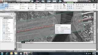
Civil 3D is a combination of AutoCAD, Map3D, and Civil 3D functions like corridor, surface, featureline etc... The coordinate conversion function is belongs to map3D, however set a coordinates system function have both in civil3d and Map3d so you could use any of them.
Sorry, Transformation of UTM / WGS84 point cloud coordinates to Local (or Topographic), what is the sequence to apply the grid scale factor for the prismoidal formula (different scale factor for each point and let C3D process it automatically) ? Thanks
@@BIM-Infrastructure Is it possible that I can please pay you to make a dwg file show in the correct location in Google earth? I can transfer you the small dwg file and a PayPal to your account.
Great..can you please guide on Lamert datum transformation...I am facing this problem...will be great help.. Or any formula in excel.. Points or toposheet is on Lambert, indian zone1 wgs 84 N41.. Thanks
Happy Khan In the below video I’m explaining how to transfer excel coordinates points into another coordinate system by using Civil3d: ua-cam.com/video/LDSEZS4LseA/v-deo.html
You do that by using this method only difference is keep same coordinate system on both drawing only change units in settings (top left side same in same window)


Great video, helped me so much headache when recieveing coordinates in another format from a customer, thank you!
I’m glad to know that was helpful.
How can you transform pts files like csv? Because I am getting just the lines, not the points. thanks
yes possible
Do you have a video for this?
Sorry, Transform UTM / WGS84 point cloud coordinates to Local (or Topographic) what is the sequence to apply the grid scale factor for the prism formula (different scale factor for each point)? Thanks
Video helped a self learner like me!
in this video, you explained the transormstion in 2 different software right? one civil3d other one map3d. So it's not connected to eachother?
coz for the first 3 min of the video, it was very simple,
right click, change the cooridnate and save it? thats it right?
Civil 3D is a combination of AutoCAD, Map3D, and Civil 3D functions like corridor, surface, featureline etc... The coordinate conversion function is belongs to map3D, however set a coordinates system function have both in civil3d and Map3d so you could use any of them.
hello, does this only work on polylines? I'm trying to transform allignments and tables but can't do it easily
This is autocad map 3d feature, I believe it won’t work with Civil3D objects.
Sorry, Transformation of UTM / WGS84 point cloud coordinates to Local (or Topographic), what is the sequence to apply the grid scale factor for the prismoidal formula (different scale factor for each point and let C3D process it automatically) ? Thanks
You could follow same method in this video
Very important tutorial..and you are nice
Please help.how to get the coordinate sir?im from philipines
Thank you so much bro :) Video helped a lot.
Please test if this converting method work for NAD 27 into NAD 83. I guess not.
yes it's possible.
Thanks so much this video helped alot.
God bless you young man!
Thank you
Query source is not available or empty. what happens?
Cosmina Chimiuc Make Sure reference drawing is attached before query.
Thank you, appreciate your effort.
Very useful. Thanks
Hi Saifud, how are you brother? can you show us the basics of an alignment pls, assuming a gas pipeline.
yes sure, kindly explain more about you requirement here: bim-infra.net/contact-us
If required we can schedule a zoom meeting.
i have Clarke 1880 coordinate in UTM 40N (MUSCAT OMAN),
how to convert to WGS84 40 N
you can convert this by using the same method showing in this video. just set in your coordinates instead of the one I'm choosing.
Very helpful
hi, Thanks. Can you please tell how to convert DLTM to WGS84
Same method you can do conversion between any coordinate system.
@@BIM-Infrastructure thanks bro. Good luck
Mashalllah very nice sir
Great video, In my system, define query window not showing please help. it is sowing in the command line
This option will available Civil3d and Map3d. Are you using normal AutoCAD?
great video
Can I do this in AutoCad 2024?
This feature available in AutoCAD Map3d and Civil3D, however this feature not available in vanila AutoCAD,
@@BIM-Infrastructure Is it possible that I can please pay you to make a dwg file show in the correct location in Google earth? I can transfer you the small dwg file and a PayPal to your account.
@@YvesLopez saifudheen.pottoor@gmail.com
Sir hello how create a lot discription and lot technical description and plot in civil 3d,
you can create/modify parcel style
Thank you sir 🙏🙏
Sooper work ,
Thank you
You are great as always
Great..can you please guide on Lamert datum transformation...I am facing this problem...will be great help..
Or any formula in excel..
Points or toposheet is on Lambert, indian zone1 wgs 84 N41..
Thanks
Happy Khan In the below video I’m explaining how to transfer excel coordinates points into another coordinate system by using Civil3d: ua-cam.com/video/LDSEZS4LseA/v-deo.html
Can i get ur contact number?
Awesome
assalam o alaikum sir i have one question how can convert local coordinate system in wgs84 coordinate system
Wa alaikum salam, you could follow same methods in this video by giving your coordinate system
Спасибо
Thank you Saifu, ...... Azzam,
Nice vedio...
Great.... thank you so much
Hi brother pls I need civil 3d software pls help me
Please check out Autodesk website.
@@BIM-Infrastructure pls sent bro
thank you for your help
Thank you bro, very useful
How we change zone 39 dwg to zone 40 in uae
Humayoun Lal Zone 39 for Qatar and Zone 40 for UAE, both are same coordinate systems (WGS84).
@@BIM-Infrastructure but western region of uae is using zone 39 mean ruwais area and some one need dwg in zone 40
Humayoun Lal tray same this method in the video and set your current drawing as wgs84 39n and new drawing as wgs84 40n.
@@BIM-Infrastructure i will try
Sooo helpful THANKS
You are welcome
i want this cordinate system meter to feet and feet to meter
You do that by using this method only difference is keep same coordinate system on both drawing only change units in settings (top left side same in same window)
Your channel looks great, thank you, subscribe to your channel.
Thank you Md Nurjamal
vnice
Karmaşık 👍acaba bende yapabilecemmi :)
Can i get ur no