How to use Bosch Laser Level for Beginners Step by Step Laser Level Tips

Вставка
- Опубліковано 28 лип 2024
- How laser levels work and how to use them on the construction site. This Bosch 800' Self Leveling Laser is the perfect laser level for any jobsite.
Check out the latest price for this Bosch Laser Level: amzn.to/3iCuH0b
Survey Stakes: amzn.to/3BfPwF9
We use this tool dozens of times in each job to build level foundations, framing, decks, cabinetry, and tile. In this video I will show how I use the laser level for two projects on the job and give an overview about using the laser level Reader. I also compare the laser level to out transit scope level.
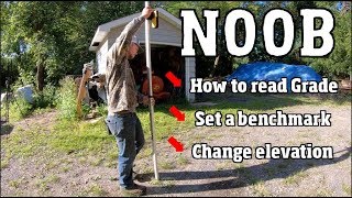
0:00 Intro
0:36 Unboxing Bosch Laser Level
11:16 Using Grade Rod
13:13 Setting up Bosch Self Leveling Laser
17:05 Using the Bosch Laser Level
19:00 Setting Grades with Laser Level
21:03 Closing Remarks
🔴 Find me on SOCIAL MEDIA:
UA-cam: / jimpaar
Twitter: jimpaar
Facebook Up2Paar: / up2paarmarketing
Facebook Jim Paar: / jimpaarcoaching
Instagram: / jimpaar
The software to create ALL my videos is Camtasia, SUPER EASY: techsmith.z6rjha.net/c/223902...
DISCLAIMER: This video and description contain affiliate links, which means that if you click on one of the product links, I’ll receive a small commission. This helps support the channel and allows us to continue to make videos like this. Thank you for your support!
Similar Searches:
laser level
how to
laser view enhancing glasses
bosch laser
laser tripod
cross-line laser
level laser
laser measurement
best laser level
bosch rotary laser
laser level how to use
how to use bosch laser level
professional laser level
self-leveling exterior laser kit
read a grade rod
read a level rod
how to use a laser level
bosch grl800-20hvk
bosch laser level
home depot Bosch laser level
lowes Bosch laser level - Навчання та стиль


Check out the latest price for this Bosch Laser Level: amzn.to/3iCuH0b
Back ground very beautiful
Thank you Sir! Great presentation and video. Much appreciated!!
Glad it was helpful!
This video was so helpful in me leanring how to use a laser level for grading, thanks! 😍
I like this one
I have about the same kit older model GRL250HV, same specs but the whole kit fits in the case which is larger than this one shown here, other than the design not much have changed and I think paid about same price @ home depot
How are you getting height of instrument on your laser on the tripod?
Height is determined by the elevations your shooting, if somewhat level site doesn't matter but if a variety of levels make sure stick with instrument is adjusted. I could do a video on this
How do you set slope like for laying pipe
Simple, just use the grade stick and it gets greater as you drop in slope
You have confused me, whats the difference between the controller & remote??
The remote is the small unit you use with the grade stick.
No, the “Laser Receiver (LR30)” is what is used with the Leveling Rod. The “Remote Control (RC1)”
Is an optional accessory and is not included with the kit. Using your terminology, it would be the “controller” is used with the grade stick.
Why do none of these kinds of laser levels (like this Bosch Rotary laser Level) or laser measuring devices (like Bosch Blaze Outdoor GLM400C like i bought) NOT INCLUDE anything to measure BEARING ANGLE POSITION, relative to point A to point B?? I know a little from County and City summer jobs in college, and now that im “all grown up”,and trying to help plan for and build our house for our family, i’m getting really confused! I don’t understand why there are never mention to bearing positions by anyone on UA-cam, or in the product manuals! Aren’t bearings a CRITICAL bit of info for ANY property developer (large and small)?!
How would people/ contractors / builders know they are putting their property lines at the CORRECT locations otherwise, and matching the topography of the surrounding land which may even be designed specifically for (like berms, rock or hill topography / creeks / rivers / underground water sources, etc.?!?
I’m confused because should be a known, “official” county or city marker for the reference point, right? Arent people using those, then measure a certain distance from there (at level, or a specified grade) at the specified bearing from that “official” government marking point?? If developers arent doing this, what ARE they doing, and how will they know their corners, and in turn their pitch / grade levels, are in the correct positions? Depending on the topography of the land, this could really mess things up if they are off from not knowing the correct bearings given the distance they are staking out??? If anyone has insights into this i would love to hear them (and so i can better understand and then hopefully, stop banging my head in the wall about it! 🔨 😂😉)!
The tool is not for surveying. This tool is for checking grade with respect to a surveyed location and elevation. You need a licensed surveyor to stake a legal boundary. The surveyor sets a stake with a precise elevation and other info pertinent to your project, maybe 5’ offsets from building corners and line only stakes. These are used as reference by the grade checker to measure from. A laser level is a more sophisticated bubble level. A geotechnical engineer determines if your bottom is suitable for it intended purpose or if remedial measures are recommended
I wish they didn't remove the thumbs down. 😕