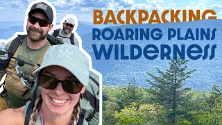
Hiking Mount Porte Crayon - Roaring Plains West Wilderness

Вставка
- Опубліковано 30 вер 2024
- This hike takes place in the Roaring Plains West Wilderness, and reaches the summit of Mount Porte Crayon, the highest point in Randolph County, WV. This trail starts off easily and has a section that I would consider moderate. I took part in a difficult bushwhack to the summit, however, I found that it was not necessary.
Starting at the parking area off of WV 32/2 (Bonner Mountain Rd) you will have a .2 mile road walk to the Trailhead. The Trail crosses private property until reaching the Wilderness boundary. The trail follows Flatrock Run and then begins an easy ascent using a path originally graded for railroad use. There is a small section of ungraded ‘traditional’ trail, which was steeper, rooty, and rocky but not overly difficult. After that section it is back to the graded trail until you deviate from the Flatrock Run Trail approximately the 5.2 miles in. At this point the trail splits into 2; there is a large cairn on the left (I believe this should lead to Roaring Plains). The right-hand trail is certainly less used and continues west.
I traveled on this unmarked trail for .4 miles until turning south on another unmarked trail. I soon found some pink plastic ribbons tied to some trees so I began following those westward. The ribbons eventually stopped at the edge of the formidable Red Spruce stand. I skirted the area to the northwest then took the plunge into the Spruce stand. Movement is slow and difficult within this dense stand of trees. Movement is characterized by backing through small gaps in the young trees, crawling under and over downed trees, and busting through branches where possible. My GPS gave me some trouble and I had to switch to an actual non-digital compass to find my way to the summit.
The Mount Porte Crayon summit area is just outside the dense Spruce stand. The actual USGS marker is on the end of a red pipe sticking out of a small pile of rocks. No views from here.
On the return trip, I headed north instead of back east through the Spruce stand. In fact, skirting the Spruce stand both ways would be a great option for those who are interested in keeping both of their eyes.
Route (out and back): Flatrock Run trail to unmaintained/unmarked trails, bushwhack to the summit.
Links:
Wikipedia Page: en.wikipedia.or...
Monongahela National Forest site: www.fs.usda.gov...
Directions to the Trailhead: Go to this intersection - bit.ly/1qU2wGh , travel 4.6 miles on 32/3 across the river, the TH parking is on the left.
Tale of the Trail
Distance: 13 miles
Elevation: 2,879 feet (total)
Max Slope: 37.2%
Time: 7 hours
Connect With Me:
Twitter: / easternhiker
www.threads.ne...
/ easternhikers
SOME DREAM, SOME DO, FEW DO BOTH
Outro - "Corncob" by Kevin MacLeod (incompetech.com)
Licensed under Creative Commons: By Attribution 3.0 License
creativecommons...


Porte Crayon, aka David Hunter Strother was a loyal Virginian from Martinsburg (West) Virginia. He served as a Civil War correspondent and General. David is buried here in Elmwood Cemetery, a beautiful 19th Century cemetery that he himself designed.
Mt Porte Crayon, obscure and in the middle of nowhere...
Do you by any chance have coords for where to leave Flatrock Run Trail heading towards the summit?
Definitely not an easy hike. Did it in 2008.