Hello! Super informative video - thanks! I'm mapping caribou in northern BC. I'm just wondering how you shifted the location data of the spotted owls in ArcGIS to preserve the real data?
Thanks Sean! I'm glad it was useful, and I appreciate the kind words. Regarding the owls, it's been a while but I'm pretty sure I went into the feature class in code and just subtracted a constant value from each X- and Y-coordinate. I wanted to put the two owls side-by-side (in map space), so I made sure that my subtraction value put them in that space relative to each other. I also clipped out the background imagery and topo maps and shifted them by the same amount. I had to do some editing on the topo map to remove identifying labels (road numbers, topographic names, etc.) I think you could do this easier than I did, though, by opening up an edit session and just selecting the owl locations, then dragging the entire set to some new location. It might be tricky getting the imagery to shift by exactly the same amount, but not impossible. And of course I did all this on a copy of the data; I still have the original locations, since that was my own research. Does this answer it? Please let me know! Take care - Jeff
@@JennessEnterprises Awesome! Thanks for the quick and thoughtful reply! I ended up using the 'Shift' tool which essentially uses your method to move my rasters based on X and Y coordinates. Thanks again!
Thanks McKenna! Glad you liked it! And check out those LoCoH (Local Convex Hull) papers when you get a chance. It's a really clever implementation of Convex Hulls to narrow down the areas the animal cares about most.
@@JennessEnterprises Could I get to know which papers those are as well. and would you mind doing a video on using the Mahalanobis tool in Arc or qgis?
@@masababridget4960 Hello Bridget, I'm so sorry for missing this message! I do apologize for my rudeness in not responding. If it is still helpful, then you can download the LoCoH papers here: drive.google.com/file/d/186r5Rswi5SUI8AEC0Nz9bdZ7hD7ajlwj/view?usp=sharing And I'm afraid I'm not skilled in QGIS so I can't give a solid explanation in how to make it work. I really like Mahalanobis, but I'm going to hold off on a lecture until I've written a decent tool to do it. I've written those tools for ArcView 3 and ArcGIS Desktop (ArcMap), but I'm still fumbling through the ArcGIS Pro SDK.


Very instructive man, thank you! I'm biologist working with endangered primates in Brazil and this video help me a lot
Thanks so much Orlando! Your message was a good way to start the day. And what a place to be a biologist! One of these days I hope to see Brazil!
Hello! Super informative video - thanks! I'm mapping caribou in northern BC. I'm just wondering how you shifted the location data of the spotted owls in ArcGIS to preserve the real data?
Thanks Sean! I'm glad it was useful, and I appreciate the kind words.
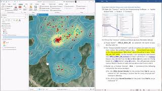
Regarding the owls, it's been a while but I'm pretty sure I went into the feature class in code and just subtracted a constant value from each X- and Y-coordinate. I wanted to put the two owls side-by-side (in map space), so I made sure that my subtraction value put them in that space relative to each other. I also clipped out the background imagery and topo maps and shifted them by the same amount. I had to do some editing on the topo map to remove identifying labels (road numbers, topographic names, etc.)
I think you could do this easier than I did, though, by opening up an edit session and just selecting the owl locations, then dragging the entire set to some new location. It might be tricky getting the imagery to shift by exactly the same amount, but not impossible.
And of course I did all this on a copy of the data; I still have the original locations, since that was my own research.
Does this answer it? Please let me know! Take care -
Jeff
@@JennessEnterprises Awesome! Thanks for the quick and thoughtful reply! I ended up using the 'Shift' tool which essentially uses your method to move my rasters based on X and Y coordinates. Thanks again!
good job
Thanks McKenna! Glad you liked it! And check out those LoCoH (Local Convex Hull) papers when you get a chance. It's a really clever implementation of Convex Hulls to narrow down the areas the animal cares about most.
@@JennessEnterprises Could I get to know which papers those are as well. and would you mind doing a video on using the Mahalanobis tool in Arc or qgis?
@@masababridget4960 Hello Bridget, I'm so sorry for missing this message! I do apologize for my rudeness in not responding. If it is still helpful, then you can download the LoCoH papers here: drive.google.com/file/d/186r5Rswi5SUI8AEC0Nz9bdZ7hD7ajlwj/view?usp=sharing
And I'm afraid I'm not skilled in QGIS so I can't give a solid explanation in how to make it work. I really like Mahalanobis, but I'm going to hold off on a lecture until I've written a decent tool to do it. I've written those tools for ArcView 3 and ArcGIS Desktop (ArcMap), but I'm still fumbling through the ArcGIS Pro SDK.
Very good!
Thanks so much Giancarlo! I much appreciate the feedback.