just a heads up you can add an extent indicator into the inset map that precisely captures the extent, rather than eyeballing a rectangle. when you have the data frame selected, you can go to insert > extent indicator in the map frames group
This video has a confusing title as "Tasks" are a toolset within ArcGIS Pro to help you do things like standardize workflows and ensure integrity of data capture.


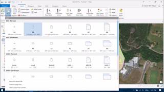


just a heads up you can add an extent indicator into the inset map that precisely captures the extent, rather than eyeballing a rectangle. when you have the data frame selected, you can go to insert > extent indicator in the map frames group
Thank you Othon!
Thank you! this helped a bunch!
This video has a confusing title as "Tasks" are a toolset within ArcGIS Pro to help you do things like standardize workflows and ensure integrity of data capture.
How do you add the inset map without moving the content of the main map??
what font are you using in the legend of that map?