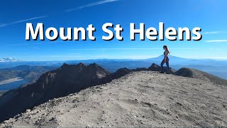
Mount Saint Helens - Summit Climb, Washington State

Вставка
- Опубліковано 12 сер 2021
- At 8:32AM on May 18th 1980, Mt St Helens in Washington State erupted with an explosion that shook the world. A hollow shell of what was once a beautiful cone shaped mountain was all that remained. The ash cloud from the 1.5 million tons of material ejected circled the world. More miles of road and businesses where forced to close than by any other natural disaster in the history of the United Stated. Today hikers can ascend the vertical mile to the south rim of the crater to view an otherworldly site. The mountain is rebuilding itself! A steaming dome within the crater is growing, pushing rock bigger than skyscrapers upwards. This is a challenging climb which requires a special permit but for those that understand the geological significance and history of this volcano, this is an experience that shouldn’t be missed.
____________
TUTORIALS
Adobe Illustrator: goo.gl/DeaKFe
Adobe Illustrator Christmas Edition ua-cam.com/users/playlist?list...
Adobe Photoshop: goo.gl/rYq4mX
____________________
BECOME A PATRON
As a patron, I can answer specific questions you may have, and help you make the most of your projects.
You are limited only by your imagination!
/ hikeart
_____________________________
MY TRAVEL - HIKING VIDEOS
Places to Visit: goo.gl/HSYoT4
New Zealand: goo.gl/d8PXte
The North Cascades, WA goo.gl/C9pF9y
Mount Rainier, WA goo.gl/XpLVQe
I Love to Hike ;) goo.gl/6gzaSZ
__________________
MY CALLIGRAPHY
ua-cam.com/users/playlist?list...
_________________________
MY RELAXATION VIDEOS
Snow Videos: goo.gl/NUUvyV
River Videos: goo.gl/BKNHHM
Waterfalls Videos: goo.gl/WbpH36
____________
FOLLOW ME
Facebook / hikeart-4978. .
Instagram / hikeart
#hikeart #mountsainthelens #climbing
Music: Light Awash by Kevin MacLeod is licensed under a Creative Commons Attribution 4.0 license. creativecommons.org/licenses/...
Source: incompetech.com/music/royalty-...
Artist: incompetech.com/ - Фільми й анімація


Now I remember reading at some time during the last 40 years since the mountain blew up that for all the devastation that took place on the north side that somebody on the south side of the mountain would have been perfectly safe and might not have even known that anything had happened. Maybe so, maybe not. Probably not on top, though. I know that the communities at the bottom of the south side were completely untouched. Here's to Harry Truman!
Outstanding work. Thank you for the great video.
Absolutely beautiful! 😊 Some great shots here! Great work!
Thanks for visiting
How hard is the climb? Are there any parts where the ground isn't very stable?
It’s mostly boulder fields the entire hike so lots of climbing the last mile or so is ash the best way to explain it is like walking up a beach uphill.
At 0:04 I like that included those wisps of steam.
Nice that there was no smoke. I went up there 3? Weeks ago and could just see the top of rainier and hood due to haze
How solid does/did the ridge feel when you were walking on it?
The ridge is fairly solid along the worn path on top, but extremely loose and potentially dangerous if you venture elsewhere.
Is the trail decently marked throughout the hike or do you have to navigate on the way?
The first and last part of the climb are very easy to follow, but the middle part is through boulders and can be a little tricky to follow. They use long wooden poles that are visible from far away to mark the route.
@@hikeart thanks for the reply!
@@johnjames9359 You're welcome!
Been there,done that.Beautiful at the top,brutal getting there!