🎯 Key Takeaways for quick navigation: 00:00 🌍 Remote sensing basics and image classification will be discussed in this lecture. 02:54 🌐 Remote sensing relies on the electromagnetic spectrum, including visible and infrared wavelengths. 05:27 📷 Remote sensing uses sensors, which are like cameras, to measure radiation in specific wavelength bands. 07:03 📊 Sensor data is converted into digital numbers, creating raster images with brightness values. 09:08 🛰️ Landsat satellites have multiple bands to capture reflectance in various parts of the electromagnetic spectrum. 13:45 🔵 Combining different bands in remote sensing software creates various types of color composites for visualization. 18:43 🌿 Band combinations and indices help highlight specific features and phenomena in remote sensing imagery. 23:12 🌱 NDVI (Normalized Difference Vegetation Index) is a commonly used index in remote sensing that ranges from -1 to 1, indicating the presence and health of vegetation. 24:05 📊 NDVI is calculated by comparing the reflectance in the near-infrared (NIR) and red bands, emphasizing differences in vegetation health and density. 26:21 💧 Other indices, like NWI (Normalized Difference Water Index) and MSAVI (Modified Soil Adjusted Vegetation Index), are used to assess water and soil characteristics in remote sensing.


🎯 Key Takeaways for quick navigation:
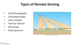
00:00 🌍 Remote sensing basics and image classification will be discussed in this lecture.
02:54 🌐 Remote sensing relies on the electromagnetic spectrum, including visible and infrared wavelengths.
05:27 📷 Remote sensing uses sensors, which are like cameras, to measure radiation in specific wavelength bands.
07:03 📊 Sensor data is converted into digital numbers, creating raster images with brightness values.
09:08 🛰️ Landsat satellites have multiple bands to capture reflectance in various parts of the electromagnetic spectrum.
13:45 🔵 Combining different bands in remote sensing software creates various types of color composites for visualization.
18:43 🌿 Band combinations and indices help highlight specific features and phenomena in remote sensing imagery.
23:12 🌱 NDVI (Normalized Difference Vegetation Index) is a commonly used index in remote sensing that ranges from -1 to 1, indicating the presence and health of vegetation.
24:05 📊 NDVI is calculated by comparing the reflectance in the near-infrared (NIR) and red bands, emphasizing differences in vegetation health and density.
26:21 💧 Other indices, like NWI (Normalized Difference Water Index) and MSAVI (Modified Soil Adjusted Vegetation Index), are used to assess water and soil characteristics in remote sensing.
Well explained and interesting to hear.
So clear and well explained. Thank you 🤓
Amazingly explained! Thank you 😊
This was a great help, thank you!
Well explained. This was such a great help
Thank you!!!
thanks for your support. Well explained.
Very well explained. Big THANKS
Well explained, thank you
Thank you so much!
Amazing ❤
nice presentation. thanks
Thank you 🙏🏽