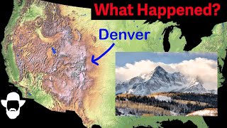
The spectacular Moab Fault: world class fault exposures, fossils, and more

Вставка
- Опубліковано 9 гру 2022
- Learn the amazing secrets of the Moab Fault just outside Arches National Park, Utah with geology professor Shawn Willsey.
*Note: this is a compilation of two 2021 videos that were launched when my channel was just getting started. I'm editing and resurrecting some of these videos and reposting for the numerous subscribers who likely missed them.
Support these videos! You can ensure these videos continue by providing support (travel logistics, content creation, etc.) Send support via:
PayPal: www.paypal.com/donate/?hosted...
or Venmo @Shawn-Willsey (be sure to put two L's in last name)
or a good ol' fashioned check to this address:
Shawn Willsey
College of Southern Idaho
315 Falls Avenue
Twin Falls, ID 83303 - Наука та технологія


An amazing explanation that exceeds what you would get in a classroom. Thank you so much for helping this 76 year old understand the geologic history of the area I grew up in.
I've been to a lot of our National Parks, but only recently became interested in geology. Thanks to you Shawn, and other geologists, I've started to look at places I've already been in a much broader way. It really is enlightening.
I envy you! When I first started to really get into geology it was as if the entire world was new to me, a mind-blowing time. I still get that feeling, because there is always something new to learn and deep time is truly vast and so much is yet unknown…but truly the early days of my interest in geology were filled with excitement and wonder, and I wish you the best in your journey of discovery. For me it has also been as much an internal shift in perspective as the external appreciation of nature in new ways.
A landscape can be nice to look at- but when you have a geological understanding of it- you can appreciate it much more.
Thanks as always Shawn.
This is what UA-cam is for, showing the marvels of nature.
The video that got me to subscribe way back when Shawn had less than 50 subscribers! It's been out for only a few hours today and already has 1.4k views! I love watching this channel grow and seeing Shawn mature as a content creator 💕 🌋 💖 thank you Shawn!
Awesome and kind words. Thank you so much! I love teaching and sharing what I can.
My geology department is severely lacking in terms of field trips and field knowledge in general. These videos are an invaluable resource and I appreciate your work immensely, Professor Willsey.
(Had a structural geology class last semester and I wanted to see what slicken-lines would look like if they weren't perfect textbook examples, thank you kindly)
Glad these are helpful!
Absolutely LOVE this channel!!! Love the indepth look and explanations of the layers.
Thanks for this short video! Will definitely see the fault when I take my husband. My running daughter just ran 16 miles in MOAB YESTERDAY. 2-19-23. I have sent her your video. Cool rocks, cool fault and cool fossils!!
Beautiful fault plane, very distinct and showing the slickenlines. You always find such great locations for your videos!
There's a lot of history and some pre-history in that same spot. The Old Spanish Trail passed through Moab Canyon, and in 1855 members of the Elk Mountain Mission improved the trail into a wagon road. In nearly the exact spot this video was taken, they had to lower their wagons down what they called the "jumping off point." At 3:48 in the video you can see a road cut in the steep, rocky hillside, and I honestly don't know whether that's part of the original wagon road or something more recent, but it could predate automobiles and heavy equipment. There are also some petroglyphs on a boulder just up the hill from that road cut. I never even noticed that faulting across the highway when I was there, but I'll sure notice it every time I drive through there now! Thanks for the vid.
The University of Road Cuts School of geology… Thanks … We got to get you a ticket to the New River here in the Appalachian Mountains… Thanks for the tour ..!
Complex life before I ever existed..
Love to have seen that humongous inland sea..
Still amazes me when seeing ocean fossils in desert landscapes, and so far inland!
A repost of an older, but golden, video. Love your channel.
Thank you Shawn. Limestone is a cool rock for many reasons.
Thank you for showing this. I grew up in that area and never noticed that fault until they widened the road in the early 2000’s.
Thank you!
I live in Northern Nova Scotia (Cape Breton). We see this type of faulting all of the time in the highlands of Cape Breton. Another excellent video- thanks again!
Thx Prof for another excellent presentation. 👍
Shawn, of course, your quick little sc/r/ambles would take me a fair fraction of a day.
Thank you for all your essays. I've been chuggin through them.
Been to Arches, Bryce and Zion and amazed by the rock formations but now that some of it’s unveiled it’s even more interesting. Thanks. I hope you can do similar videos near those other parks.
So great to be able to see the rocks through your eyes!
Wonderful video. Thank you. Been past there many times, but never got a geology lesson! Wonderful!
Wow, great video Professor Shawn! Being someone back East, the west looks like a different planet sometimes, lol
I can’t wait until AI is good enough to animate what you’re describing, Moab is one of my favorite places on earth!
One of my favorite places. Really interesting to hear that salt made those formations. 👍
I saw them on a geology field trip 30 years ago. So cool.
Please do videos about Zion, Arches, Bryce, and other national parks! I've been to many of these parks, but want to know much more about the rock formations. I'm addicted to your videos! I'm learning so much! Thank you! ❤
Great to hear. I'll be in all of these later this fall but have already done a few similar ones that you can find on my channel. Here's a couple: ua-cam.com/video/GiTKpweJM1k/v-deo.html
ua-cam.com/video/5o-Gb2KPcAg/v-deo.html
Hi Shawn, greetings from England! Absolutely loving your clear and concise explanations. I’ve always been fascinated by geology, though I studied mainly Physics and Astronomy. I’ve visited Arches NP several times and was only vaguely aware of the Moab Fault. To see that it’s so spectacularly exposed right by the park entrance and visitor centre, along with those amazing fossils in the rocks, wow! Thank you for your excellent videos!
Geology has always fascinated me like nothing else, but I could never become a paid geologist, too much info to remember.
Awesome" I passed thru there back in Spring! Thanx4posting!
Great video. Knowing more of this interesting geology.
They May not know, but most people are amazed when things like this are pointed out. Adds some dynamics to an otherwise static environment.
These videos are really very informative and inspiring to watch. It would also help greatly, if GPS locatin co-ordinates (from maps location on your phone) can be captured and posted on the description of the videos, so that others like me can figure out how to get to exactly the same spots to take in the geological wonders! Much thanks.
Also to be able to study the locations on Google Earth.
Oh yeah, these are the rocks they all had us as kids press our faces into feel it moving.
A lovely place with some excellent hiking. Thanks for the video drop!! Helps to “know” what you’re looking at 🖤🖤
Your posts make me want to get a Class B RV
and tag along your travels
You do a first rate job of explaining and videoing your posts.
Thanks!
Thank you.
Another amazing post professor!! Thank you!!
Fascinating!!!
Have been through the Moab area a few times (RV'ing) and postulated to my husband why the formations there were so unique. Great to learn how and why these interesting rock formations were created. Also, backs up my postulation, my husband groans in the background! LOL Great video, and really enjoy your channel.
Hey thanks and glad you enjoyed it. Check out more like this on my channel.
You SEE what you look at, and are teaching us to, as well, and to be more curious. The Roadside Guides are great help. Thank you Shawn!
Truly fascinating. And great explanation of what we're seeing.
I did enjoy this! Things I didn't know! 🇺🇸🇺🇸🇺🇸❤️❤️❤️
CPA/armchair geologist here watching on a Saturday morning enjoying my coffee with a question (which I freely admit may show my ignorance). At 4:04: (1) is there an unconformity here between these two formations? [Permian & Triassic missing?] (2) Both the Honaker & Carmel formations were deposited horizontally, then faulting occurred after uplift & tilting? Thank you for your great videos!
There are unconformities in SE Utah in the Jurassic above Entrada and below the Carmel but that's a fault between the Honaker and Carmel here where they are both sort of level, not very tilted. They are vertically displaced from one another. That is not an unconformity at all. That's why it's called The Moab Fault. He says the younger Carmel on the right has slid down but that's only relative to the older Pennsylvanian that is upthrust on the left. Really it's all a series of uplifts, some more than others. The displacement between the left and the right is thousands of feet! North of Moab a few miles the displacement is so dramatic that the Morrison at Dalton Wells almost appears continuous with the Chinle right on the other side of the Hwy 191.
Thanks for this great explanation and field guide to the Moab Fault!
You bet. I'll be back down that way in the fall if there is anything you'd like me to do a video on.
Excellent explanations, as always! Moab was one of our mapping locations for 6 week Geology Summer Field Camp, back when no one was there. No tourists, no mountain biking, no concrete roads & parking lots - just a lot of dirt & black flies. We were the only ones at Delicate Arch! We did our mapping just to the west of the arch, also looking for dinosaur coprolites.
Thanks for another great video about the many amazing geologic areas out west! I always appreciate your enlightening explanations on how many of said places were formed.
When you turned to show the scene behind you, I immediately thought of ancient Egypt. That site needs a temple or tombs!
The salt formations beneath the surface of Moab were also used for propane storage until the tragic accident in a campground in 1981. Although the propane leak that caused the fire was from a surface facility failure the storage of propane in a major fault zone was ill advised.
There are lots of Spirifers and Brachiopods in the Pennsylvanian along the Shafer Trail near Thelma and Louise Point. You just need to look around and pick them up.
Thanks
Thanks for repeatedly including years to the geologic time names. Helps to keep the timeline sorted…kind of. Jurassic to Pennsylvanian et al, it’s nice to be reminded of the giddiness of deep time. Great field reporting as usual!
Amazing
Thank you Shawn!
Great video! Thanks for making it and posting it for us
Thanks - been there before the visitor center was evens gleam in the governments eye! - your vid brought a lot of memories.
I became a rock collector because I know I will not be able to travel in my life time - finding you to reach me about them - while showing me how they formed - on adventures all over our beautiful planet 🌎 Priceless 🌞🗿🏕️🗻🌄🚞⛰️🏔️🌊🌅🪐🌏 Thank you for all your wonderful videos ❤ your teaching style is calming and pleasant 🌞
Thanks for sharing and your kind words. Glad you enjoyed this.
@8:00: _"All these people have no idea there's such great little geologic treasures a few yards away from their cars."_
Exactly the same is the case with a place nearby where I live: The Neander Valley. Everyone here knows about the Neanderthals and has visited the museum but nobody knows about the limestone from the Middle Devonian that once formed this valley and which is full of fossils like Tabulata and Rugosa corals and also Crinoids.
I remember seeing them and thinking they looked like candies and cut up screen door screen. I was a full grown adult. 😂
Really appreciate these insights, and that you are taking the time to detail them so well, always look forward to seeing them pop up in the feed!
I am always trying to read the stories in formations as I travel, but my knowledge is severely lacking. Your videos are so interesting and help me understand and enjoy the natural world even more. Thank you!
You bet. Glad these help.
Just found your site, love it, you do a great job.
Thank you very much! Welcome aboard and hope you enjoy perusing the existing videos.
Excellent!
Crinoids are echinoderm animals, related to starfish and sea urchins. The "stems" and feeding appendages look reminiscent of plants but, the stems are part of the animal that attaches it via a holdfast to the seafloor. In addition to modern "sea lilies" there are also free-swimming crinoids called feather stars that don't have stalks.
They are fun to drive over in my Jeep.
Very interesting.
Great video, thank you sir
Awesome videos Shawn hope thing goes very well on this channel. I have never sponsored a channel before but I promise when I do it will be this one. Ty
I think I just saw myself drive by, lol.
Amazing explanation
Glad you liked it
Those cracks in the road match up with the faults…. Is it still moving? Great road cut thank you
Cool to see some amazing evidence of the salt water sea known as the Western Interior Seaway. It existed from 100 Mya
to 66 Mya. All this land was below sea level and the area was a tropical one, thus those particular fossils.
Yes and no. The Pennsylvanian fossils he is examining in this video in the Honaker Trail formation are from a different ancient seaway from 300+ million years ago. The one you are referring to occurred 200 million years later, and would not have formed a salt dome under all of this.
interesting stuff!! have you ever done anything on the superstition mountain area in AZ?
That sounds a bit spooky! Don't do it Shawn!...at least not alone!
Not yet but I had grandparents that lived in Apache Junction. Great volcanic geology there!
Are those track-ways or the base of plants in the Pennsylvanian lime stone vault zone?
Spectacular fault of the two contrasting materials, so sharp and clean. If the salt deposition is the main cause of the anticline , what then would have generated the faulting I wonder ? Great video. Cheers.
Yes, the upward movement of the salt domed the rocks to make the anticline.
If I had only known as I drove up the road into the park. Next time!
Was the west side of the moab valley subjected to a reservoir, because of the Colorado River was backing up, due to faulting, and then over topped the rim?
I have been to Moab and Arches Park once (from Europe), and learned that there was also Uranium found in the area. I wonder if there is any relation to the geological features described here, like the salt deposits?
"... all those people have no idea..." I have never understood why the NPS has not set up an exhibit at this fault exposure, It is so close to the visitor center and is a great exposure of a critical structural element of the area.
Don't blame the NPS, it's not their fault.
*Let the Sunshine in.*
The Sun way up in the sky...
I guess the potash mining in this region is as a result of the areas history of ancient oceans and everywhere.
So what actually causes a fault to be a "straight line"? Is it because of the difference in hardness of the rocks?
When you drop a plate or a mirror what shape are the cracks? Mostly straight. When the crust of the earth breaks under pressure it breaks in mostly straight lines.
Watching this, I wondered if this salt was related to the salt near Delta, Utah where there's an effort to solution mine caverns to store hydrogen. But that salt is Miocene in age (and non-marine).
Thanks for the question. Totally different ages so unrelated. Moab salt is ~300 million years old as opposed to much younger salt deposits in western Utah.
The comments make me wonder where we went wrong.. As a moab kid i have known this stuff since the third grade... Why isnt everyone able to still learn this? Maybe video guy has a new calling!
Also, is that hailite now? The salt below.
Because of the inland ocean that was there.
My faults are nicely exposed for all to see!
❤
GPS coordinates 38*36’52”N 109*37’14”W 4,130ft super easy to find on google earth
Why do the Uinta mountains run east west? Salt?
Nope. The short answer is the Uintas were an extensional (stretched) fault-bounded basin during the Proterozoic and accumulated tens of thousands of feet of sediment (mostly sand and mud), which later lithified into the rocks you see in the Uintas (the Uinta Mountain Group). Later when the region was compressed due to the Laramide Orogeny (about 70 million years ago), these same faults were reactivated as compressional (reverse) faults, which pushed the Uintas up.
Let’s see some of the questions.
1. Whose fault is it?
2. How did salt get there?
3. Did people carry sea creatures there anciently and those became fossils?
( Just covering the average comprehension of tectonics)
There were no homonids 300 million years ago. The sea creatures got there on their own.
Awesome exposure! Just have to mention, though-sea lillies/crinoids are animals-echinoderms, like starfish, and not plants. I’m sure you know that and just misspoke, but just for the benefit of other viewers I wanted to put that out there.
Right misspoke for sure. Thanks!
why are the different layers different colours?
So you can tell them apart
What is cryptobiotic soil?
A dark, biologic crust on soils.
I have a selfish question, if you will, if you care to entertain.
How did the Uintah Mountains come into being turned sideways from the rest of the Rocky Mountains?
Sure thing. The not so short answer is there is a very old structure, the Cheyenne Suture Zone, which formed when Proterozoic terranes collided with and sutured onto the ancient North American continent. This collision mirrors the E-W orientation of the Uintas. This suture zone (a zone of faults) was one border to a large rift basin in the Neoproterozoic that accumulated tens of thousands of feet of sediment (Uinta Mountain Group, the rocks in the Uintas). The modern Uintas rose about 70 million years ago, during the Laramide Orogeny when compressive forces reactivated these old, weak faults. Since the old basin was later pushed up into mountains, this is sometimes called basin inversion.
@@shawnwillsey
Awesome! Thank you very much!
@shawnwillsey
First of all, Merry Christmas.
Now to the meat, unless you are vegan, then down to the tofu?
Anyway, I purchased a microscope, bino-style, and have made a "thin slice ".
It appears to have fractured quartz and included diamonds within this material. There are cube, hex, and octagon, structures within the material.
Is there any way that I can have this "theory confirmed? By you, or someone else, that you trust to be discreet. I had a fire assay performed on some material by a person in Colorado. "The process", he said would take less than a week.
Seven weeks later, I called and asked what the hold-up was. He promptly sent an assay giving the percentage of Au and Ag. With a very nice letter stating to contact him if I needed "anything " in further assistance.
Our conversation on the phone previously was more like this. Yeah just send the sample it is highly likely nothing, don't get your hopes up.
I look forward to your response.
My best regards
@shawnwillsey
I just found a new feature.
There is a "cauldron/caldera " on the surface. Within the cauldron is a material resembling crystal sulfer or other transparent yellow material. On the edge of this cauldron, you can see where it has melted and flowed out over the surface of the remaining material. It is a mishmash, of all the other things I have described.
It appears to be golden in color transitioning to a bright silvery color that shimmers in a multi-colored
fashion. These features are all observed through a microscope.
It is a amscope bifocal 40x 2500x .
I am currently using the WF25x eyepiece and the 4/0.10 over 160/0.17 objective lens.
R U interested yet?
Please respond, aye, nay or maybe and I will proceed from there.
Thanks again
Crinoids are animals.