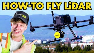
The Most Accurate Way To Capture 3D Data | ROCK R3 PRO

Вставка
- Опубліковано 25 кві 2023
- Visit www.rockrobotic.com/r3pro to learn more!
Introducing ROCK R3 PRO from ROCK Robotic - The Best Just Got Better.
ROCK R3 PRO is the most accurate way to capture 3D data from the sky or on the ground.A groundbreaking Surveying tool to capture unprecedented, accurate 3D LiDAR and Photogrammetry data for Surveying, Mapping, Engineering, Mining, Powerline, Utility, BIM, Forestry and more.
Next Level 3D Mapping:
🔸 Survey-Grade (±3cm accuracy)
🔸 Hesai Pandar XT32 Sensor
🔸 Triple-band GNSS receiver
🔸 Capture 1.28 million points per second
🔸 26MP detachable camera
🔸 Lightweight 1.20kg (2.6 lbs)
🔸 0.006 deg Pitch and roll;
🔸 0.03 deg Heading with ROCK Desktop
🔸 LiDAR, Photogrammetry and SLAM enabled
The ROCK R3 PRO Offers:
✅ Unmatched Precision: Achieve cm-level accuracy with its powerful LiDAR sensor and cutting-edge technology.
✅ Easy Integration: Compatible with a wide range of drone platforms, making it a versatile and adaptable solution.
✅ Quick and Efficient Data Collection: Capture up to 1,280,000 points per second, allowing you to complete projects in record time.
✅ Rugged and Reliable: Designed with a robust build to withstand harsh environments and challenging conditions.
✅ ROCK Cloud: Access the powerful cloud-based platform for data processing, analysis, and sharing of your data.
The Journey Begins Now!
ROCK R3 PRO Website:
➡️ www.rockrobotic.com/r3pro
Buy R3 PRO Now:
➡️ www.rockrobotic.com/talk-to-s...
R3 PRO Indiana Drones Video:
➡️ • Best LiDAR Drone in th...
R3 PRO Unboxing & Setup Video:
➡️ • #unboxing a $30,000 #d...
R3 PRO Accuracy + Dataset Example:
➡️ www.rockrobotic.com/post/insa...
R3 PRO Featured On DroneLife.com:
➡️ dronelife.com/2023/04/21/rock...
Questions? Let's Talk:
📧 hello@rockrobotic.com
Be sure to like, comment, subscribe & share!
#R3PRO #LiDAR #Drone #3dmapping #DroneLife #LandSurveying #LandSurveyor #CivilEngineering #Aerial #UAV #Mapping #SLAM #ROCKRobotic #DronePilot #DJI #M300 #Technology - Наука та технологія


I love this!
cool
Do you plan on making something for other manufacturers? If someone is planning on doing Federal contracts and state level contracts in a growing number of states they cant use DJI and possibly AUTEL like in Florida and soon Texas.
We have a mount coming out next month. It will work with all the American drones. It works with the TiTH quick release, dovetail quick release and has ability to mount to 3rd party mounts.
Hey Indy love your work! Random question for you. Do you know anything about flying drones on beach areas where sightseeing helicopters may be present? I want to fly at a beach near my house but frequently will see those small stereotypical sightseeing choppers flying INSANELY low and it worries me. I know about weather patterns at 8000ft thanks to drone cert, but not stuff like this smh. ❤❤
Take your recreational flyers test and you will learn all the rules to fly recreational.
Cool
Totally!
Cool
Too cool.