ArcMap Data Driven Pages

Вставка
- Опубліковано 12 лис 2024
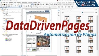
- Learn how to use ArcMap's Data Driven Page functionality to create map books and atlases. This instructional video from eGIS Associates will demonstrate the basic steps you need to know in order to enable and use this functionality.
eGIS Associates dedicated to helping organization leverage the power of place using GIS and related technologies. Please visit our website at www.egisassociates.com to learn more about us.


Thanks for making this straight forward.
This is an exceptional tutorial, thank you very much for publishing this!
So happy you found it helpful.
Excellent Tutorial, would be really interested in how you set your predefined template. We have premade company templates with a 20cm x 26cm portrait map display, I just couldn't get it to fit correctly.
Hey thanks for the comment. I originally created this video but am not with the company anymore. This is a good question. So what I did was figure out what scale I need the maps to print at. I then used that to determine the size my index grid rectangles needed to be. Being in the United States, we tend to like things to be based on scales of one inch equals so many feet. So if I wanted the map book pages to print at 1 inch equals 100 feet and I had a map area in the layout of 10 inches by 15 inches, then my index grid retangles would be 1,000 feet by 1,500 feet. Hopefully that helps.
I am running into an issue. Example: I draw polylines in layers representing a new fiber cable build but some of the old cable that are not part of the layer need to be in the stripe map because the will eventually be wrecked out but I cant change the layer because the need to stay on the map until the job is done. What would you recommend me do to make them included in the strip map?
Since you need to show both the old and new cables, I would suggest having an attribute field that can be used to identify the new and the old within the same layer. You can symbolize them differently based on the attribute values while keeping them in the same layer. Hope this helps. BTW I am the former owner of this channel. The Davey Resource Group, which acquired eGIS back in 2019.
Thanks for this tutorial. I will like you to create a tutorial on how to create grid index features. thanks
Thanks for the feedback
i would like to thank you sir for this wonderful job thank you very much indeed.
You are welcome. Glad you like the content.
Thanks for this Tutorial. If you can tell me how to generate cadastral maps in series, where the reference for each map is the number of cadastral parcels, where the map automatically displays in the form table the data of the respective parcel?
Excelente video
So glad you enjoyed it.
Very helpful - thank you!
A question how can one export a file with multiple fields in the name ?
Is there no way to export to something other than .pdf for the series? Frustrating, now I need to add an additional export step or use some python.
You can export to any format ArcGIS Pro exports too including JPG, PNG, SVG and so on. PDF just happens to be the most common because a single PDF file can contain multiple pages. Where other formats would be a single file per index feature. Also remember ArcGIS Pro does not support export to Adobe Illustrator. Instead, there is now a free plugin from Esri for Illustrator that allows you to open ArcGIS Pro files in Adobe. I have not tried this plugin so I do not know how well it works.
Please create a video with how to create the index. Thanks!
I did and posted last week. Here is the link - ua-cam.com/video/BrQd3nrk4G4/v-deo.html
a very helpful clear tutorial, thank you :)
So glad you found it helpful.
Judith - Can you please contact us at info@egisassociates.com. You have been selected as one of the comment winners in our contest to reach 2000 subs. You will receive a copy of the ArcGIS Pro 2.x Cookbook eBook. Details will be provided once you contact us. Congrats.
very much helpful for me and save my time. Thanks
That is wonderful to hear. So happy the video was helpful.
Thank you for your useful video
You are very welcome.
thank you very much
You are very welcome
My page numbers are changing but not the pages?
Interesting