Bailey Mountain Preserve 4K

Вставка
- Опубліковано 6 лют 2025
- Our twenty-first hike of the year ... December 31, 2024
Sally & I
4.8 miles / 1,467' elevation gain
Trails used ... Robert L Hoffman (yellow) trail
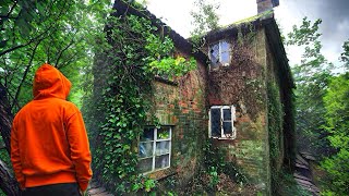
I found these via Google Maps ... I'd never heard of it but I was looking for a new place for Sally & I to hike before returning back to South Carolina. So, once I saw it was conveniently close to our route - we hit the road eagerly anticipating seeing something new.
This trail area is relatively new as far as I can tell ... they're working on parking area and other things to make the preserve better. So, we parked in a pretty full gravel parking area where there's one toilet (I'll note that this trailhead was less than 20 minutes from the NC Visitor Center (going southbound on I-26) - so if you don't want to use the portable toilet at the trailhead - that'd be an option). We hit the trail ... it wove it's way through some low land and over a couple of small water streams. At .29 the trail enters the forest and starts climbing. At .5 miles - the trail merges with another trail and a fantastic view looking south. There's a nice little bench here as well - where you can sit and enjoy the view. Continuing the climb up ... around 1.4 miles there's a great little rest bench with winter time views from here. At 1.7 miles, you pass by the junction with the red trail which can make a lollipop type loop. But, we chose to stay straight on the yellow trail. From here ... the trail gets a little steeper as it continues it's climb up to Bailey Mountain. At 2.1 ... we pass by the junction with the blue trail (this is how you'd make the lollipop loop if you choose to do that). Continuing straight, the trail starts switchbacking making the climb up to the summit much easier. Plus, there's some great views along the way to stop and catch your breath if you need to. Finally, at 2.37 miles we hit the top where there's a bench along with a trail register/log book. We signed the log book and briefly flipped through enjoying reading other's comments. We wandered a little ways past the log book area to a rocky outcropping that seemed to be the actual summit of Bailey Mountain. But the wind had kicked up - making it pretty chilly to just stand around. So, we retreated back to the bench - enjoyed a snack while enjoying the view. We eventually made our way back down the trail and at 4.26 ... we arrived back at the bench with the fantastic view where we sat and enjoyed the evening light illuminating the valleys and mountains beyond. From here, we continued straight (the trail we came up on earlier - on our left). At 4.42 ... the trail veers a sharp left (if you stay straight - you come out in a meadow where there's barns and such). A short ways down at 4.49 ... we turned right onto the trail we'd climbed earlier. From here it was an easy walk through the bottomland to our car. Sally enjoyed sniffing all the smells along the way!
Things to note ... I thoroughly enjoyed this preserve. The trails are in outstanding shape ... and I'd consider what we did easy/moderate - only moderate because of the climb - but the trail itself is pretty clear of any obstacles making it easy to hike. Plus, every 1/4 mile there's a post indicating the mileage. This would probably be a great trail running area as well. Another thing, everyone we met was super nice and friendly - probably one of the friendliest trails I've been on. They are also trying to expand the preserve ... so they have a website and a gofund me page - if you want to help them out! Definitely a great hike and a wonderful way to wrap up 2024!
libguides.mhu....


Sam's gap to big bald we hiked that last year, that's near marshill also
I remember seeing your video of it! It’s one I’m excited to do hopefully this year ☺️
Can I pet dat daaaawwwwg
Sally says hi! 🐾🐾🐾🐾