Wind River High Route Virtual Tour

Вставка
- Опубліковано 21 жов 2024
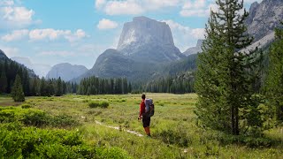
- This tour is based off Alan Dixon and Don Wilson's Wind River High Route in Wyoming, which is about 80mi long. The WRHR is a route and much of it is off trail. The track viewed in the videos is more of a guide for the eye to follow and not an indication of an actual trail. This route can be done either direction, but the tour goes southbound as they recommend purely for timing the crowds of the Cirque of the Towers...
The GoogleEarth images are from July 22, 2014 the first half of the tour and June 28, 2014 the second half.
Songs: Midnight Sun by Phillip Phillips, Never Come Back Again by Austin Plaine


Having done this route and the KCHBR I really enjoy these virtual tours. They were helpful in planning and a great review after the trip. One thing I would like to see on a tour like this would be at the end, and maybe at the beginning too, an overhead shot of the whole route to put it all in perspective with the range as a whole.
Thank you for creating and sharing this. Just read your blog entries too. Great insight! Thanks!
This looks like a fun route. Doesn't seem too bad, but Earth never shows all the fun little details that a hiker has to deal with on the ground. Look forward to following along.
+Barefoot Jake Yeah, it's deceiving, but the WRHR is definitely great with those breaks along the lakes at times and some break from talus. It definitely has some sketchy parts in there on those passes. There is already a lot of snow out there so that will add to the fun too:)
Aron Saver ......your google Earth tours are great. I'd love to make similar videos for myself on my upcoming hikes. Could you give us some insight how you are making them so smooth and keeping the camera elevation relatively consistent? Specifically, are you using google Earth's "movie maker ", using "record a tour" option and using a 3dConnexion Mouse or clicking on places that you marked before recording the tour, or writing the code directly in (far beyond my skills)? Neither?
+Mastersofmishna I use a Mac and I can easily do a QuickTime screen recording and the edit it on iMovie. I tried to do this on a PC and it was too frustrating. I'm sure it's possible, but I just stopped once I learned how much easier it was on the Mac. To get the Google Earth settings right, (for a Mac) I went to Google Earth-->Preferences-->Touring to play with the angles, range, and speed. Then the tour auto plays the tour when you click the icon of the video camera that is in the center of the sidebar view. This is most simply done on a straight track, but if there is more difficult turns or a loop, you may have to use the controls by hand using arrows on the keyboard and the shift button to smoothly turn or adjust angles. It takes me many practice runs before recording to do that and isn't as smooth and goes slower...but in those situations, I use iMovie to edit the speed of the recording and give the illusion of a faster more smooth flyover. Hope that helps!
Hey Erin, do you happen to have a link or file where I could see this route in Google Earth?
Cheers
Yes, just email me at erinsaver at walkingwithwired dot com
Erin Saver how many days was this route?
dominic stegman it took 9 days in a pushed pace. Here is the daily journal of each day. walkingwithwired.com/wrhr-2016
Thanks Evin Saver