
- 153
- 292 409
Andrea Cippa / Siteplanner / WASH
Switzerland
Приєднався 16 лип 2007
Site planning and WASH tutorials and webinars, for the IDP and refugees sites
QGIS Basics: Understanding and Using Map Projections Made Easy
Learn the basics of map projections in QGIS with this simple and practical guide! Discover what a projection is, how to choose the right UTM projection for your site, and how to identify and reproject your project's shape and raster files. Perfect for beginners!
Переглядів: 48
Відео


Creating Hazard Flooding Maps & Risk Mitigation Using qGIS: A Webinar for humanitarian workers
Переглядів 1552 місяці тому
This webinar, organized by the Geneva Technical Hub, in collaboration with UNHCR, SDC, and ETHZ, focuses on the creation of flood hazard maps and the identification of mitigation measures to safeguard facilities at risk. The session is particularly tailored for humanitarian workers, aiming to provide practical insights and tools for disaster risk management. During the webinar, participants wil...
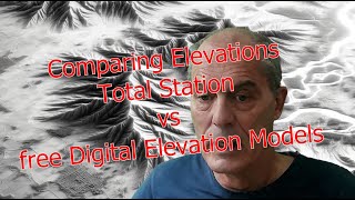
Precise Elevation vs. Free: Comparing Elevations from Total Station and Digital Elevation Models
Переглядів 6436 місяців тому
• Introduction to Elevation Data: Understand the difference accuracy of elevation data for site planning and WASH (Water, Sanitation, and Hygiene) projects, particularly in regions with limited access to precise measurement tools. • DEM Sources Compared: - FabDEM - SRTM - NextMap - ASTER GDEM - ETOPO1 • Comparison Methodology: The analysis focuses on calculating the standard deviation of differ...

How to Access Sentinel-2 Imagery for Flood Risk Mapping with a qGis plugin: (Part 3 of 3)
Переглядів 2297 місяців тому
Welcome to the final part of our instructional series focused on flood mapping using Sentinel-2 imagery through QGIS. This video is crafted for individuals working in disaster management, humanitarian science, GIS, and anyone interested in remote sensing applications. In this segment, we cover advanced band combinations for flood mapping, introduce styling techniques for enhanced map visualizat...

How to Access Sentinel-2 Imagery for Flood Risk Mapping with a qGis plugin: (Part 2 of 3)
Переглядів 2207 місяців тому
Dive into the transformation of a construction site of Ethimlat, captured in 10m/pixel resolution through Sentinel-2 imagery. From the onset of construction to its completion, watch the site evolve over time and see how it stands up against flooding before, during, and after development. This concise video compares the detailed progression and showcases the effectiveness of flood mitigation eff...

How to Access Sentinel-2 Imagery for Flood Risk Mapping with a qGis plugin: (Part 1 of 3)
Переглядів 4067 місяців тому
In the fist tutorial, we introduce the Sentinel-2 satellite's capabilities and its imagery use, including the setup process for the Sentinel Hub page. Here's what's covered: - Starting at 0:00, there's an overview of the satellite's capabilities and camera characteristics. - At 1:50, you'll learn how to register on the Sentinel Hub website (www.sentinel-hub.com/). - By 2:50, discover how to fin...

Importing High-Resolution Plans into Garmin GPS with QGIS (GarminCustomMap PlugIn)
Переглядів 6268 місяців тому
Welcome to our instructional video, where we'll explore a practical workflow that leverages the capabilities of QGIS and Garmin GPS. In this brief tutorial, we'll guide you through the steps to import high-resolution site plans into your Garmin GPS device using the qGis PlugIn "GarminCustomMap". This method proves invaluable for navigation across extensive sites, plotting essential structures s...

Shelter detection; semi-automatic vectorization of raster images; Part 3 of 3
Переглядів 1089 місяців тому
I introduce an innovative methodology tailored for site planners leveraging high-resolution imagery, such as those obtained from drones. This method facilitates the vectorization of shelters occupied by refugees or displaced individuals evident in these high-quality images. Comprising three concise short tutorials, the third workflow delineates 6 sequential steps.

Shelter detection; semi-automatic vectorization of raster images; Part 2 of 3
Переглядів 979 місяців тому
I introduce an innovative methodology tailored for site planners leveraging high-resolution imagery, such as those obtained from drones. This method facilitates the vectorization of shelters occupied by refugees or displaced individuals evident in these high-quality images. Comprising three concise short tutorials, the second workflow delineates 2 sequential steps. It relies predominantly on hi...
Shelter detection; semi-automatic vectorization of raster images; Part 1 of 3
Переглядів 2779 місяців тому
I introduce an innovative methodology tailored for site planners leveraging high-resolution imagery, such as those obtained from drones. This method facilitates the vectorization of shelters occupied by refugees or displaced individuals evident in these high-quality images. Comprising three concise short tutorials, the first workflow delineates 3 sequential steps. It relies predominantly on hig...
Agisoft Metashape Part 6 of 6. Comparing the quality of the Digital Terrain Model
Переглядів 19311 місяців тому
Agisoft Metashape Part 6 of 6. Comparing the Digital Terrain Model between the DEM produced by drone and DEM downloaded from FabDem.
Agisoft Metashape Part 5 of 6. Display the Orthophoto and the Digital Terrain Model
Переглядів 26311 місяців тому
Part 5 of 6 about Agisoft Metashape. Display the orthomosaic on qGis, compare it with Google Satellite, display the Digital Terrain Model, develop contour lines.
Agisoft Metashape Part 4 of 6. Inserting images Building the Orthophoto and the DEM
Переглядів 23011 місяців тому
Agisoft Metashape Part 4 Building the Orthophoto and the Digital Terrain Model (DEM)
Agisoft Metashape Part 3 of 6. Building the dense point cloud
Переглядів 83611 місяців тому
Agisoft Metashape Part 3 of 6. Building the dense point cloud, filter it, clean it and build the Model. Smooth the model for the contour lines creations.
Agisoft Metashape Part 2 of 6, Cleaning the sparse cloud
Переглядів 90511 місяців тому
Tutorial Agisoft Metashape. Part 2. Cleaning erroneous points of the sparse point cloud
Agisoft Metashape Part 1 of 6. Inserting images
Переглядів 54011 місяців тому
Agisoft Metashape Part 1 of 6. Inserting images
Flight over the site of displaced people in Rusayo I & II Democratic Republic of Congo
Переглядів 13511 місяців тому
Flight over the site of displaced people in Rusayo I & II Democratic Republic of Congo
SAS Planet español; descargar imágenes y mapas geo_referenciados
Переглядів 751Рік тому
SAS Planet español; descargar imágenes y mapas geo_referenciados
qGis, creating, shaping and styling contour lines
Переглядів 2,7 тис.Рік тому
qGis, creating, shaping and styling contour lines
SAS Planet; download geo_referenced imagery and maps
Переглядів 6 тис.2 роки тому
SAS Planet; download geo_referenced imagery and maps
HEC-RAS part 10/10, exports maps from HEC-HMS and HEC-RAS and produce nice looking thematic maps
Переглядів 6 тис.2 роки тому
HEC-RAS part 10/10, exports maps from HEC-HMS and HEC-RAS and produce nice looking thematic maps
HEC-RAS part 9/10, Display and discuss the results of the simulation with HEC-RAS 6.1
Переглядів 3 тис.2 роки тому
HEC-RAS part 9/10, Display and discuss the results of the simulation with HEC-RAS 6.1
HEC-RAS part 8/10, insert the computational parameters for the simulation with HEC-RAS 6.1
Переглядів 2,6 тис.2 роки тому
HEC-RAS part 8/10, insert the computational parameters for the simulation with HEC-RAS 6.1
HEC-RAS part 7/10, insert the boundary conditions and hydrograph with HEC-RAS 6.1
Переглядів 7 тис.2 роки тому
HEC-RAS part 7/10, insert the boundary conditions and hydrograph with HEC-RAS 6.1
HEC-RAS part 6/10, insert the land cover and Manning's coefficients with HEC-RAS 6.1
Переглядів 8 тис.2 роки тому
HEC-RAS part 6/10, insert the land cover and Manning's coefficients with HEC-RAS 6.1
HEC-RAS part 5/10, start the 2-D analysis with HEC-RAS 6.1
Переглядів 2,1 тис.2 роки тому
HEC-RAS part 5/10, start the 2-D analysis with HEC-RAS 6.1
HEC-RAS part 4/10, display and analyze the results
Переглядів 2,4 тис.2 роки тому
HEC-RAS part 4/10, display and analyze the results
HEC-RAS part 3/10, Insert Manning's values and boundary conditions
Переглядів 3,7 тис.2 роки тому
HEC-RAS part 3/10, Insert Manning's values and boundary conditions
HEC-RAS part 2/10, Create a project and 1D geometry
Переглядів 2,5 тис.2 роки тому
HEC-RAS part 2/10, Create a project and 1D geometry
Hello! If a LULC raster is loaded to HEC-RAS, would the raster need to be in the same raster resolution as the terrain one?
Best SewerGems video
thank you
Thankful for this tutorial, besides the cell phones, I still use my Garmin. 👌🇦🇷
It is nice tutorial. but not visible some where.
Very helpful thanks a lot
Thanks a lot
Excellent tutorial and style in presentation 🎉🙏
Many thanks
Thank you master..
Welcome
thank you so much for sharing this video, this is help me a lot, thank you🙏🏻🙏🏻
Thanks to @mohammed
it was very useful. thank you
Thanks to @mohammed
wow thank youuuuu
Thanks to @Mohammed
I like the video
Thanks to @Mohammed
Thanks for guiding
Thanks to @Mohammed
Mateandoxiqq_
Please I need help why I can’t add world imagery ?
no idea, download it with SAS Planet, see my tutorial
Hello Sir, how are you, The video time is 11.35 min to 11.45 min (Land cover Shape) you skipped one step, I do not understand how to go to the next step. Please explain one time. this video is very helpful for me.
thank you very much for this helpful videos
welcome, all the credit to @Eng. Mhannad Mhimeed
You are awesome sir.
Thanks a lot
it is interesting Mr. Andrea,
Thanks to @Mohammed
Hello Sir. In my attribute table, one of the DN number is 11. How can I find the soil type and CN number for this?
He has written WHEN DN = 9 THEN 'Snow-Ice' ELSE 'Cloud' END . So That means after 9 all of them Cloud.
Deberías comparar también el mdt de tándem-X
hola tienes razón, no lo conocía. ¡Pero eso no es gratis! Asi que los ingenieros no van a utilizarlos. Gracias de toda forma
I appreciate it very much, it has been very helpful.
Thanks a lot
Thank you so much. I had a hard time trying to know where I had to input this flow data. Now I know. Again, thank you for this.
Apart from the great explanation, I love the visual and musical drama of these tutorials! "Please be quiet!"
Could you please make a video on how to make a drainage map in qgis with and without the actual data available of an area.
I stuggled with exporting a map from QGIS to a Garmin GPSMap 64s until seeeing your video. Thank you!
Thanks
When adding CN number to hec ras, can we do it to a single map layer with different soil type? or should we input separate maps of each soil type?
Thank you for Andrea. Your lessons have been very beneficial.
very helpful video. thank you sir!
Very useful video - thank you. Is there a way to save the model animation for presentation, not just as a still photo? It appears you have done this at the very end of the video.
You need video editing software and you record the screen in several steps.
@@AndreaCippa-Siteplanning perfect, I had a feeling this would be the case. I will take this advice and find a screen recording software to use. Thank you once again!
@@bacayans.b3733 Hello, there are many screen recording software, as well open source. Google it and find the most convenient for you. OBS Studio
Many thanks!
We appreciate all the work you have done for us. GOD BLESS YOU
THANKS
GOOD
Asalam.o.Alaikum
Many thanks! Sometimes we rely too much in the mobile phones, but the higer level of accuracy of the GPS devise is always welcomed! Thanks
The GPS is also not the best solution, but if no other option, let's go! Did you ever try "Columbus P-10 Pro - GNSS Datenlogger"? Any experience with this gadget?
I think you miss the camera calibration and the rolling shutter correction necessary for mavic 2 pro haselblad camera
thanks for the comment
Hello Sir. Thank you for the tutorials . They have been helpful so far. Please could you help me understand how to get the values for the 1D steady flow boundary conditions for upstream and downstream for a river. Normal depth and critical depth
I have doubt on minimum slope and maximum slope...
can you share the cad file and sewer gem files?
you might ask Eng. Mhannad Mhimeed. You will find his contact in LinkedIn. Sorry for that
Very interesting thanks for the video, but Andrea can we have the French version?
I will once I have the time
Great 👍
Hi MR. Andrea Cippa. Could you kindly help me appreciate hydraulic modeling the more by explaining to me the science behind this modeling. I appreciate your videos a lot and I'm learning a lot. you've made it more simpler. I'm new at this yet already enjoying it. I will be expecting your feedback Sir.
I appreciate your interest in hydraulic modeling and I'm glad to hear that you've been finding my videos helpful. However, I must apologize as I'm unable to fulfill your request at this time. While I strive to provide educational content, explaining the science behind hydraulic modeling in depth would require a more comprehensive approach than I can provide in a brief response. I encourage you to continue exploring the topic through reputable resources and perhaps seek guidance from a qualified instructor or expert in the field. Keep up the enthusiasm for learning, and I wish you the best in your endeavors.
your videos are easy to understand and simply amazing thanks a lot for helping us ❤
thanks
Could you make a video on how to manually create the land cover polygons with qGis? Thanks
I'm busy with other stuff. I might come to that once I'm done, sorry
@@AndreaCippa-Siteplanning thanks for the reply.
@@AndreaCippa-Siteplanning I would also be interested in one too when you have time! thanks
I would also be very interested in that topic and would be very thankful if you find the time to make this video. Or is there another video on youtube with that specific topic out there by now?
Dear Professor, I have a doubt. I ran my simulation, but my flow ended in the middle of the flow path; it did not end at or near the external boundary condition. What to do?
Thanks for this helpful course , Only one thing can you upload the file which is you used in this sewergem videos. Thanks
you might ask Eng. Mhannad Mhimeed. You will find his contact in LinkedIn.
Hello Sir, could you please explain what the a,b,n,Tc means? Thank you
You might contact Eng. Mhannad Mhimeed and ask. You can find him in LinkededIn. Sorry for this unsatisfying answer.
@@AndreaCippa-Siteplanning Thank you a lot
Hello Sir, the stormcad part 3/5 is missing, can you please upload it?
ua-cam.com/play/PLFY4zB63z16I9NEXo92xOY2xgFXzl4x8V.html&feature=shared
@@AndreaCippa-Siteplanning thank you very much
Merci Andrea pour ce Très bon tutoriel sur Agisoft
Le plaisir Heritier
Hi there. Thanks for the video. Is there any other projection that we can add to SASplanet other than the default projection system?
Hello, when you download the tiles, you have the option to select few projections and your choose none might not be possible. Do not worry. Download it with the geographic projection and then in qGis or in Esri you can re-project the image. On UA-cam you can find many tutorials how to re-project an image.
@@AndreaCippa-Siteplanningthank you so much