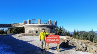
Charlies Bunion and The Jumpoff - Great Smoky Mountains National Park, NC

Вставка
- Опубліковано 3 лип 2018
- **I added something new in this video, a Google Earth tour of my GPS track. Let me know if you like it or not by leaving a comment. I think it is a cool addition.**
My hike from June 3 beginning at the Kephart Prong Trailhead in Great Smoky Mountains National Park, NC. I needed to bag Mount Kephart for the South Beyond 6000 Challenge. Most people hike the mountain from Newfound Gap and add on Charlies Bunion. That's the easier and more crowded route, so I settled on this tougher lollipop hike which begins below 3,000 feet and requires over 3,200 feet elevation change to reach the summit. The Kephart Prong Trail follows a forest road beside Kephart Prong, crossing it 4 times on log bridges. The trail ends at a 3-way junction beside the Kephart Shelter. I took the Grassy Branch Trail which has the most elevation change of the hike, but it was never difficult. The Dry Sluice Gap Trail then connects with the Appalachian Trail at Dry Sluice Gap. From there I decided to hike up to the real Charlies Bunion, since a side trail was obvious. Although steep, it followed exposed slate and was short. The summit of Charlies Bunion (5,541 feet) has 2 exposed rocks with views west and northeast. From the top you can pick out many of the remote 6K peaks in the northeast Smokies. I kept calling a particular peak Brushy Mountain in this video, it was actually Horseshoe Mountain.
Next I visited the Tourist Bunion, the popular viewpoint that most assume is the only Charlies Bunion. The rocks are more exposed and dangerous here, and the panoramic view is more expansive. The northeast views are not as spectacular, but the western views of Mount Kephart and Mount LeConte are better. After the Tourist Bunion the AT steadily climbs to the Icewater Spring Shelter. I took the Boulevard Trail and then The Jumpoff Trail over Mount Kephart (6,217 feet) and kept hiking out to The Jumpoff, a sheer drop on the east side of the mountain with great views northeast. These views were better than either Bunion, including Greenbrier Pinnacle and Cataloochee Divide. I still had a long slog down the Sweat Heifer Creek Trail, and it started raining about midway near the two waterfalls so I breezed by those without stopping. Overall a great hike, and a fun way to avoid crowds most of the day.
Hike was 16.1 miles with 4,495 feet elevation gain in 8 hours and 20 minutes.
Hike location
goo.gl/maps/FnCapvhbQMP2


Beautiful scenery. Thanks for sharing.
Great info! Thanks for sharing. 😊
Thanks Amy!
Enjoyed the video, Zach. The peak you were puzzling over below the Jumpoff is Horseshoe Mountain. Brushy Mountain is visible from the Bunion (both of them) behind LeConte on the right.
Yup, Landreth already corrected me on all that on Facebook lol. I haven't hiked in the Smokies enough unfortunately.
Bojangles before a hike like that? I'd have hit Grandma's diner or Sassyfrass in Cherokee. And the Qualla Java has all organic good coffee. Like to hike w you sometime.. if I could keep up. Peace
I almost never eat breakfast in my daily life. When I do before a hike, I want something quick so I can eat in the car and not waste any time going inside or sitting down at any restaurant. For most hikes this will be a granola bar I brought with me or a single doughnut. Also I don't drink coffee.
Zach, it just doesn’t get much better than that. The info was incredible, the map at the beginning was really helpful. Loved the geology lesson. The google earth map was nothing short of awesome!!! Bravo!
Thanks, glad you liked the Google Earth clip. Sometimes I get the info wrong, I kept calling Horseshoe Mt as Brushy Mt.
Awesome video
Loved the map at the end
Planning to do this hike this fall
Thanks zach. Your vids are great. Like the google map.
Thanks Earl
Thanks again from WNC
Thanks for watching
Just came back with my hiking buddies and am looking for some different ideas for future hikes...Yes, like the google earch tour...helps a lot...
Well you should check out my site and videos for that, I should have enough variety for NC and VA at least.
Great great video Zach....weve done Kephart/Sweat Heifer several times...love that area...your knowledge of the peaks and ranges is great info....how do you tell what your looking at ?? If we lived closer we would do these same kind of hikes....love your channel, thanks for sharing....
I mainly memorize guide books and maps. Sometimes I'll pull out the map to check just in case, but I typically only pull out the map when I'm filming a video of it lol.
Hey Zach I loved your video it is so clear and a lot of interesting and informative you are in that hiking club I would like to join . Could you tell me what equipment you use for your video
Jb
I'm not sure where I mentioned hiking club, because I've never hiked with a club. You could mean the CMC, which I'm a member with for the challenges but have never participated with because I live 3.5 hours from Asheville. All I use is my phone for video and a StickPic to hold it. www.carolinamountainclub.org/index.cfm/do/home.main
I like how you did the GE tour . Its sad that GE don't support Base camp any more ,
Garmin BaseCamp? I make kmz files from my BaseCamp GPX tracks to make these tours.
Hi Zach love your videos. I want to do a 2 day overnight hike in the Smoky Mountain National Park. Do you have any recommendations on where to start out and where to end. Thanks
That could be almost anything, would you prefer views or water, campsites or shelters, solitude or touristy?
@@bigzach322 views, campsites, solitude
I always recommend the Big Creek trails or Cataloochee Valley trails for this kind of question. You can do big loops from those area onto the ridges and the interior campsites don't get a lot of use except for Mt. Sterling. The Laurel Gap Shelter is the least used shelter in the park, highly recommend that site.
@@bigzach322 thank you so much
I can give you more detailed suggestions if you aren't able to figure it out, I've been busy of late.
Great video Zach of a great loop. I've done that loop a couple of times, although once on a day hike in the 90's I had to bail. The snow on upper Dry Sluice Gap Trail and the AT was knee deep and very slow going, so I decided to hike out to Newfound Gap and get a ride back to my car. When I got to Newfound Gap it was about 7:00 PM and only one car was there. I had to beg the guy, even after offering him $20, to take me down to the Kephart Prong Trail Head. He was going the other way toward Gatlinburg. I felt pretty bad because after about 10 minutes in his car I was putting off so much heat that I fogged up his windshield. The Google Earth map was pretty cool. How did you record the map with the motion?
That sounds like a good trip, I love crazy winter excursions as long as I don't get frost nip. You're lucky someone was passing through, that would've been a long walk.
I saw a friend with a quick motion map using the app Relive, but you have to be actively tracking and uploading with certain apps that connect to Relive and cannot add old tracks. So I looked around and found that making a video in Earth is very common. Media outlets and businesses use it all the time All you do is open the kmz file in Earth, and there's a button on the left below the track that plays the tour. This works with any GPS track. You can save that tour with one click, then save that tour as a video with Movie Maker. The tricky stuff is what kind of settings you want for the camera angle and speed of the tour, and the settings for the video file. After a few tries I can make a video quickly with no changes, already finished a bunch for my upcoming videos. The slowest part is the Movie Maker step, it takes a while to create the tour video considering the file size.
This link was most helpful for me, for the settings that work well for a mountains hike
www.thewave.info/Help/CreateaVideo.html
Let me know if you've tried this out yet.
Hey Zach, sorry I should have said thank you for posting this information. I looked at it briefly and saved it as a Word file. Last week was really busy and I've been out of town since Tuesday. Also I'm packing up everything for my annual Wind River trip. I'm leaving next Thursday, 7.26.18, and I'll be there until early September, so it will be late September before I really have a chance to figure it out. It appears to be GPS based, so I don't know if I'll be able to use it since I don't use GPS, except to occasionally use a phone app to track a trail distance. I've stayed away from GPS units since it's another electronic device and more batteries to deal with. I'm a little old fashion and prefer paper maps over digital maps. I've seen several videos where an aerial map is used and the route moves forward as a line with the video. Maybe they are all GPS based, but I'll check it out and do some research. Thanks for all the information!
If you were really interested you could draw your tracks on CalTopo and that's all you need. I could probably draw some of your hikes in a couple minutes, as long as they're hikes following trails. I often draw out my planned hikes on there to get an idea of mileage and gain for multiple options in an area. I think all of those Earth videos are going to be GPS based, otherwise I'm not sure how they would know what to follow.
My GPS typically has 35-40 hours of battery life, so it lasts longer than you'd expect. I change the batteries once a month on my normal hiking schedule. Have fun in Wyoming!
A friend sent me a link to CalTopo a few weeks ago after my Middle Prong video. I checked it out briefly by zooming to Middle Prong, but didn't see any trails, but I do intend to check it out further. May ask for some advice.