Wilderness Navigation Skills- Orientating a Map with a Compass

Вставка
- Опубліковано 6 жов 2024
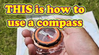
- Two ways of orientating a map with a compass. First set your compass to magnetic north (adjust for local declination), then align the edge of the compass with any north-south line on the map, or the edge of the map. Then rotate the map and compass together until the magnetic needle falls into the orienteering arrow (put Red in the Shed). The second option is to set 0 (North) at the index line and align the edge of the compass with the Magnetic North line of the Declination Diagram, then rotate the whole map and compass until the orienteering arrow falls into the orienteering arrow (put Red in the Shed).
Details on the next online live Wilderness Navigation Course here: northeastalpin... - Спорт


This is the best you tube vid out there for orienting a map. Simple, short, direct and all you need to know.
Thank you for the kind words! Glad this was useful!
Thank you for the easy, simple instruction - without rambling for 5 min!
Thank you for such clarity. I will direct my students to this. Perfect for orienting of map.
I would suggest that you take a close look at the graphic showing the angle of the declination. Some of them are (or cannot be) drawn correctly for various reasons. In other words, the angle shown graphically does not correctly represent the actual written declination.
Interesting! I haven't come across an inaccurate diagram yet but it never hurts to double check it with a protractor! Thanks for the comment!
We would wear our belts with the buckle to the side or back to prevent compass magnetic interference. I see her buckle rather close to her compass. Some of the crew used rope for a belt.. one junior famously kept getting lost and we saw him holding his compass inches from his cowboy belt buckle!
We used liquid dampened compasses. Bruntons were extremely accurate but took forever to settle down. Suunto MC2 and Silva Rangers with dip meters.
Simple and brief and clear. Thanks.
Perfectly simple
More tips coming soon be sure to subscribe!
🔥🔥🔥🔥🔥
I need to ask, when orienteering, do you orient to magnetic north or true north. BTW easy and quite good video
Great question! When orientating a map with a compass you should use magnetic north otherwise the map will be “off” by the amount of local declination. There are a couple methods to do this. I prefer to set my compass to 0 (no declination adjustment), align the edge of the compass with the MN line on the declination diagram, then rotate the map and compass until the magnetic needle is in the orienteering arrow. Others use the edge of the map and adjust the declination on the compass. both ways work. Does this clarify?
@@NorthEastAlpineStart thank you this really helps
Excellent!! Finally someone who gets it! When you orient your map while adjusting for declination, you don’t have to worry about doing math or remembering to reverse the rhyme if you’re triangulating your position on a map!
You set 17 deg East Dec. on compass. Your map shows 17 deg. West Dec. ??
Is useing the orienteering lines inside my compass bezel only for shooting a bearing to travel and not for orientating my map ? Or is it all the same ?
You can use the orienteering lines inside the compass bezel to measure a bearing off the map, or to orientate the map. Some books and navigation instructors teach that you should orientate the map before measuring a bearing off the map. This is a waste time and can introduce error into your bearing measurement as it relies on the magnetic needle, which should just be ignored when taking a bearing off the map (using the compass as a protractor).
@@NorthEastAlpineStart awesome, thank you very much for taking the time to reply.
If you have a compass that you can adjust the declanation is it better to do it the first way or the second way? Or does it matter? If it does, why so?
My personal opinion is I don’t use the adjustable declination on my compass. I prefer to add or subtract when necessary so I leave my compass un-adjusted. If you do set your local declination on your compass then you should only align the compass with the edge of the map or any true/grid north south line. If you align an adjusted compass with the declination line on the diagram your map will be 2x the declination off correct (so if you have 15 degrees declination your map would be 30 degrees off correct orientation). Hope that helps!
@@NorthEastAlpineStart When would be a time where you have to add and subtract when un adjusted?
Any time you measure a bearing off the map and want to follow that bearing in the world, and in reverse, if you take a bearing in the world and want to draw the bearing on your map (resection/triangulation) you need to adjust for declination. See the video on my channel for “Taking a Bearing from a Map”… it explains it a bit more.
@NorthEastAlpineStart ok I will definitely check that out. Then if you adjust the declination on compass you don't have to worry about adding or subtracting though?
@@epi9 If your compass is adjusted then you would only use the true/grid north line on the diagram and not do any math.
Good videos, but it's orienting the map. Orientating isn't an actual word.
I was about to leave that comment as well.