SMCT: Convert Azimuths and Compute Back Azimuths

Вставка
- Опубліковано 5 бер 2020
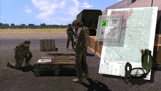
- A visualization depicting the Soldier’s Manual of Common Tasks (STP 21-1-SMCT) task Convert Azimuths and Compute Back Azimuths (071-COM-1016 and 071-COM-1017). This was developed for the Center for Initial Military Training, FT Eustis, Va.
Storyboard developed from the STP 21-1 Soldier's Manual of Common Tasks Warrior Skills Level 1, September 2017
Approved by the Center for Initial Military Training (CIMT) G-3/5/7, Initial Entry Training, Fort Eustis Virginia. - Фільми й анімація


I love these videos, OEC G&V please make more! i tried finding the page on facebook (used link on the channel page) but the facebook page gave an error saying the page does not exist anymore
as I read the comments I've seen how much these videos help current members of the military and ones panning on joining (like me) and would just like to say thank you for creating the videos they're informative and instructive to anyone even those without any military knowledge
just like for you guys to know you're work is incredibly appreciated and to please make more! Videos like this in an age of technology where anyone can access them, videos like this are extremely helpful and important for the public and a great refresher for any in service member! (sorry for spamming this on all your videos just want to make sure you guys know you're doing an incredibly important public service! and that its appreciated)
Thnxs for uploading and sharing this
👍🏻🇺🇸
Salute!!!!
Learned this in 1990. Nothing has changed. Even the cheap protractor article is same. Maybe declination changed a little.
Thats the good thing about physical maps
Yes! some new videos.
so with going from field to grid or map, adding the 9.5 degrees will put u right on target on the map? I mean say a water tower is 190 degrees on my magnetic reading, and then I use my protracter on my map, from exact point I took magnetic reading to the water tower it will be 199.5 degrees?
@@danjarvis6980 I get your explanation and I apply the same rules, but on paper, I don't get it, just like OP said. I did a prismatic compass calibration and upon verifying my azimuth with the "correct" (surveyed) azimuth that was on the calibration post, I had to substract the GM angle, just like the map says (West GN here). But the drawing on my map confuse me.. my magnetic north is to the left, why would I make a substraction to get a grid azimuth if my grid north is on the right side ? (+) ?
So the order of operations of adding or subtracting for a Grid azimuth vs a Magnetic azimuth changes depending on the declination chart angle?
They really do usin ARMA 3
I think it's VBS4 by the same Devs, it's arma 3 but for military use
Edit, VBS4 gets more updates...
Can you tell me about the meaning of True Azimuth, Magnetic Azimuth and Grid Azimuth?
True Azimuth = angle between the direction of the True North and the direction of the qobjective
Magnetic Azimuth = angle between the Magnetic North (measured with your compass) and the direction of your objective (measured on the field)
Grid Azimuth = angle between the direction of the North of the Map and the direction of the objective (measured on the map)
I hope this helps.
Azimuth is a fancy Greek and Latin word for direction of travel.
True Azimuth is direction to Polar North Pole.
Magnetic is direction to magnetic north pole, which is not fixed , but moves a few inches every year. Difference between True and Magnetic north is called DECLINATION.
Grid azimuth is a line on map from one point on map to another.
Civilian sport is called Orienterring.
Armed Forces skill is called Land Navigation or LandNav.
In US Armed Forces, you can be weak in some tasks, and be OK. But there are three tasks which an individual must pass. Basic Rifle Marksmanship with M4 or M-16 family of weapons, Land Navigation, and radio procedures with NATO phonetic alphabet. Inability in any of those core skills puts individual, and unit at safety risk . Jeopardizing unit readiness and mission.
There are unrecovered remains of Marines , soldiers, and airmen somewhere in the high desert of Ft. Irwin, 29Palms, and China Lake. During training they somehow got separated, got lost, ran out of water, and perished. As this area of California and Nevada is bigger then some nations, and empty. Well you can imagine the rest.
Why you’re not told your exit bearing until some time in the middle after confirmations are in order. By now, ten minutes and five hundred feet can turn into thirty feet or a two thousand foot sprint.
Update 2022europa NAVO landen Rusland super EMI powervolt