i received a .rcp , I followed your instructions but my dxf. or dwg file turnes out empty. Autodesk clam you cannot exporte a could point into a dwg or dfx. What am I missing?
Hi. I've tryed the process shown in the video, but i'm facing a little problem. When i export a DWG from 3DSMax it creates a 9mb file and i think it's very heavy for Revit to read. When i import this file in Revit it keeps reading forever and doesn't work. Any idea of what can i do to solve this?
Did you ask Infraworks to create a light wight surface? If you did, and it did not work, then you may need to use a different method. You could try decimating the mesh in Recap Photo.


Recap
Infrawork
3dsmax
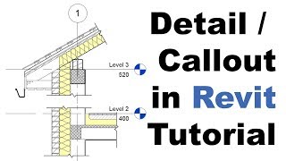
Revit
Revit to dxf
Revit
Dxf to topo
I counted 4 apps to use doing this process. I love it!!!!!! Pinning this vid!
I always come back to this viedo, thank you very much
i received a .rcp , I followed your instructions but my dxf. or dwg file turnes out empty. Autodesk clam you cannot exporte a could point into a dwg or dfx. What am I missing?
Hi. I've tryed the process shown in the video, but i'm facing a little problem. When i export a DWG from 3DSMax it creates a 9mb file and i think it's very heavy for Revit to read. When i import this file in Revit it keeps reading forever and doesn't work. Any idea of what can i do to solve this?
Did you ask Infraworks to create a light wight surface? If you did, and it did not work, then you may need to use a different method. You could try decimating the mesh in Recap Photo.
Autodesk credit, should be free for suite subscribers.
Can I get some help please
How come you didnt just import the Pointcloud direcrtly into revit?
@@xeenarodriguez839 If your purpose is to generate a surface, then you need to bring in the point cloud as a different form.
At least that was the case when this video was made. There may be new tools inside of Revit that allow you to now create a surface from a point cloud.