Map Making (1961)

Вставка
- Опубліковано 28 вер 2024
- Various brief shots illustrating the changing countryside; a tree being felled; workman at a table looking at plans while another holds a pneumatic drill beside a 'Road Works Ahead' sign; a man on a machine chucking up earth; a large pipe being lowered into the ground; a new (and nearly empty) motorway (this is from CP 325 - 300 M.P.H. Road).
Various shots of Bert Smith using a tellurometer; a machine with a kind of aerial dish on the front that measures distances through sound waves for ordnance survey maps; another man sits at the 'speaker' of the machine and makes notes. Three men are seen at adding machines in an Ordnance Survey office; a girl feeds some cards into an IBM computerised sorting machine.
Various shots of Dennis Braten using a stereo plotting machine which traces a 6 inch scale map from an aerial photographic plate. On a field by a parked Land Rover, Norman Facey uses a sight rule on a 6 inch detail survey and draws across the map.
In another Ordnance Survey office, some men are seen working on very detailed maps; panning C/U of one of the maps. M/Ss and C/Us as a draughtsman tracing hill outlines on wax-coated glass; very exacting work!
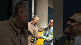
M/S as two men fix a map into position on a wall; an elderly man, George Dart, operates a huge camera to take a copy of the map. From the negatives, zinc printing plates are etched out; M/S of a printing plate being loaded into a printer. Comical M/S of Joe Hollingsworth mixing some red ink on a table; it looks like ketchup! M/Ss of the maps being printed. M/S of a couple, Janet and Alan Franks in a village looking at a Ordnance Survey map then walking off.
Note: The two Ordnance Survey centres seen are at Southampton, Hampshire and Chessington, Surrey. On file are notes on the workers and processes seen plus an article from 'The Motor' about map making.
FILM ID:145.04
A VIDEO FROM BRITISH PATHÉ. EXPLORE OUR ONLINE CHANNEL, BRITISH PATHÉ TV. IT'S FULL OF GREAT DOCUMENTARIES, FASCINATING INTERVIEWS, AND CLASSIC MOVIES. www.britishpath...
FOR LICENSING ENQUIRIES VISIT www.britishpath...
British Pathé also represents the Reuters historical collection, which includes more than 136,000 items from the news agencies Gaumont Graphic (1910-1932), Empire News Bulletin (1926-1930), British Paramount (1931-1957), and Gaumont British (1934-1959), as well as Visnews content from 1957 to the end of 1984. All footage can be viewed on the British Pathé website. www.britishpat...


This is a truly remarkable piece of history!
I am so glad youtube recommended this to me, so mesmerising!
I'm glad there's a girl to help. Doing her part. ;)
If she's helping the machine who's making the tea?
@@awatt the men if they're smart enough :)
@@dictatoribenevolo8394
Those "girls" are probably too busy inventing computer programming and such.
Extremely underrated comment
Makes you wonder how much trial and error the early map-makers went into the process of ancient map-making from thousands of years ago.
A great deal and they knew it!
i mean look at the maps that had all kinds of wierd ass monsters in them they got alot wrong mainly cause they didnt know any better but still we came a long way from rolled up paper
the peak of the mechanical age!
Now peak of computer age
@@theaudiobook80you tube age
Electro mechanical
AI
Congratulations British Pathé. It is amazing to see a great job being done to preserve the History from United Kingdom and around the World. From Rio, Brazil.
A valuable skill.
It’s always a great ego check to see the brilliant and skilled people who transformed history doing what appears to be complete magic
Am I glad that there is GIS (geo informatics) today. Map making on computers is SO much easier. It still can be tedious today, but the process is a lot quicker.
Disagree.
@@handsoffmycactus2958 You have the right to be wrong.
Thank you for this video.
Amazing video ❤
The time when Britain decided to draw their own map instead of making a new one for others on Earth.
This would be a frustrating job to me as maps are always needing to be updated.
"With a girl to help" 😂
When people knew their craft...
Which years did thise video was made ? And we see all thise machanicsem are not too advance tecnology like us know so how can thy make it thise is awesome gread for us very much help to thy feture that we are using know so all of thise are make and made for us if thy don't created at that time thn we are still in the dark age so thanks of all the scientific technology and advance mechanical engineering tht we are used from every home an transportation tht we still have use you and me so we are thankful and salute to our forefathers and God that give us wanterfull idea and mind to genarate every advance technology
1.6 views and only 15 comments?! 💬🗺
This is the pre-Google Maps age
0:01
No trecho 1:51 do vídeo, o cara não deveria usar um modelo esférico( Globo ) ao invés do plano para medir o ângulo e a distância, no mapa?
A terra segue plana desde o princípio da criação.
This is how our Grandparent navigated without GoogleMap 😉
My dad was a cartographical draughtsman at the Ordnance Survey in Southampton during the war, and up to the early 1970's when he retired. It's great to see how map making was done then, compared to the way it's done these days.
Great job.
interesting...
Such intricate skill. Computers have replaced a lot of the work humans have to do these days, and I’m not always sure if that’s a good thing. There’s something so great about seeing these masters practicing their craft.
Interesting
Truely Masterpiece..
Wow that's so amazing 💕
Brilliant work....with amazing skills.. Stilla surprise for all humans. 🎊🎉👌👌🎉
Amazing 👏👏👏👏
We may be the last generation who got trained this method.
Still these machines are available in survey department of Sri Lanka.
The quality of old maps from the 1900s are remarkably accurate with the shaps of buildings and trees i like seeing old maps of where i live and where i went to school some councl estates were built as late as the 70s council dwellings started at the end of ww1 you can see the fashion of the times with red bricks and a render on the top half with an archways on doors then in the 50s they started modernised with upvc features
Map men map men map map map men men men
this is very interesting to be watch.
Thank you gells, we couldn't hev made the meps without yew.
Well done Girl, doing her bit!
What's fascinating back in 1961, is modes of dress.
Chaps with long brown overalls are lower order workers.
The higher order workers are in suits.
The girl isn't even featured.
If you ever want to feel inadequate as a modern mapper, watch this video.
Literally me rn.
The announcer's voice reminds me of a Monty Python sketch.
Civil drafmen
still all magic...
Good old nationalised departments
This video fails the Bechdel test!
0:07 When you've had a bad curry.
And now we have it on our phones.
Satellite today what next in 100 years, we might be mapping space route to mars or Pluto
Ви це бачили, а я це робив)
wow
Land surveyor...
❤🎉❤🎉❤🎉❤🎉❤🎉❤🎉❤🎉❤🎉
Fascinating
😲
It used to take 2 men a whole year to do what these machines can do in an afternoon. People have been replaced by machines for decades. And now, there’s AI.