
- 4
- 68 792
GIS for Beginners
Приєднався 21 лип 2017
This Channel is made for the purpose of demonstrating the concepts of remote sensing and GIS, particularly using the softwares QuantumGIS and GRASSGIS .
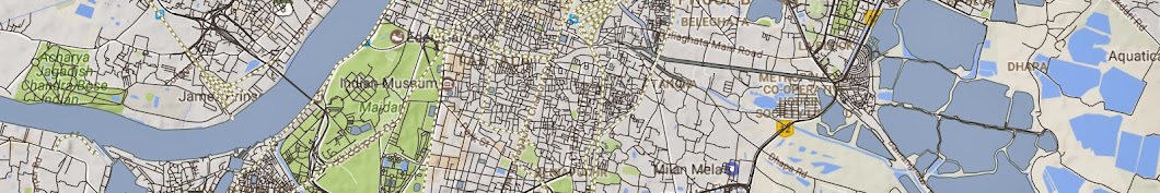
Raster operations in QGIS
The video demonstrates how to download the Global administrative boundaries. It also demonstrates basic raster operations such as raster clipping and merging.
Переглядів: 12 976
Відео


Downloading satellite data from USGS websites
Переглядів 53 тис.7 років тому
In this video I've explained how to download satellite data i.e landsat data, sentinel data, SRTM data etc from the USGS websites (Earthexplorer & Glovis) and also adding those data in QGIS. the data is available free for download.

Remote Sensing Datatypes and applications
Переглядів 1,8 тис.7 років тому
This video is about various remote sensing datatypes and their application in brief.

Coordinate reference system in QGIS and GRASSGIS
Переглядів 9207 років тому
The video explains how to set up coordinate reference systems in QGIS and GrassGIS. I've also explained how to know the UTM zone for sny desired location. Link for pdf on basics of coordinate reference systems: drive.google.com/file/d/0B3QWVeSeMxl5NERPV2laWklRSHc/view?usp=drivesdk Please watch the video and do subscribe and like
your voic is not clear
ua-cam.com/users/shortsqdMpBaZsA7g?feature=share How can this happen?
Asmelash
how can i get difference between 2 raster files like in vector files; i tried raster calculation but its failed. Like here you clipped one small polygon but i want to cut this polygon from the big raster file. i can do this by convert raster to vector first & then difference between 2 vector files. Is there any way to do without conversion then please let me know
I guess conversion to vector and then doing the calculations is the best possible option.
This is an outstanding effort for researchers in this area. Thank you.
I dont mean to be off topic but does anybody know of a way to log back into an Instagram account? I was dumb forgot my account password. I love any help you can offer me.
its been 3 years please make ....vegetation index video
Nice Vide. I want download the River basin shapefiles of Indian rivers. can u plz help where I can download the data
Can you tell me how to project a large area to UTM system which lies in UTM zone 43N and 44N both ?
Hello,,there is no any downloading botton on my screen
Please make and share next topic
That helps me a lot , thanks
Great
Download show nhi ho rha
hello everybody! i've just recently had my classic car stolen. unfortunately i didnt had a GPS installed on my car. could someone help me out to get images from a specific dates? i do pay it well if someone does the right job. many thanks
Please in the future that you make sure you can be heard, your voice is way too low even with the volume maxed out.
Thank u soo much for the video... Can u please upload the video of identification of ground control points and mosaic of different sources of maps
while i am downloading the data from earth explorer, i am getting image in gray color what could be the reason?
It's all in black & white - you have to use false color in order to get the wanted
أريد صور فضائية لمتابعة التطور العمراني فأي قمر تنصحني به
Thank you so much. can we create a 3D image of a selected area using Q GIS?
Yes you can. For that you need to create a digital elevation model. there are various data formats available to do that for example srtm data which allows to create 3D data models. However, QGIS does not offer many functionalities w.r.t 3D modelling. It's much better on arcgis.
Hello, I am about to download some landsat 5 and landsat 7 data from USGS website but the L1 GeoTIFF data for each image is not more than 240 MB. Is there a possibility that I am not downloading the full data product? Thanks
Landsat 5 and Landsat 7 are supposed to be of that size. Landsat 8 and later products had a higher size due to better resolution
Hi, can't find the downloading icon, what should I do?
when i log in usgs to dowload data landsat archive does not show what is reason ?how can i solve this?
can anyone tell how to convert the geotiff data to jpeg od csv file format
There’s a tool in arctools-conversion. Hope you can find it.
I NEED A VIDEO FOR DATA PROCESSING IN ARCGIS
I wish to download GLOVIS data for path 148 and row 045 for Landsat MSS image as of 11th Nov 2011. It shows zero images available.
Aakanksha Chaudhary can you please specify which dataset you are searching for? Is it Landsat 8?
I didn't get download icon/option once i clicked results. There are only options like show footprint, show browse overlay,compare browse,show metadata and browse, order scene AND exclude scene from results. Where can I find download option??
Hi, Did you find any thing?
register frist then easy
wakanyanya
thanks for the video. I need to use Arc GIS for land cover change analysis (from 1990 to current). Can you suggest the best data for such a study and how can I use the data on Arc GIS?
Yvonne Nti you can use sentinel 2 data for Land use land cover analysis. You can use arcmap for supervised classification of the data to generate LULC maps.
ua-cam.com/video/H9Vr3bmLvB4/v-deo.html. You can use this video for supervised classification of satellite data.
Thank you for the prompt reply and suggestions. A lecturer I am working with suggested this data: www.esa-landcover-cci.org/. Whats your suggestion on this compared to sentinel?
Yvonne Nti, I think the data suggested to you is preprocessed data with a spatial resolution of 300m, whereas the sentinel 2 data has a resolution of 15 m and the coverage area also differs accordingly. So it totally depends on the purpose which data to use.
Thank you again. So in short the sentinel is better? I am quite new to application of GIS so pardon me for the amateurish questions but what do you mean by different coverage area?
please tell me how to input this image in Arc gis
Thakuri channel, Are you asking about the downloaded satellite imagery?
thanks a lot
pls share a video how I select only one administrative area from many areas and dizitized it
Sorry I could not reply earlier. as I was busy with a lot of things. You can select one single feature and save it as a different layer. You can then make changes in that particular layer.
Hard to hear.
Thankyou for your feedback, it would be better next time.
wow! very great,thank you very much and continue making more tutorials,i personally benefited from your tutorials and everything is working very well,thank you once again.
Hello guys, If you have any queries related to the video, feel free to ask here.!!
Hi, I can't find the downloading icon? What is the problem?
أريد صور فضائية لمتابعة التطور العمراني فأي قمر تنصحني به
Same me
Hello guys, If you have any queries related to the video, feel free to ask here.!!
Wow, great vlog this time
Yuvraj Goyal thanks bro
brother the link shows the certificates of mr narayan dey it would be helpful if u could upoad the pdf file
Sorry for the inconvenience. I've updated the link, please check.
Another great vlog. Nice job👍
Bro nice video but sound is not audible this tym
nice bro Great job kudos..
thanks brother
wow. Great start👌👍
thanks brother... I hope the video is informative.
Yes it is. Good job bro👍