
- 14
- 119 406
idletime2
Приєднався 16 січ 2007
Відео
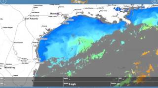

RipCharts Custom Sea Temp Mobile App Tutorial
Переглядів 1,7 тис.8 років тому
Instructions on how to customize sea surface temperature satellite imagery on the RipCharts mobile application.

RipCharts - Gulf of Mexico - Loop Current Discussion
Переглядів 3,8 тис.12 років тому
A discussion on the loop current and its importance to the fisheries in the gulf. What to look for and how to monitor certain bodies of water to increase pelagic fishing success.


RipCharts - Why Satellite Imagery?
Переглядів 9 тис.12 років тому
Discussion on why fisherman use satellite images to help find water color transitions, and temperature transitions.


RipCharts Sea Surface Temperature Tutorial
Переглядів 20 тис.12 років тому
Discussion of sea temps, ssts, and temp breaks. How best to use sea temp data to locate fish offshore.

RipCharts Chlorophyll and True Color Image Tutorial
Переглядів 24 тис.12 років тому
Discussions on how to use chlorophyll and true color satellite imagery to locate rip lines, weed lines and color breaks.

RipCharts Altimetry Tutorial
Переглядів 20 тис.12 років тому
Altimetry and sea surface height discussion for offshore fishermen.
RipCharts General Site Tutorial
Переглядів 12 тис.12 років тому
General Site Navigation and Map Navigation
RipCharts Adding Fishing Report Tutorial
Переглядів 7 тис.13 років тому
Tutorial on adding fishing reports to your RipCharts maps.
RipCharts Waypoint Tutorial
Переглядів 1 тис.13 років тому
Tutorial on how to add waypoints to RipCharts maps.
Does Rip Chart integrate with Garmin by any chance?
I can't add waypoints?
Can we Calculate chlorophyll Using Remote Sensing Measurements.....?
can i download it ?
nice fish track :) ....
interesting
This is fucking app
Haha. That was pretty cool.
Axis deer is another name of Cheetal deer of India and of all the deer meat ive eaten its the best, its absolute fat free.Give it a try.