
- 187
- 82 228
Geology Software
Pakistan
Приєднався 28 чер 2020
In this channel, You want to see geology-related software. How to use and interpret data and also see to make objects in 2D and 3D using GIS, Corel draw, Move, Glopper mapper, and Google Earth.
"How to Import Excel Data into ArcGIS Pro & Create Heat Maps & Pin Charts, Part 2/2"
In this tutorial, you'll learn how to import an Excel spreadsheet into ArcGIS Pro and visualize your data effectively. We’ll cover:
✅ Importing Excel (.xls/.xlsx) data into ArcGIS Pro
✅ Converting tabular data into a spatial layer
✅ Creating a heat map to analyze data density
✅ Generating a pin chart for better visualization
Whether a beginner or an advanced user, this step-by-step guide will help you maximize your GIS data. Don't forget to like, share, and subscribe for more ArcGIS Pro tips!
📌 **Chapters:**
00:00 Introduction
00:30 Importing Excel Data
02:15 Converting to Spatial Data
04:00 Creating a Heat Map
06:30 Generating a Pin Chart
08:00 Final Tips
🔔 Subscribe for more GIS tutorials!
Переглядів: 19
Відео


"How to Import Excel Data into ArcGIS Pro & Create Heat Maps & Pin Charts, Part 1/2"
Переглядів 422 години тому
In this tutorial, you'll learn how to import an Excel spreadsheet into ArcGIS Pro and visualize your data effectively. We’ll cover: ✅ Importing Excel (.xls/.xlsx) data into ArcGIS Pro ✅ Converting tabular data into a spatial layer ✅ Creating a heat map to analyze data density ✅ Generating a pin chart for better visualization Whether a beginner or an advanced user, this step-by-step guide will h...

"How to Create a Pin Chart for Data Visualization in ArcGIS Pro Part 1/2"
Переглядів 1094 години тому
In this tutorial, you'll learn how to represent your data using pin charts in ArcGIS Pro. We will cover the step-by-step process of creating and customizing pin charts to effectively visualize and communicate your data. Whether you're working with geographic or tabular data, this guide will show you how to leverage the powerful charting tools in ArcGIS Pro to present your information in a clear...

"How to Create a Pin Chart for Data Visualization in ArcGIS Pro Part 2/2"
Переглядів 24 години тому
In this tutorial, you'll learn how to represent your data using pin charts in ArcGIS Pro. We will cover the step-by-step process of creating and customizing pin charts to effectively visualize and communicate your data. Whether you're working with geographic or tabular data, this guide will show you how to leverage the powerful charting tools in ArcGIS Pro to present your information in a clear...

"Step-by-Step Guide: Creating a Study Area & Working Layout in ArcGIS Pro Part 2"
Переглядів 67 годин тому
"Learn how to set up a study area and design a professional working layout in ArcGIS Pro with this step-by-step tutorial! Whether you're a beginner or an experienced GIS user, this guide will walk you through defining your study area, organizing spatial data, customizing layouts, and optimizing your workspace for analysis. Perfect for geologists, researchers, and GIS professionals looking to en...

"Step-by-Step Guide: Creating a Study Area & Working Layout in ArcGIS Pro Part 5"
Переглядів 87 годин тому
"Learn how to create a study area and working layout in ArcGIS Pro with a focus on geology students and researchers, especially those studying the Salt Range of Pakistan! This step-by-step guide will help you define study areas, organize geological data, and create professional mapping layouts for research and analysis. Perfect for Pakistani geologists, GIS enthusiasts, and students working on ...

"Step-by-Step Guide: Creating a Study Area & Working Layout in ArcGIS Pro Part 4"
Переглядів 77 годин тому
"Learn how to create a study area and working layout in ArcGIS Pro with a focus on geology students and researchers, especially those studying the Salt Range of Pakistan! This step-by-step guide will help you define study areas, organize geological data, and create professional mapping layouts for research and analysis. Perfect for Pakistani geologists, GIS enthusiasts, and students working on ...

"Step-by-Step Guide: Creating a Study Area & Working Layout in ArcGIS Pro Part 3"
Переглядів 187 годин тому
"Learn how to set up a study area and design a professional working layout in ArcGIS Pro with this step-by-step tutorial! Whether you're a beginner or an experienced GIS user, this guide will walk you through defining your study area, organizing spatial data, customizing layouts, and optimizing your workspace for analysis. Perfect for geologists, researchers, and GIS professionals looking to en...

"Step-by-Step Guide: Creating a Study Area & Working Layout in ArcGIS Pro Part 6"
Переглядів 137 годин тому
"Learn how to create a study area and working layout in ArcGIS Pro with a focus on geology students and researchers, especially those studying the Salt Range of Pakistan! This step-by-step guide will help you define study areas, organize geological data, and create professional mapping layouts for research and analysis. Perfect for Pakistani geologists, GIS enthusiasts, and students working on ...
"Step-by-Step Guide: Creating a Study Area & Working Layout in ArcGIS Pro Part 1"
Переглядів 207 годин тому
"Learn how to set up a study area and design a professional working layout in ArcGIS Pro with this step-by-step tutorial! Whether you're a beginner or an experienced GIS user, this guide will walk you through defining your study area, organizing spatial data, customizing layouts, and optimizing your workspace for analysis. Perfect for geologists, researchers, and GIS professionals looking to en...
"How to Import an Excel Sheet into ArcGIS Pro | Step-by-Step Guide"
Переглядів 179 годин тому
Learn how to import an Excel sheet into ArcGIS Pro with this easy step-by-step tutorial! 📊🗺️ Whether you're working with spatial data, coordinates, or attribute tables, this guide will help you seamlessly bring your Excel data into ArcGIS Pro for analysis and mapping. ✅ Topics Covered: ✔️ Preparing your Excel file for ArcGIS Pro ✔️ Formatting data correctly (column names, data types, etc.) ✔️ I...
"Step-by-Step Guide to Hydrological Analysis in ArcGIS Pro From DEM to Watershed Delineation Part 2"
Переглядів 2212 годин тому
This step-by-step tutorial will guide you through the process of performing hydrological analysis in ArcGIS Pro. You will learn how to use Digital Elevation Models (DEMs) to analyze terrain, generate flow direction and accumulation maps, delineate watersheds, and extract stream networks. Whether you're a beginner or an advanced user, this tutorial provides clear instructions and practical insig...
"Step-by-Step Guide to Hydrological Analysis in ArcGIS Pro From DEM to Watershed Delineation Part 1"
Переглядів 2112 годин тому
"Step-by-Step Guide to Hydrological Analysis in ArcGIS Pro From DEM to Watershed Delineation Part 1"
ArcGIS Pro Graphs & Charts Learn, Analyze, and Visualize Data and Mapping Made Easy.
Переглядів 2214 годин тому
ArcGIS Pro Graphs & Charts Learn, Analyze, and Visualize Data and Mapping Made Easy.
"Geological Mapping Mastery: ArcGIS Pro Tutorials Part 4"
Переглядів 1516 годин тому
"Geological Mapping Mastery: ArcGIS Pro Tutorials Part 4"
"Geological Mapping Mastery: ArcGIS Pro Tutorials Part 3"
Переглядів 3016 годин тому
"Geological Mapping Mastery: ArcGIS Pro Tutorials Part 3"
"Geological Mapping Mastery: ArcGIS Pro Tutorials Part 2"
Переглядів 4316 годин тому
"Geological Mapping Mastery: ArcGIS Pro Tutorials Part 2"
"Geological Mapping Mastery: ArcGIS Pro Tutorials Part 1"
Переглядів 3416 годин тому
"Geological Mapping Mastery: ArcGIS Pro Tutorials Part 1"
"How to Create a 3D Geological Model of Your Area Using Field Data | VisibleGeology Tutorial"
Переглядів 2319 годин тому
"How to Create a 3D Geological Model of Your Area Using Field Data | VisibleGeology Tutorial"
"Step-by-Step Guide: Creating Elevation Profiles in ArcGIS Pro Part 7"
Переглядів 4221 годину тому
"Step-by-Step Guide: Creating Elevation Profiles in ArcGIS Pro Part 7"
"How to Split and Merge Polygons in ArcGIS Pro: A Step-by-Step Guide, Part 6 "
Переглядів 1521 годину тому
"How to Split and Merge Polygons in ArcGIS Pro: A Step-by-Step Guide, Part 6 "
"Step-by-Step Guide: Create Stunning 3D Models in Blender for Beginners, Part 2"
Переглядів 39День тому
"Step-by-Step Guide: Create Stunning 3D Models in Blender for Beginners, Part 2"
"Step-by-Step Guide: Create Stunning 3D Models in Blender for Beginners Part 1"
Переглядів 35День тому
"Step-by-Step Guide: Create Stunning 3D Models in Blender for Beginners Part 1"
"Step-by-Step Guide: Create 3D Terrain Models using Fishnet and Hillshade tools Part 5 ArcGIS Pro"
Переглядів 60День тому
"Step-by-Step Guide: Create 3D Terrain Models using Fishnet and Hillshade tools Part 5 ArcGIS Pro"
"Step-by-Step Guide: Create 3D Terrain Models from DEM Files in ArcGIS Pro Part 4 ArcGIS Pro"
Переглядів 57День тому
"Step-by-Step Guide: Create 3D Terrain Models from DEM Files in ArcGIS Pro Part 4 ArcGIS Pro"
"Master ArcGIS Pro: From Basics to Advanced | Complete Beginner's Guide Part 3"
Переглядів 39День тому
"Master ArcGIS Pro: From Basics to Advanced | Complete Beginner's Guide Part 3"
"Master ArcGIS Pro: From Basics to Advanced | Complete Beginner's Guide Part 2"
Переглядів 57День тому
"Master ArcGIS Pro: From Basics to Advanced | Complete Beginner's Guide Part 2"
"Master ArcGIS Pro: From Basics to Advanced | Complete Beginner's Guide Part 1"
Переглядів 45День тому
"Master ArcGIS Pro: From Basics to Advanced | Complete Beginner's Guide Part 1"
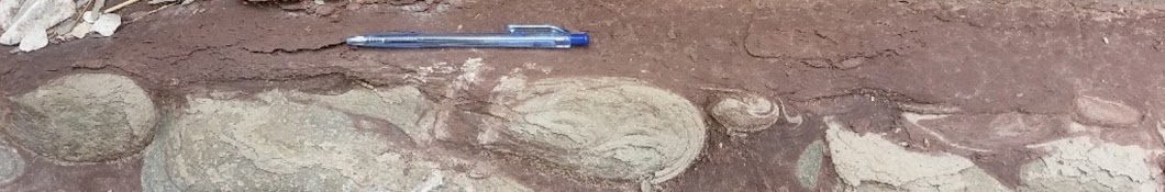
"Early Permian Rocks of Pakistan: Sea Level Changes, Tectonism, and Depositional Models"
Переглядів 85Місяць тому
"Early Permian Rocks of Pakistan: Sea Level Changes, Tectonism, and Depositional Models"